- Magelang
-
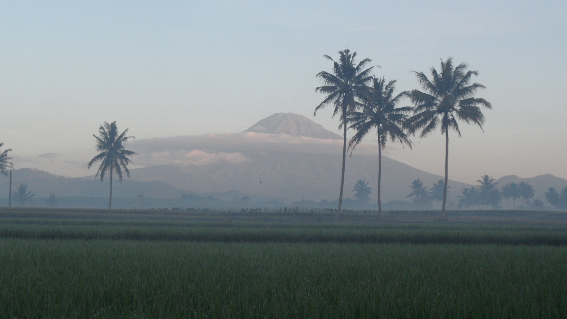
Magelang Scenery of Magelang
Motto: HARAPAN 
 Magelang
Coordinates: 7°28′0″S 110°13′0″E / 7.466667°S 110.216667°E Country Indonesia Province Central Java Regency Magelang Regency Government - Mayor Ir. H. Sigit Widyonindito, M.T.[1] Area - Total 18.12 km2 (7 sq mi) Elevation 350 m (1,148 ft) Population (2010) - Total 118,227 - Density 6.524/km2 (16.9/sq mi) Time zone WIB (UTC+7) Area code(s) +62293 Website www.magelangkota.go.id Magelang is one of the largest cities of the 1,130 km² Magelang Regency, Central Java, Indonesia. It is also the largest town in the Kedu Plain between Mount Merbabu and Mount Sumbing in Central Java, Indonesia. Magelang is located 43 km north from Yogyakarta, and 75 km south of Semarang, the capital of Central Java.[2]
Magelang has two official residency government, Magelang Resident and Magelang City.
Contents
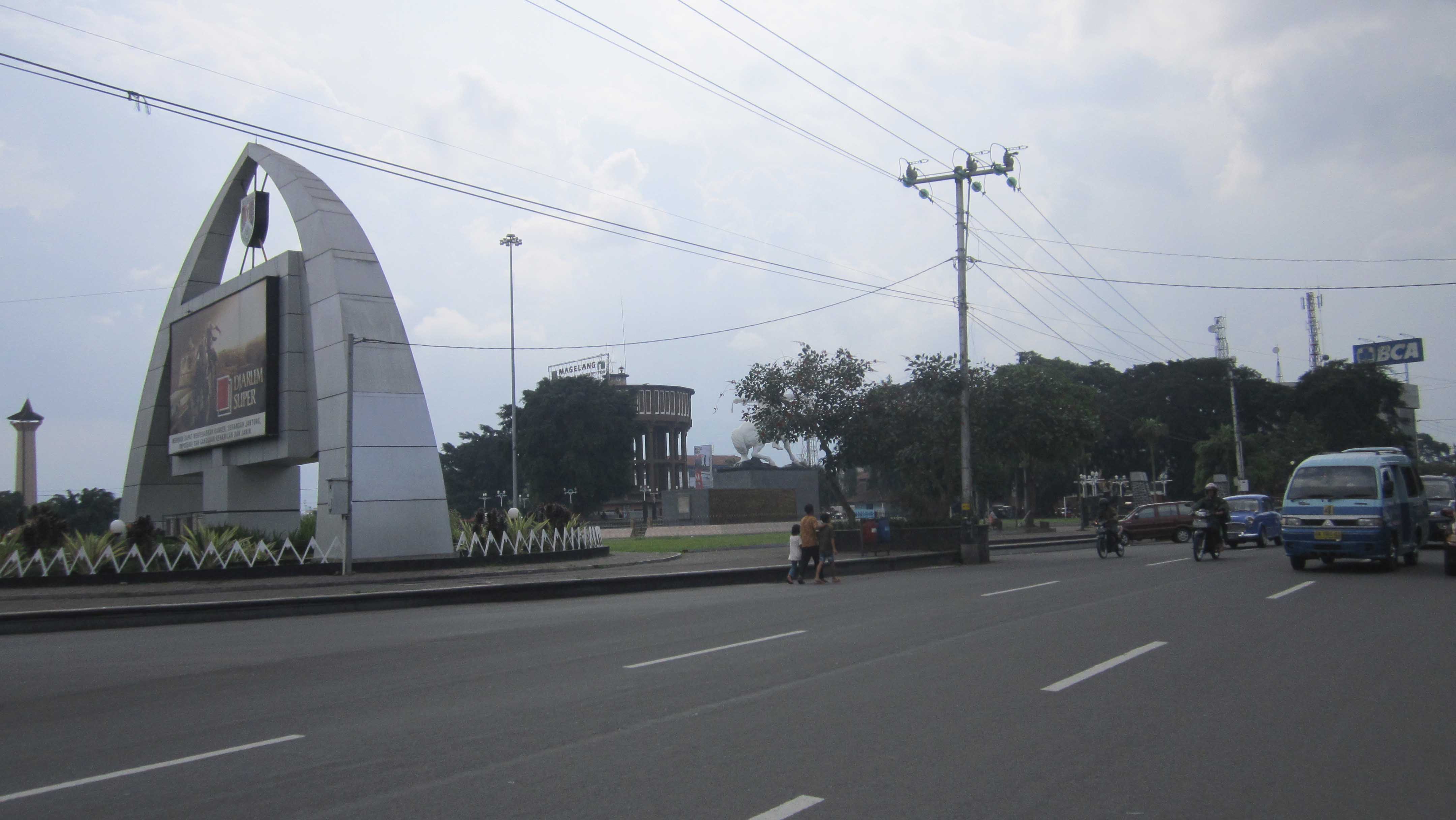
Landscape of Magelang City
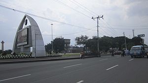 Magelang Central Park Street View
Magelang City is a small city which is located in a fertile agricultural area and one of the most densely populated regions on Central Java. Magelang City has two borders. Its western border is Progo River; its eastern border is Elo river. The city is divided into three districts and several subdistricts.[3]
Magelang Utara (North Magelang):
- Kramat Utara
- Kramat Selatan
- Kedungsari
- Wates
- Potrobangsan
Magelang Tengah (Central Magelang):
- Magelang
- Cacaban
- Kemirirejo
- Gelangan
- Panjang
- Rejowinangun Utara
Magelang Selatan (South Magelang):
- Tidar Utara
- Tidar Selatan
- Rejowinangun Selatan
- Magersari
- Jurangombo Utara
- Jurangombo Selatan
History
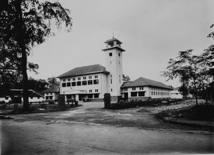
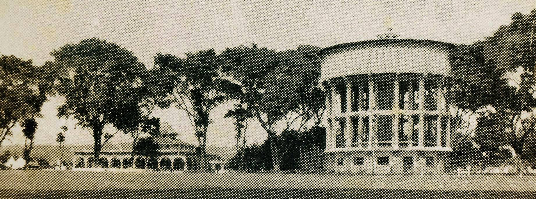
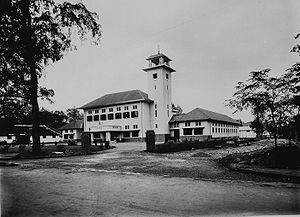 The Magelang town hall in 1925-1936
According to a local act number 6 (1989), Magelang was established on 11 April 907. Magelang was then known as a village called Mantyasih, which is now known as Meteseh. There are three stele of historical importance in Magelang, namely Poh, Gilikan and Mantyasih, all of which are written on a plate of copper. Poh and Mantyasih were written under the rule of King Balitung of Mataram Kingdom. In those stele, the villages of Mantyasih and Glanggang were mentioned. They became Meteseh and Magelang respectively.
In Mantyasih stele, it mentioned the name of King Watukura Dyah Balitung, as well as 829 Çaka bulan Çaitra tanggal 11 Paro-Gelap Paringkelan Tungle, Pasaran Umanis hari Senais Sçara atau Sabtu, which means Saturday Legi, 11 April 907. The village Mantyasih was made by the king as tax-free village which was led by a patih (similar to Prime Minister nowadays). Also mentioned are Mount Susundara and Mount Wukir Sumbing which is now known as Mount Sindoro and Mount Sumbing.
When Britain colonised Magelang in the eighteenth century, Magelang became the seat of the government and was made to the same level as a regency with Mas Ngabehi Danukromo as its first leader (Bupati). Mas Ngabehi Danukromo built Alun-Alun (town square), bupati residence and a mosque. Magelang became the capital of Karesidenan Kedu in 1818. After the Dutch defeated the British, Magelang was made the central of economy because its strategic location. The Dutch government built drinking water tower (known locally as Menara Air Minum) in 1918 which provides the city with water. Electricity became available in 1927. The roads were remade using asphalt.
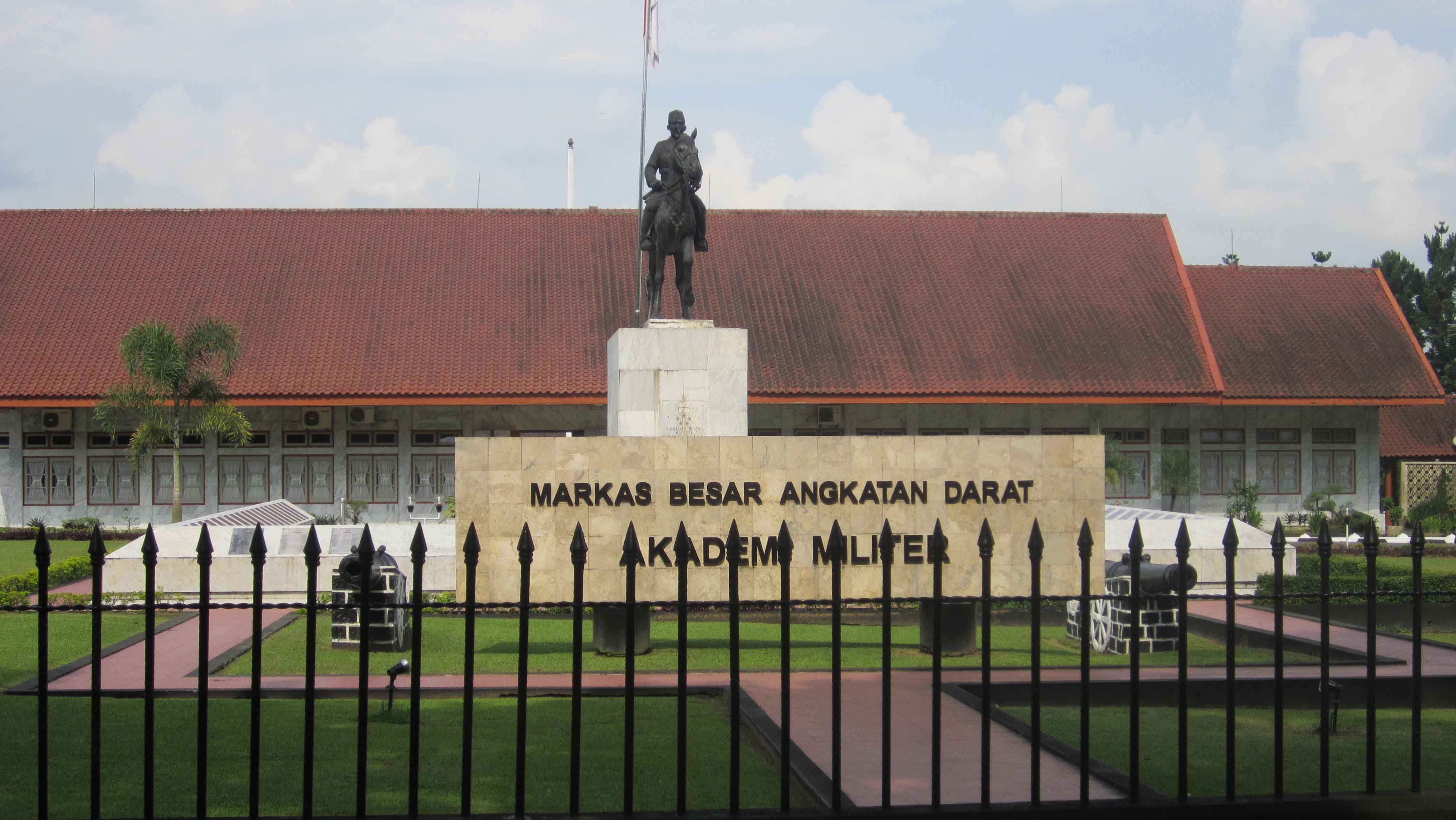
The city has historically been a military post, dating back to the Dutch East Indies colonial era. It subsequently acted as an army stronghold for Indonesian pro-independence movements against the Dutch government during the resistance period. Currently, it is host to two military landmarks: The National Military Academy, and the only military-associated school, Taruna Nusantara.[2]
After the independence of Indonesia, Magelang became kotapraja (same level as a district) and then kotamadya (same level as city).[4][5]
Demography
The composition of demography based on its religion and belief, Magelang people has varied and different belief and religion. Majority of magelang citizen are Muslim, but there are minority group such as Christianity, Buddhism, Hinduism, Confucianism, and also there are also spiritualism and traditional Javanese belief. Therefore, Magelang citizen are plural, although majority of them Muslim. They usually stick together and keep mutual relationship among them. Perhaps, it is a Javanese wisdom which every people to get close and involve to maintain society.
As of February 2010, Magelang has a total population of 118.227.[6] Magelang's population is 58.311 men (49 % from total population) and 59.916 women (51 % from total population).[7]
Places of interest
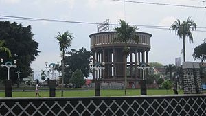 Magelang Big Stove - Water Container
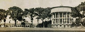 Magelang Big Stove - Water Container - 1925
Temples
Magelang is the closest major town to Borobudur, a ninth-century Buddhist monument located about 40 km (25 mi) north west of Yogyakarta. The Canggal Temple, also located in the Magelang regency, has a Sanskrit transcription bearing the name of the first Mataram Kingdom ruler, Sanjaya.[8]
Museums
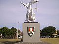
A number of the town's buildings from the Dutch East Indies era have become heritage landmarks. The Karesidenan Kedu building, now known as Museum Pangeran Diponegoro, was where Prince Diponegoro was arrested by the Dutch colonial government during the Java War (1825–1830).[9][10] The chair on which the Prince sat remains in the museum. A fingernail, believed to be Diponegoro’s, remains on the arm of the chair. A statue in his honour stands in Magelang’s town square.[2]
Jalan Pemuda
Jalan Pemuda (“Youth Street”) is Magelang's Pecinan (Chinatown). The one-way 1.5 km long road is the centre of business and includes shops, a minimarket, and restaurants. The road, running along a former railroad,[2] is divided with a narrow section reserved for rickshawss.
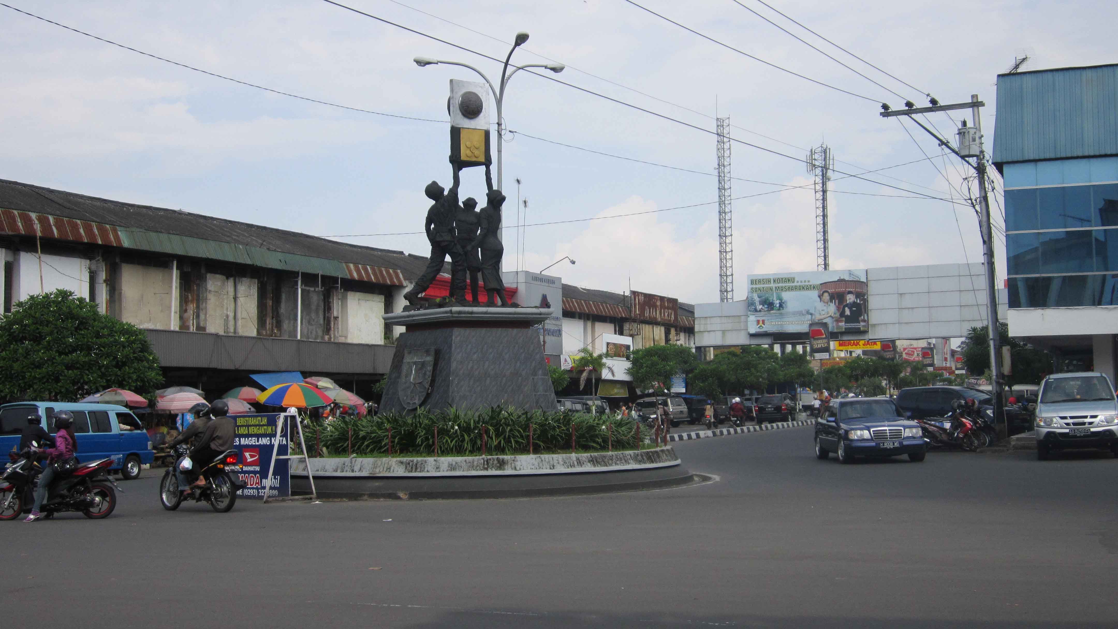
Alun-alun (Town Square)
The Alun-alun or town square is located in the city centre. The area has the Matahari and Gardena department stores, Magelang’s only cinema, to the north the Trio Plaza and the BCA tower; in the south a police station, the BPD Bank building, and a Confucian temple along Jalan Pemuda. In the west, is city’s largest mosque, locally known as Kauman. Within the vicinity of the town square is a 15-metre high watertower, and also a statue of Diponegoro riding a horse.[2]
Sports
There are a number of sport centers in Magelang City. In 2006, for example, a golf course was opened, well known as Borobudur International Golf and Country Club. Then, The football stadium is known as Abu Bakrin. This stadium is located in Jl. Tidar, which is closed to the golf course. Beside that, Gedung Olah Raga Samapta is one of popular sport centers located in North Magelang district. Nowadays, the area is being developed because of the plan to raise its status to Sport Centre of the Central Java. It is located east of Progo river.
Parks
A 28 hectare park, Kyai Langgeng, is located at Cempaka Street approximately one kilometre south of the city centre. Research is undertaken on rare plant species here. The park has a playground for children and their families. The river Progo is accessible from this park.[11]
Badaan park is located in Jalan Pahlawan (Pahlawan Road) and one of two parks in Magelang. It is smaller compared to Kyai Langgeng and mostly regarded as a children's playground. It includes animal statues, such as elephant and giraffe. Hawkers sell a variety of bakso (Meat Balls) here.
Mount Tidar
Mount Tidar is located in Magersari, South Magelang and located within the complex of Military Academy (Akmil). Here lies the remains of Syekh Subakir from Iran.[12]
Universities
Although Magelang City is a small city, it has a number of universities or academy or colleges. At least, there are six universites located in Magelang City such as Military Academy of Magelang (AKMIL), Muhammadiyah University of Magelang (UMM), Tidar University of Magelang (UTM), Bina Patria Computer College of Magelang (STIMIK Bina Patria), Tirtawiayasa Water College (Akademi Tirtawiyasa), and Nurse Academy of Magelang (AKPER Magelang)
Transportation
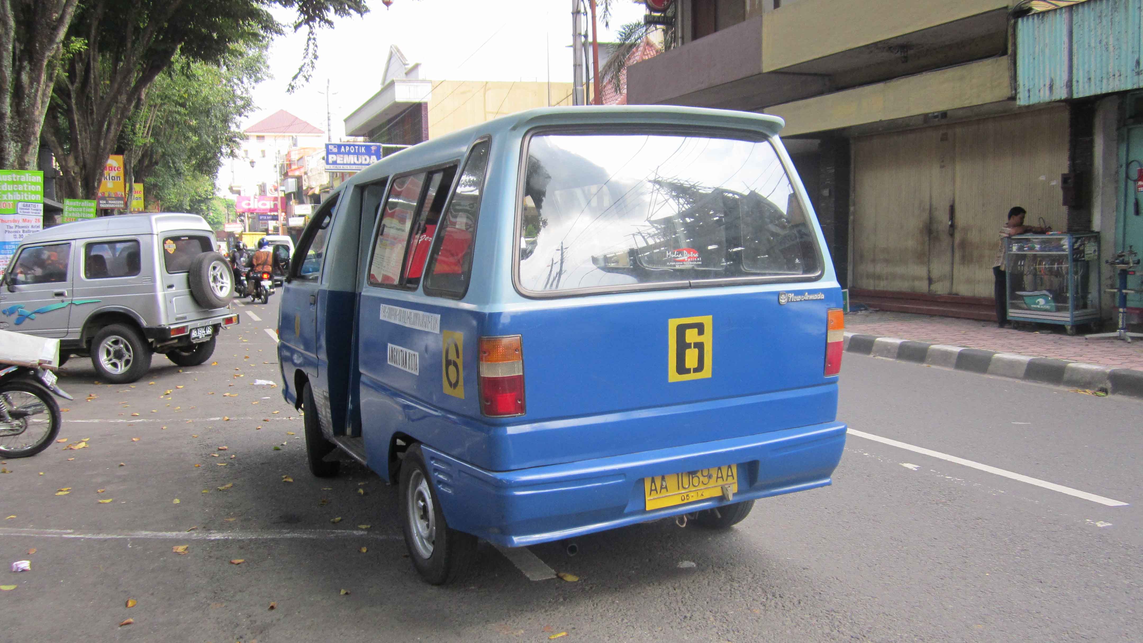
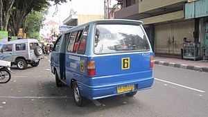 Jalur 6, one of Magelang Mass Public Transport
Main transportation which is operating in Magelang are cars, motorcycles, buses, paddy cabs, becak, and bicycles. Today, most popular of them are cars and motorcycles. Even almost household has a motorcycle as mean of mobility in daily activity. Then, for public transportation is mainly using buses and cars.
Magelang used to have a railway track from Semarang to Yogyakarta passing at its centre (along Jalan Pemuda), but have since been redirected outside the city.[2] Unfortunately, today the railway track does not function again. It was closed by the government due to the operational cost in that time.
Magelang does not have its own airport and therefore relies on Yogyakarta's Adisutjipto International Airport, Surakarta's Adisumarmo International Airport and Semarang's Achmad Yani International Airport. Then, to reach the airport, especially Adisucipto,from Magelang needs about one hour by bus or car or taxi. But today its easier way to reach Adi Sucipto International Airport in Yogyakarta by using DAMRI special bus that special operated to carry people from Magelang to Adi Sucipto Airport and its way-back.
November 2011: Due to lava flooding from Mount Merapi through Kali Putih River in Gempol, Magelang, the main road connecting Magelang and Yogyakarta has several times closed. An estimated Rp.64 billion ($7.3 million) project to build bridge over the river, a 2.3 kilometer-long stream dredge and land acquisition is being built by government.[13]
Motto
Magelang's motto is HARAPAN (in English: Hope). It is made of "Hidup", "Aman", "RAPi", "Asri" dan "Nyaman" (in English: living, safe, tidy, green, and comfort)[14]
Gallery
-

Magelang Shopping Center
-

Military Academy Front View
-
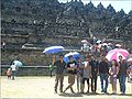
The shoot from North yard of Borobudur Temple
-
The shoot of Magelang Central Park
-
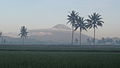
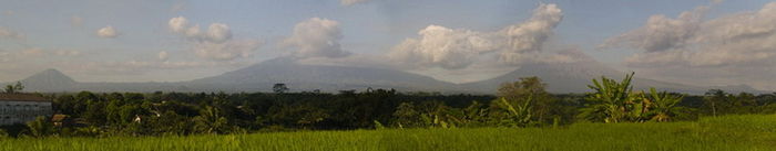
The silhouette of Sumbing Mount from Bondowoso, Mertoyudan
See also
- List of cities of Indonesia
References
- ^ http://www.magelangkota.go.id/profile.php
- ^ a b c d e f http://www.javatourism.com/index.php?Page=619
- ^ http://www.magelangkota.go.id/potensi.php?id=3
- ^ http://www.magelangkota.go.id/page.php?id=5
- ^ http://translate.google.co.id/translate?u=http%3A%2F%2Fwww.magelangkota.go.id%2Fpage.php%3Fid%3D5&hl=id&ie=UTF-8&sl=id&tl=en
- ^ "Population Census 2010 Province JAWA TENGAH". Population Census 2010. Badan Pusat Statistik. http://www.bps.go.id/aboutus.php?sp=0&kota=33. Retrieved 25 May 2011.
- ^ "Population Census 2010 Province JAWA TENGAH". Population Census 2010. Badan Pusat Statistik Republik Indonesia. http://jateng.bps.go.id/2006/web06sp2010/sp2010_001.htm. Retrieved 25 May 2011.
- ^ W. J. van der Meulen (1977). "In Search of "Ho-Ling"". Indonesia 23: 87–112. http://cip.cornell.edu/Dienst/UI/1.0/Display/seap.indo/1107118718.[dead link]
- ^ http://www.magelangkota.go.id/detailpariwisata.php?id=70
- ^ http://translate.google.co.id/translate?u=http%3A%2F%2Fwww.magelangkota.go.id%2Fdetailpariwisata.php%3Fid%3D70&hl=id&ie=UTF-8&sl=id&tl=en
- ^ http://www.indonesia-tourism.com/central-java/kyai-langgeng-park.html
- ^ http://www.magelangkota.go.id/detailpariwisata.php?id=88
- ^ "New stream built to reduce lava impact". November 9, 2011. http://www.thejakartapost.com/news/2011/11/09/new-stream-built-reduce-lava-impact.html.
- ^ http://www.suaramerdeka.com/harian/0509/22/ked04.htm
External links
- Website resmi Pemerintah Kota Magelang/Official Website of the Government of the City of Magelang (in Indonesian)
- Official Website of Muhammadiyah University of Magelang
- Official Website of Military Academy of Magelang
- Collection of Magelang Streetview Photo Gallery
- Collection of Magelang P.O.I. Photo Gallery
Coordinates: 7°28′S 110°13′E / 7.467°S 110.217°E
Regencies and cities of Central Java (Jawa Tengah) Capital: Semarang Regencies
Banjarnegara • Banyumas • Batang • Blora • Boyolali • Brebes • Cilacap • Demak • Grobogan • Jepara • Karanganyar • Kebumen • Kendal • Klaten • Kudus • Magelang • Pati • Pekalongan • Pemalang • Purbalingga • Purworejo • Rembang • Semarang • Sragen • Sukoharjo • Tegal • Temanggung • Wonogiri • Wonosobo

Cities
Karanganyar • Magelang • Pekalongan • Purwokerto • Salatiga • Semarang • Surakarta • Tegal • Ungaran
See also: List of regencies and cities of Indonesia Categories:- Populated places in Central Java
- 907 establishments
- Magelang
- Cities in Central Java
- Cities in Indonesia
- Regency capitals of Indonesia


Wikimedia Foundation. 2010.