- Salatiga
Infobox City
official_name = Salatiga
nickname = city of retirement
motto = salatiga hati beriman
imagesize =
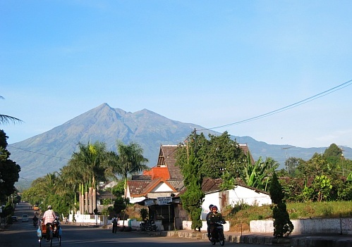
image_caption = Mount Merbabu viewed from Salatiga.
image_
mapsize =
map_caption = Location of Salatiga in Indonesia
pushpin_
subdivision_type = Country
subdivision_name =Indonesia
subdivision_type1 = Province
subdivision_name1 =Central Java
subdivision_type2 =
subdivision_name2 =
leader_title = Mayor
leader_name =
established_title =
established_date =1 July 1917
area_magnitude =
area_total_km2 = 17.87
area_total_sq_mi =
area_land_km2 =
area_land_sq_mi =
area_water_km2 =
area_water_sq_mi =
area_water_percent =
area_urban_km2 =
area_urban_sq_mi =
area_metro_km2 =
area_metro_sq_mi =
population_as_of = 2006
population_note =
population_total = 176000
population_density_km2 = 8.898
population_density_sq_mi =
population_metro =
population_density_metro_km2 =
population_density_metro_sq_mi =
population_urban =
timezone = WIB
utc_offset = +7
timezone_DST =
utc_offset_DST =
latd=7 |latm=19 |lats=29 |latNS=S
longd=110 |longm=32 |longs=39.79 |longEW=E
elevation_m = 700
elevation_ft =
website = [http://www.pemkot-salatiga.go.id/ www.pemkot-salatiga.go.id]
footnotes =Salatiga is a city in
Central Java ,Indonesia , located between the cities ofSemarang andSurakarta . It sits at the foot of Mount Merbabu (3,142 m) andMount Telomoyo , and has a relatively cool climate due to its elevated position.Origin of name
Salatiga is thought to be named after the goddess of Trisala or the three wrongs done to the first king of Semarang.
In the first explanation, the people of the village celebrate the "goddess of Trisala" called the village "Trisala" and in the years to come became "Salatri" and eventually Salatiga.
The second explanation is that of Ki Ageng Pandanaran, the first regent of
Semarang , was robbed by three muggers, and he thus named the location "Salah Telu". "Salah" means "wrong" in Indonesian and Javanese, and "telu" is Ngoko Javanese (Low Javanese) for "three", while "tiga" in both the more polite Kromo Boso (Middle/High Javanese), and Indonesian, hence "Salatiga.History
The official birthdate of Salatiga is 24th July, 750 A.D. (the 31st date and 4th year of the
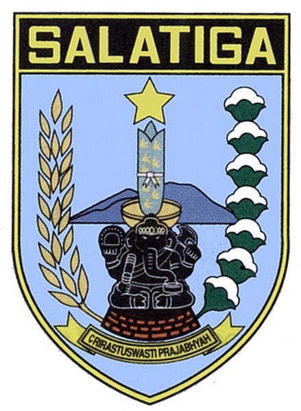
Saka calendar ). The scroll "Monolith of Plumpungan" ("Prasasti Plumpungan " inSanskrit ) byKing Bhanu , declares "May you be happy! All the people" ("Srir = astu swasti prajabhyah") and designated "village of Hampran (Desa Hampran)" a "Perdikan village (Desa Perdikan, meaning a tax-free village)".On 1st July 1917 the village of Salatiga was designated as a "staads gemeente" or small town, by the Dutch colony.
Administration
Salatiga is divided into 4 subdistricts ("kecamatan"):
Argomulyo ,Tingkir ,Sidomukti , andSidorejo .Geography
Salatiga is located about 47 km south of
Semarang and about 100 km north of Yogyakarta. Its elevation is between 450–800 metres with typical tropical climate. The average rainfall is 118 mm (145 rainy days) with the highest temperature in October (31.8oC) and the lowest in July (23.9oC).External links
* [http://www.pemkot-salatiga.go.id/index.php?lang=en Official website]
* [http://www.klaseman.uni.cc Salatiga-Klaseman website]
* [http://www.virtualtourist.com/travel/Asia/Indonesia/Central_Java_Province/Salatiga-1208307/TravelGuide-Salatiga.html Salatiga travel guide]
Wikimedia Foundation. 2010.

