Deadman Canyon

Deadman Canyon
Deadman Canyon

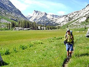
Backpacker in Ranger Meadow, Deadman Canyon
Location Kings Canyon National Park, California, United States
Floor elevation 7,620 feet (2,320 m)
Long-axis length 8 miles (13 km)
Coordinates 36°42′18″N 118°34′47″W / 36.705°N 118.57972°W / 36.705; -118.57972Coordinates: 36°42′18″N 118°34′47″W / 36.705°N 118.57972°W / 36.705; -118.57972[1]

Deadman Canyon is a glacier-carved canyon in Kings Canyon National Park. Its namesake is an Iberian sheep-herder who died and is buried there.

Contents

Geography

Deadman Canyon is located almost directly north of Elizabeth Pass, between Ranger Meadow and Scaffold Meadows, in the south-central area of the park. The canyon is surrounded by steep granite walls, and is traversed by a stream.

Flora

Plant life in the canyon include aspens and pines, along with buckwheat, sagebrush, Indian paintbrush, mariposa lily, columbine, delphinium, daisy, Mexican hat, penstemon, pennyroyal, and shooting star.

The Grave

Near the trail that crosses the canyon is the grave for which the canyon is named. The rustic plot is surrounded with a timber fence, and features a marker that reads, “HERE REPOSES ALFRED MONIERE, SHEEPHERDER, MOUNTAIN MAN, 18—TO 1887.” Two common versions of this man’s story exist. In one, he is murdered, and in the other, he became ill and died while his partner went to Fresno for help.

Despite the date on the marker, the February 14, 1894 issue of National Geographic states that Moniere died in 1875.

References

External links


Wikimedia Foundation. 2010.

Игры ⚽ Нужно сделать НИР?

Look at other dictionaries:

  • Kings Canyon National Park — Infobox protected area | name = Kings Canyon National Park iucn category = II caption = locator x = 22 locator y = 85 location = Fresno County Tulare County, California, USA nearest city = Fresno lat degrees = 36 lat minutes = 48 lat seconds = 0… …   Wikipedia

  • Tijeras Canyon — Not to be confused with Tijeras Canyon Creek, a tributary of Trabuco Creek. Deadman s curve on old Route 66 Tijeras Canyon is a prominent canyon in the central part of the US state of New Mexico. Tijeras Canyon is often referred to by locals as… …   Wikipedia

  • List of Ace double novels — Ace Books began publishing genre fiction starting in 1952. Initially these were mostly in the attractive dos à dosfact|date=July 2008 | dos à dos or tête bêche? format, but they also published a few single volumes, in the early years, and that… …   Wikipedia

  • List of Ace western double titles — Ace Books published 250 western Ace doubles between 1952 and 1973 in dos à dos format.Genres and collectabilityAce published science fiction, mysteries, and westerns, as well as books not in any of these genres. Collectors of these genres have… …   Wikipedia

  • List of Ace western letter-series single titles — Ace Books have published hundreds of western titles, starting in 1952. Most of these were Ace Doubles (dos à dos format), but they also published a few single volumes. Between 1952 and 1968, the books had a letter series identifier; after that… …   Wikipedia

  • List of Ace titles in F series — Ace Books published its F series of books, priced at 40 cents, from 1960 to 1967. The following list may not be complete; some numbers are not listed, and it is not known if a book corresponds to them. The missing numbers are 136, 228 and 338.*F… …   Wikipedia

  • Ridge Route — Ridge Route, Old U.S. National Register of Historic Places …   Wikipedia

  • List of mountain passes in Montana (A-L) — Map of all coordinates from Google Map of all coordinates from Bing Export all coordinates as KML …   Wikipedia

  • Interstate 84 in Oregon — Interstate 84 Route information …   Wikipedia

  • Colton Point State Park — Coordinates: 41°41′59″N 77°27′53″W / 41.69972°N 77.46472°W / 41.69972; 77.46472 …   Wikipedia

Share the article and excerpts

Direct link
Do a right-click on the link above
and select “Copy Link”