- Seymour Arm, British Columbia
-
 Seymour Arm
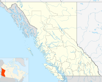
Seymour Arm, known historically also as Ogdensville or Ogden City and Seymour, is an unincorporated area and former town located at the head of the inlet of the same name on Shuswap Lake in British Columbia, Canada. Located at the mouth of the Seymour River and the disembarkation point for trails over passes across the Monashee Mountains connecting that river's valley to that of the Columbia River, and navigable by water from Savona at the farther end of Kamloops Lake,
Contents
History
Seymour Arm became the location of a bustling boomtown serving travellers to the Big Bend Gold Rush on the Columbia which grew up around a Hudson's Bay Company post founded at the start of the rush in 1865. With a peak population of 500, Seymour Arm had 13 stores, 11 shoemakers, 8 wash houses, 6 barber shops, 6 physicians, 6 saloons, 5 bakeries, 3 restaurants, 2 blacksmiths, 1 bath-house, 1 drug store, 1 stationery shop, a coffee and doughnut stand, and a livery stable. The town was destroyed by fire in the late 1860s but was revived again by English developers promoting the Seymour Arm Fruits Land Company, and a post office, hotel, school and hotel were established in 1910. The hotel closed in 1925 and by 1940 the town was largely abandoned, save for a few remaining settlers. Today the hotel, since reopened with a restaurant and pub, and one of the orchard-era mansions remain, and the locality is a farming and recreational community.
Climate
Climate data for Seymour Arm Month Jan Feb Mar Apr May Jun Jul Aug Sep Oct Nov Dec Year Record high °C (°F) 12
(54)10.5
(50.9)15.6
(60.1)32.8
(91.0)36
(97)35
(95)38.9
(102.0)36.7
(98.1)31.1
(88.0)23.5
(74.3)12.5
(54.5)8.5
(47.3)38.9
(102.0)Average high °C (°F) −2.5
(27.5)1.1
(34.0)7.1
(44.8)14
(57)19.3
(66.7)23.1
(73.6)25.7
(78.3)25.3
(77.5)19.4
(66.9)11.3
(52.3)2.7
(36.9)−1.7
(28.9)12.1 Average low °C (°F) −7.5
(18.5)−5.4
(22.3)−3
(27)0.6
(33.1)5.6
(42.1)9.3
(48.7)11.2
(52.2)10.5
(50.9)6.6
(43.9)2.2
(36.0)−2.1
(28.2)−5.8
(21.6)1.8 Record low °C (°F) −32.5
(−26.5)−29.5
(−21.1)−25
(−13)−10
(14)−2.5
(27.5)0.5
(32.9)4.5
(40.1)1
(34)−4.5
(23.9)−13
(9)−33.5
(−28.3)−34
(−29)−34
(−29)Precipitation mm (inches) 91.5
(3.602)80.6
(3.173)58.7
(2.311)57.4
(2.26)75.6
(2.976)85.5
(3.366)78.8
(3.102)76.3
(3.004)66.1
(2.602)75.9
(2.988)114.7
(4.516)117.7
(4.634)978.9
(38.539)Source: Environment Canada[1] See also
References
- ^ Environment Canada—Canadian Climate Normals 1971–2000, accessed 28 March 2010
External links
Coordinates: 51°14′15″N 118°56′45″W / 51.2375°N 118.94583°W
Categories:- Populated places in the Columbia-Shuswap Regional District
- Ghost towns in British Columbia
- Unincorporated settlements in British Columbia
- Canadian gold rushes
- British Columbia gold rushes
- Shuswap Country
- 1865 establishments
- Designated places in British Columbia
- British Columbia Interior geography stubs
- Canada ghost town stubs

Wikimedia Foundation. 2010.