- Newfoundland-Labrador fixed link
-
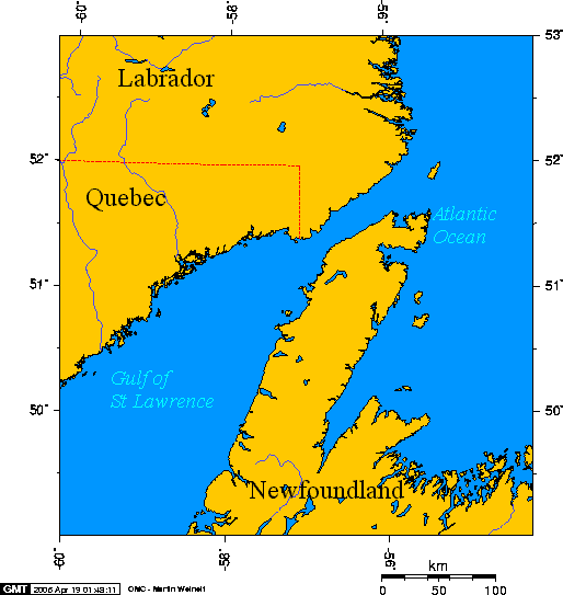
The Newfoundland-Labrador fixed link refers to various proposals for constructing a fixed link consisting of bridges, tunnels, and/or causeways across the Strait of Belle Isle, connecting the province of Newfoundland and Labrador's mainland Labrador region with the island of Newfoundland. This strait has a minimum width of 17.4 km (10.8 mi).
 Strait of Belle Isle
 Looking across the Strait of Belle Isle in moonlight from Green Island Brook March 24, 2005. From left to right Point Amour light, L'Anse-au-Loup and Capstan Island.
The idea was conceived by mining engineer Tom Kierans during the early 1970s as a means to bring hydroelectricity from Churchill Falls to the island part of the province. Approximately $75 million was spent by the provincial government on constructing such a utility tunnel but the project was cancelled in 1975.
In the lead-up to the October 2003 provincial election, Progressive Conservative leader Danny Williams promised to fund a feasibility study to placate link supporters.
Contents
2004 Feasibility Study
The feasibility study into a Newfoundland-Labrador fixed link, resulting from the 2003 election promise by newly-elected premier Danny Williams, was released in 2004. It examined causeway, bridge and tunnel options and recommended that a tunnel beneath the Strait of Belle Isle, accommodating a single railway track, would be the only feasible option, given the area's harsh winter weather conditions, the strait's bathymetry (the depth and shape of the sea floor), and the geology of underlying soils.
Electric-powered trains would be loaded on either side and carry cars, buses and transport trucks. The authors of the study estimated that construction, either by tunnel boring or lowering pre-constructed tunnel sections to a trench in the sea floor, is beyond the current technological limit due to the depth of the sea floor and scouring of the strait by icebergs.
The authors also stated that the cost of construction and low traffic levels would not justify the cost. Conceivably, if built with federal aid, the 1949 terms of union might be amended to remove federal subsidies from the federally operated Marine Atlantic ferry service that connects Port-aux-Basques with North Sydney, Nova Scotia and place them instead on the proposed fixed link.
In terms of driving distance, a fixed link would not be favourable for residents of the Maritimes or parts of the Eastern Seaboard of the United States as they would have to drive to Quebec City where bridges cross the St. Lawrence River (there are ferries further downstream), before continuing east along Quebec's Côte-Nord (of the Gulf of St. Lawrence).
Highway connections
The south coast of Labrador was isolated from the rest of the North American road network, until completion of the Trans-Labrador Highway in 2009 and upgrades to its counterpart Route 389.
An ideal road connection for a fixed link across the Strait of Belle Isle would be a complete highway along Quebec's Côte-Nord, however, Route 138 is currently completed only to Natashquan.
Additionally, parts of Route 389, starting approximately 212 km (132 mi) from Baie-Comeau at the Manic-5 generating station to 482 km (300 mi) at Fire Lake have a substandard alignment. The section from Manic-5 through Fire Lake to Mount Wright is extremely accident-prone and notorious among drivers for its poor surface and sharp curves; the joke being you can see your own taillights.
Residents in Labrador lobbied the Quebec government to realign the highway, and are lobbying the Newfoundland and Labrador government to upgrade the Trans-Labrador Highway from loose surface to asphalt at Trans-Canada Highway standards. On 9 April 2009, the Quebec government announced a $438 million project to upgrade Route 389 from Route 138 to Fermont, bringing it very close to the Labrador border [1]. This should be particularly beneficial to the Manic-5-Mount Wright section.
Criticism of the project
In light of federal government plans to make significant upgrades to its Marine Atlantic ferry service, it would appear that federal politicians and bureaucrats have not accepted the vision of a fixed link to the island of Newfoundland, preferring instead to focus on improving a ferry service that has been in daily operation since 1898.[citation needed]
Many business and community leaders in Newfoundland and the rest of Canada have also spoken out against the project, noting that the economic argument for such a link is not proven. Internationally, the influential business news magazine The Economist has derided the proposal in a story called Now let's dig an expensive hole.
External links
Categories:- Transportation in Newfoundland and Labrador
- Proposed undersea tunnels
- Proposed transport infrastructure in Canada

Wikimedia Foundation. 2010.