Milang, South Australia

Milang, South Australia
Milang
South Australia
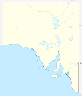
Milang is located in South Australia
{{{alt}}}
Milang
Population: 512 (2006 Census)[1]
Established: 1853
Postcode: 5256
Coordinates: 35°24′22″S 138°58′13″E / 35.4062163°S 138.9701994°E / -35.4062163; 138.9701994Coordinates: 35°24′22″S 138°58′13″E / 35.4062163°S 138.9701994°E / -35.4062163; 138.9701994
Time zone:

 • Summer (DST)

ACST (UTC+9:30)

ACDT (UTC+10:30)

Location: 20 km (12 mi) SW of Strathalbyn
LGA: Alexandrina Council
State District: Hammond
Federal Division: Mayo

Milang is small town situated on the shores of Lake Alexandrina, just over 20 km from Strathalbyn, South Australia. At the 2006 census, Milang had a population of 512.[1]

The town was surveyed in December 1853.[2] Milang was a significant port on the Murray River System between 1860 and 1880, before the railway line was built to connect Adelaide to Morgan further upstream.[3] Milang Football Club currently compete in the Hills Football League C Grade competition.

References

  1. ^ a b Australian Bureau of Statistics (25 October 2007). "Milang (L) (Urban Centre/Locality)". 2006 Census QuickStats. http://www.censusdata.abs.gov.au/ABSNavigation/prenav/LocationSearch?collection=Census&period=2006&areacode=UCL415400&producttype=QuickStats&breadcrumb=PL&action=401. Retrieved 6 October 2011. 
  2. ^ "Milang, South Australia". Place Names Online. Government of South Australia Department for Transport, Energy and Infrastructure. http://www.placenames.sa.gov.au/pno/pnores.phtml?recno=SA0044731. Retrieved 2008-08-02. [dead link]
  3. ^ "Milang: The Jetty". http://www.milang.org.au/History/Jetty.htm. Retrieved 2008-08-02. 

Wikimedia Foundation. 2010.

Игры ⚽ Нужен реферат?

Look at other dictionaries:

  • Rail transport in South Australia — South Australia was the first colony in Australia to build a railway line. It was a horse drawn tramway from the port of Goolwa on the Murray River to an ocean harbour at Port Elliot in 1854. Today the state has RailGauge|1600 broad gauge… …   Wikipedia

  • Lake Alexandrina (South Australia) — Lake Alexandrina Lake Alexandrina ist der größere der Lower Lakes Geographische Lage South Australia Zuflüsse Murray River, Bremer River, An …   Deutsch Wikipedia

  • Mount Barker Junction railway station, South Australia — Mount Barker Junction railway station is a railway station in South Australia located on the Melbourne Adelaide railway, 50km (31mi 25ch) by rail from Adelaide Railway Station. It is west of the junction of the Victor Harbor line. The station… …   Wikipedia

  • Victor Harbor railway line, South Australia — The Victor Harbor line is a broad gauge railway line in South Australia. It branches from the Adelaide Melbourne railway at Mount Barker Junction and then runs south to Victor Harbor.HistorySouth Australia’s first railway venture was the opening… …   Wikipedia

  • List of cities and towns in South Australia — This is a list of town and locality names in South Australia outside of the metropolitan postal area of Adelaide.:For a list of suburbs in metropolitan areas of Adelaide, see lists inside following individual city council articles: City of… …   Wikipedia

  • List of postcodes in South Australia/numeric sort — Postcodes are used by Australia Post to identify postal districts in Australia. This list is sorted numerically to facilitate seeing which towns/suburbs share a postcode.5000s inner suburbs* 5000 Adelaide * 5001 GPO Boxes * 5005 University of… …   Wikipedia

  • Alexandrina Council — District Council of Alexandrina Lage des Alexandrina Council in South Australia Gliederung …   Deutsch Wikipedia

  • Windeyer County — Map of all coordinates from Google Map of all coordinates from Bing Export all coordinates as KML …   Wikipedia

  • Michael Atchison — Michael Plant Atchison O.A.M. (4 August 1933 – 16 February 2009) was an Australian cartoonist who worked for the South Australian Advertiser for over 40 years. He was born in Sandringham, Victoria and moved to South Australia with his family in… …   Wikipedia

  • Victor Harbor railway line — The railway station used by the SteamRanger in Mount Barker Contents …   Wikipedia

Share the article and excerpts

Direct link
Do a right-click on the link above
and select “Copy Link”