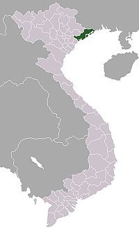
- Quang Ninh Province
Infobox province of Vietnam
Name = Quảng Ninh
Meaning = Secure Serenity
Council Chair =
Committee Chair =
Capital = Hạ Long
Township =Mong Cai
Region = Northeast
Area = 5,899.6
Population = 1,067,300
Population year = 2004
Population density = 180.91
Ethnicities = Vietnamese, Tày, Dao, Sán Chay, Sán Dìu,Hoa
Calling code = 33
ISO code = VN-13
Website = www.halong.com:"There is a district inQuang Binh Province called Quang Ninh.Quảng Ninh (audio|Quang Binh.ogg|pronunciation;Hán Tự : ) is a large province located along the northeastern coast ofVietnam .Geography
The province has the shape of an oblique rectangle inclined in a northeast-to-southwest direction. To the west, the province borders an extended forest and mountain region. To the east, it is adjacent to the Gulf of Bắc Bộ. It features a meandering coastline, numerous estuaries and tidal flats and more than 2,000 large and small islands. Exactly 1,030 of these have been named. Quảng Ninh's coordinates are
longitude 106º25' to 108º25' east andlatitude 20º40' to 21º40' north. Its width from east to west is 195 km (at the widest part).The total length from north to south is 102 km. The northernmost point is in mountain range at Mo Toòng village (Hoành Mô Commune, Bình Liêu District). The southernmost point is in Hạ Mai Island (Ngọc Vừng Commune, Vân Ðồn District). The westernmost point is in Vàng Chua River (Bình Dương and Nguyễn Huệ communes, Ðông Triều District). The easternmost point is inland at Got Cape, northeast of Trà Cổ Commune,
Mong Cai Town.Quảng Ninh has a common international border with the People’s Republic of China. Inland, north of province (Bình Liêu, Hải Hà districts and
Mong Cai borders Fang Cheng District and Ðông Hưng Town inGuangxi Province,PRC with the borderline of 170 km. To the east, it adjuncts to Bắc Bộ Gulf. The province also borders Lạng Sơn, Bắc Giang and Hải Dương provinces to the west, and the city of Hải Phòng to the south. The coastal line is 250 km. The total area of Quảng Ninh is 8,239.243 km², of which 5,938 km² is mainland. The area of islands, bays and sea is a tremendous 2,448.853 km². The total area of the islands is 619.913 km².Districts
Quảng Ninh is divided into one city (
Hạ Long ), three towns (Cẩm Phả ,Móng Cái , andUông Bí ), and ten districts:*
Ba Chẽ
*Bình Liêu
*Cô Tô
*Đầm Hà
*Đông Triều
*Hải Hà
*Hoành Bồ
*Tiên Yên
*Vân Đồn
*Yên Hưng Topography
Quảng Ninh is a mountainous and coastal province, with more than 80% of its area being made up of mountains and hills. The 2,000 some islands are also considered mountains. The mountainous zone can be divided into two parts: the eastern mountainous region extending from
Tiên Yên throughBình Liêu ,Hải Hà ,Ðầm Hà andMóng Cái ; and the western zone ranging from Tiên Yên throughBa Chẽ andHoành Bồ , north ofUông Bí Town . The former is a continuation of theThâp Van Ðai Son range in China. There are two main chains:Quang Nam Châu 1,507 m andCao Xiêm 1,330 m. The western zone features smooth and curved mountains calledÐông Triều withYên Tu Mount 1,068 m inUông Bí region andAm Váp Mount 1,094 m inHoành Bồ District.The midland and coastal plains include a low range of hills weathered by both wind and water; forming fields and river basins. They include the zones of
Ðông Triêu ,Uông Bí , northernYên Hưng , southernTiên Yên ,Hải Hà and some ofMóng Cái . In the estuaries, alluvial soil is deposited, creating low tidal flats. This can be found in the areas of southern Uông Bí, southern Yên Hưng (Hà Nam Island), eastern Yên Hưng, Ðông Rui (Tiên Yên), southern Ðầm Hà andMong Cai , southeastern Hải Hà. The midlands and plains of the coastline are extremely favourable for agriculture and transport. It has become a densely populated area of the province.The sea and island zone of Quảng Ninh has a unique terrain. There are more than 2,000 islands, making up two thirds of the country’s islands. They extend along the coast for more than 250 km and divide into numerous layers. The largest islands are Cái Bâu and Ban Sen, while the smallest are just like rocks in a garden. Vân Ðôn and Cô Tô are island districts. There are thousand of islands on Hạ Long Bay and Bái Tu Long Bay, many of which contain
cave s. Besides areas of alluvial deposits, there are also white sand zones which have built up from tidal action. Some places have formed white sand mines producing materials for the glass industry (Vân Hai), or have developed into wonderful tourism spots (Trà Cô, Quan Lan, Minh Châu, Ngoc Vung).The sea bottom terrain of Quảng Ninh isn't smooth, and has an average depth of 20 m. There are the remnants of ancient streams and underwater rocky banks. The streams from the mainland connect to deep drains along the sea-floor; creating a series of waterways, canals and harbours along the coast.
Hydrography
In Quảng Ninh, there are numerous rivers and springs, but most are short and small, and feature currents that differ between seasons. In winter, most rivers run dry, but in summer, waterfalls pick up fast currents. The water current reaches 1.45 m³/s in dry season, but up to 1,500 m³/s in the rainy season. Quảng Ninh’s sea borders upon the Gulf of Bắc Bộ. It is large and protected by the ranks of islands, so the wind is quieter and the water smoother. The gulf’s current runs from north to south. It is Vietnam’s coldest sea, with the temperature sometimes dipping below 13 °C.
Climate: Quảng Ninh’s climate is symbolic of the climate of North Vietnam; featuring all four seasons. In summer, it's hot, humid and rainy, while
monsoons flourish. In winter, it's cold, dry, and sees little rainfall.The average heat radiating during a year is 4,828 MJ/m². The average temperature is over 21 °C, while the average humidity is 84%. Annual rainfall totals between 1,700 and 2,400 mm, and there can be between 90 to 170 rainy days in a year. These are mainly concentrated in the summer (more than 85%), and especially in the months of July and August. In winter, rainfall only reaches between 150 and 400 mm.
In comparison to other provinces in the north, Quảng Ninh has been more under the influences of north-eastern monsoons. The wind blows strongly and the temperature drops to between 1 and 3 °C. During a north-eastern monsoon, high mountainous regions such as Bình Liêu and Hải Hà, Ðầm Hà sometimes see the temperature drop below 0 °C. Storms have a large influence on the province, mainly in June, July and August. The intensity can be extremely strong, especially in island and coastal regions.
Due to differences in terrain, the climate of sub-regions vary. The border area of the Móng Cái District is colder and rainy, with an average temperature of around 22 °C and rainfall reaching 2,751 mm. In the Yên Hưng District, the most southern area, the average temperature is 24 °C and sees an average rainfall of 1,700 mm. The high mountainous region of Hoành Bồ, and Ba Chẽ districts, has 20 days of frost a year, and is subject to little rainfall. In the Bình Liêu District there is heavy rain (2,400 mm) and winter lasts for six months. The offshore island region is not the wettest area, with only 1,700 to 1,800 mm of rainfall per year, but winter is often accompanied by thick mists.
Currently, many factories have been setup - and this may be source of bad for climate of Halong
Water and mineral water
Water resources in the province of Quảng Ninh are abundant and distinct.
The largest rivers are: the
Ka Long (the natural national border between China and Vietnam),Hà Côi ,Ðầm Hà ,Tiên Yên ,Phố Cũ ,Ba Chẽ ,Diễn Vọng ,Trới ,Míp ,Uông ,Ðạm andCầm rivers. The provincial border is theKinh Thầy River which joins the Ðá Bạch River and runs into Bạch Ðằng. The total static capacity is estimated at 175.106 m³ of water. Out of the 72 lakes and dams, there are 28 large lakes with a total of capacity of 195.53 million m³ of water. The largest is Yên Lập Lake, which blocks the Míp Estuary. Its water volume is 1.18 million m³. Other lakes include:Khuất Ðộng ,Trúc Bài Sơn ,Khe Táu ,Ðoan Tĩnh ,Khe Uơn ,Khe Chếnh ,Yên Trung ,Bến Châu ,Trại Lốc ,Rộc Cả andAn Biên .Underground running water is also abundant, and can even be found on some of the larger islands. According to prospective data, 13 urban and industrial areas make use of 64,388 m³ water/day. In the province there are natural bottle water points in
Quảng Hanh (Cẩm Phả ),Khe Lạc (Tiên Yên ) andÐồng Long (Bình Liêu ). Mineral water is concentrated in the village of Quảng Hanh. Presently, there are 15 exploration holes, and according to preliminary results, capacity could be 1,004 m³/day. Quảng Hanh mineral water is clear and colourless, with mineral content varying from 3.5 to 5.05 g/l.Fauna andflora Quảng Ninh, because of its varied terrain, climate and soil, features a diversified and abundant environmental system.
Fauna: There are the regular domestic animals:
cattle ,pigs ,poultry ,cats ,dogs , andrabbits . Cattle breeding has developed well in the mountainous regions, while the Móng Cái pig is now famous for its especially lean meat. In eastern districts, swans hybridized with ducks, called "cà sáy" by locals, are also becoming popular. Numerous foreign cattle are imported as well: buffaloes fromIndia , milk cows from theNetherlands and India andhorses ,sheep andgoats fromMongolia .Wild animals: Formerly, as with the rest of Vietnam, there were once numerous wild animals. In more remote times, there were
elephant s,rhinoceros ,tiger s,leopard s andbear s roaming the area. Today, there aremonkeys ,deer ,pheasant s,eagle s, wildboar s, variousbird s andtortoise s (which unfortunately are less abundant than they once were).Aquatic fauna: In Quảng Ninh aquatic fauna is very abundant, both fresh and sea water. There are large schools of fish swimming in the Gulf of Bắc Bộ. In addition, there are special products such as
pearl mussels ,stockfish ,sea turtle s andlobster s, while along the coastline,oyster s and edibleseaweed abound. These numerous fruits of the sea have always been an important source of income for the residents of Quảng Ninh.Flora: Quảng Ninh’s floral strong point has always been forestry. Agricultural land is narrow and unfertilized, so the production of
rice ,maize andsweet potatoes is poor. Making up for this is high productivity from fruit trees, lumber trees and industrial plants. The area for fruit trees in the Ðông Triều District totals around 30 km². Formerly in Quảng Ninh, there was diverse and high-quality wood available, in particular ironwood and teak trees. Presently, there are mainly pine trees. In mountainous areas, there are some very diverse trees and plants, providing spices and traditional medicines.In general, Quảng Ninh is a province having good and abundant geography which create great potentials to develop the economy in all fields. Because of its great tourism potentials, Quảng Ninh now becomes a centre, one of the important locations of the master plan in developing the economy of the whole country.
External links
* [http://www.halong.com/halongcom/index/e_index.asp]
Wikimedia Foundation. 2010.