- Hai Phong
Infobox Settlement
name = Hải Phòng
official_name =
other_name =
native_name =
nickname =
settlement_type = Provincial city
total_type =
motto =
imagesize = 300px
image_caption = A street in Hai Phong
flag_size =
image_
seal_size =
image_shield =
shield_size =
image_blank_emblem =
blank_emblem_type =
blank_emblem_size =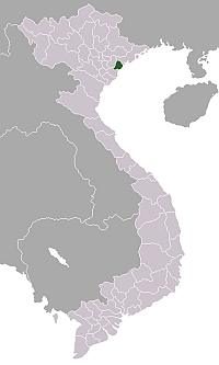
mapsize = 260px
map_caption = Provincial location in Vietnam
mapsize1 =
map_caption1 =
image_dot_
dot_mapsize =
dot_map_caption =
dot_x = |dot_y =
pushpin_
pushpin_label_position =
pushpin_map_caption =Location of in Vietnam
pushpin_mapsize =
subdivision_type = Country
subdivision_name = flag|Vietnam
subdivision_type1 = Province
subdivision_name1 =Hà Giang Province ,Red River Delta
subdivision_type2 =
subdivision_name2 =
seat_type =
seat =government_footnotes =
government_type =
leader_title =
leader_name =
leader_title1 =
leader_name1 =
established_title =
established_date =
area_magnitude =
unit_pref =
area_footnotes =
area_total_km2 = 1507.57
area_land_km2 =
area_water_km2 =
area_total_sq_mi =
area_land_sq_mi =
area_water_sq_mi =
area_water_percent =
elevation_footnotes =
elevation_m =
elevation_ft =
elevation_max_m =
elevation_max_ft =
elevation_min_m =
elevation_min_ft =
population_as_of =
population_footnotes =
population_note =
population_total =1,884,685
population_density_km2 =
population_density_sq_mi =
timezone =
utc_offset =
timezone_DST =
utc_offset_DST =
coor_type =
latd=20|latm=51|lats= |latNS=N
longd=106|longm=41 |longs=|longEW=E
postal_code_type =
postal_code =
area_code =
website = www.haiphong.gov.vn
footnotes =Hai Phong audio|Haiphong.ogg|pronunciation (Vietnamese:
Hải Phòng ; /haɪ˧˩˧ fɔŋ˨˩/;Hán Tự : ) meaning "Coastal Defence" is the third most populous city inVietnam .Geography
Hai Phong is located in the center of the Red River. It is approximately 100 kilometres from
Hanoi , the Vietnamese capital, and serves as the primaryseaport for the northern region of the country.Hai-Phong
History
Hai Phong has existed as a significant port city for at least several centuries, and was one of Vietnam's principal trading centres. When Vietnam was invaded by the French, the city became France's main naval base in Indochina. After
World War II , when Vietnam attempted to regain its independence, Hai Phong was the site of the first military action undertaken by the French, being shelled by the French heavy cruiser "Suffren" which resulted in more than two thousand casualties.Fact|date=March 2008 Later, in theVietnam War , the city was subjected to heavy bombing by US Navy and Air Force strike aircraft due to its status asNorth Vietnam 's only major port. After the war, the city was built up as a significant industrial centre.Today, known as a port city, it serves the entire northern region of Vietnam and has managed to attract large FDIs that fueled economic rates of growth exceeding 12% per annum over the last decade.
Administration
Administratively, Hai Phong constitutes an independent municipality at the same level as Vietnam's provinces. It is divided into administrative units:
7 urban districts :
* Đồ Sơn : Area : 42.37 km²; population: 51.500; has 7 wards : Vạn Sơn, Vạn Hoa, Ngọc Hải, Bàng La, Hợp Đức, Minh Đức, Vạn Hương.
* Dương Kinh : Area : 45.85 km²; population : 50.000; has 6 wards : Đa Phúc, Hưng Đạo, Anh Dũng, Hải Thành, Hoà Nghĩa, Tân Thành.
* Hải An: Area : 104.92 km²; population: 77.600 (2002); has 8 wards : Đông Hải 1, Đông Hải 2, Đằng Hải, Đằng Lâm, Nam Hải, Tràng Cát, Cát Bi, Thành Tô.
* Hồng Bàng: Area : 14.6 km²; population :110.000; has 11 wards: Hoàng Văn Thụ, Minh Khai, Quán Toan, Trại Chuối, Hùng Vương, Phan Bội Châu, Quang Trung, Sở Dầu, Phạm Hồng Thái, Thượng Lí, Hạ Lí.
* Kiến An: Area : 29.6 km²; population: 84.000; has 10 wards : Bắc Sơn, Đồng Hoà, Nam Sơn, Ngọc Sơn, Phù Liễn, Quán Trữ, Tràng Minh, Trần Thành Ngọ, Văn Đẩu, Lãm Hà.
* Lê Chân : Area : 12 km²; population :180.000; has 15 wards : An Biên, An Dương, Cát Dài, Đông Hải, Dư Hàng, Dư Hàng Kênh, Hàng Kênh, Hồ Nam, Lam Sơn, Niệm Nghĩa, Nghĩa Xá, Trại Cau, Trần Nguyên Hãn, Vĩnh Niệm, Kênh Dương.
* Ngô Quyền: Area : 10.96km²; population: 155.000; has 13 wards : Đông Khê, Máy Tơ, Lương Khánh Thiện, Cầu Đất, Lạch Tray, Đằng Giang, Lương Khánh Thiện, Gia Viên, Cầu Tre, Vạn Mỹ, Lạc Viên, Đổng Quốc Bình, Máy Chai.
8 suburban districts :
* An Dương : area : 95.7 km²; population : 110.000; has 15 communes : An Hoà, Lê Thiện, Đại Bản, An Hưng, An Hồng, Tân Tiến, Hồng Phong, Bắc Sơn, Nam Sơn, Lê Lợi, Đặng Cường, Quốc Tuấn, An Đồng, Đồng Thái, Hồng Thái and 1 town : An Dương.
* An Lão: area :114.58 km²; population : 126.939; has 15 communes : Bát Trang, Trường Thọ, An Tiến, Quang Trung, An Thắng, Tân Dân, Tân Viên, Chiến Thắng, An Thái, Trường Thành, Quang Hưng, Quốc Tuấn, Thái Sơn, Mỹ Đức, An Thọ and 2 town : Trường Sơn and An Lão which is the capital of district.
* Bạch Long Vĩ has a special administration, has no commune, with a very small area is 1.78 km² with the highest tidal, 2.33 km² with the normal level of sea, anđ 3.05 km² with the lowest tidal; people in island isn't indigenous, with a unstable amount, because the appearance of wanderer people come from fishing action and trading action around island. But someone estimated the population of island is about 2000, except unstable citizens.
* Cát Hải: area : 323.1 km² ; population : 28.000; has 10 communes and 2 town: Hoàng Châu, Nghĩa Lộ, Đồng Bài, Văn Phong and Cát Hải town on Cát Hải island ;and Phù Long, Gia Luận, Việt Hải, Hiền Hào, Trân Châu, Xuân Đám and Cát Bà town, also the administrative centre of this district. A lot of islands in Halong Bay include some famous islands as Gà Chọi rock, Đầu Gỗ island... now are considered as the common administrative part of both Hải Phòng city and Quảng Ninh province.
* Kiến Thuỵ: area : 107.53 km²; population: approximate 126 000; has 18 communes : Đông Phương, Đại Đồng, Hữu Bằng, Thuận Thiên, Du Lễ, Ngũ Phúc, Kiến Quốc, Thuỵ Hương, Thanh Sơn, Đại Hà, Ngũ Đoan, Tân Trào, Đoàn Xá, Đại Hợp, Tú Sơn, Tân Phong, Minh Tân and 1 town: Núi Đối.
* Thủy Nguyên: area : 242 km²; population : 290.000; has 34 communes : Lại Xuân, An Sơn, Kỳ Sơn, Liên Khê, Lưu Kiếm, Gia Minh, Gia Đức, Minh Tân, Phù Ninh, Quảng Thanh, Chính Mỹ, Kênh Giang, Hợp Thành, Cao Nhân, Mỹ Đồng, Đông Sơn, Hoà Bình, Trung Hà, An Lư, Thuỷ Triều, Ngũ Lão, Phục Lễ, Tam Hưng, Phả Lễ, Lập Lễ, Kiền Bái, Thiên Hương, Thuỷ Sơn, Thuỷ Đường, Hoàng Động, Lâm Động, Hoa Động, Tân Dương, Dương Quan and 2 towns : Minh Đức and Núi Đèo; Núi Đèo is the district's capital.
* Tiên Lãng : area : 180.9 km²; population: 150 000; has 22 communes : Tiên Cường, Tự Cường, Tiên Tiến, Quyết Tiến, Khởi Nghĩa, Cấp Tiến, Kiến Thiết, Đoàn Lập, Bạch Đằng, Toàn Thắng, Tiên Thắng, Tiên Minh, Bắc Hưng, Nam Hưng, Hùng Thắng, Tây Hưng, Tiên Hưng, Vinh Quang, Đại Thắng, Tiên Thanh, Quang Phục, Đông Hưng and 1 town : Tiên Lãng.
* Vĩnh Bảo : area : 180.54 km²; population : 185.000; has 29 communes : Giang Biên, Việt Tiến, Vĩnh Long, Hùng Tiến, Tân Liên, Tam Đa, Vinh Quang, Thanh Lương, Lý Học, Hòa Bình, Vĩnh Phong, Cao Minh, Vĩnh Tiến, Thắng Thủy, Dũng Tiến, Trung Lập, Vĩnh An, Hiệp Hòa, An Hòa, Nhân Hòa, Hưng Nhân, Đồng Minh, Liên Am, Tam Cường, Tiền Phong, Cộng Hiền, Cổ Am, Trấn Dương, Tân Hưng and 1 town : Vĩnh BảoCát Hải and Bạch Long Vĩ are islandish districts in the
Gulf of Tonkin - Cát Hải is a larger island just off Hai Phong's coast, while Bạch Long Vĩ is a small island near the centre of the Gulf.ister Cities
Places of interest
* Traditional Trade Villages
* Elephant Mountain
*Cat Ba - Pearl Island
*Do Son Resort
* Trang Kenh - Bach Dang
* Hai Phong Post Office, built by French colonial government
* People's Theatre Lake
* City Exhibition and Trade Center
* Catholic Cathedral
* Football Stadium
* Children Amusement Park
* University Belt
* Trading complex includes Big C Center and TD PlazaTransport
It is served by
Hai Phong Railway Station .External links
* [http://www.easyvietnamtravel.com/Destinations_travel_view.asp?id=15 Hai Phong tourism]
* [http://www.haiphong.gov.vn/en/ Hai Phong government website]
* [http://www.activetravelvietnam.com/city/haiphong.html Hai Phong Information]
Wikimedia Foundation. 2010.