- List of Maryland hurricanes (1980–present)
List of Maryland and Washington, D.C. hurricanes from 1980–present encompasses 54 known hurricanes, tropical storms and tropical depressions that have affected the
U.S. state ofMaryland andWashington, D.C. The majority of storms that affected Maryland also had some impact of Washington, D.C. Hurricanes are the most intense classification of these storms, while tropical storms and tropical depressions are generally weaker. TheDelmarva Peninsula is often affected by cyclones that brush the East Coast.Cite web|author=Tropical Prediction Center|title=Best Track Anaylsis|year=|publisher=Unisys corporation|accessdate=2008-05-08|url=http://weather.unisys.com/hurricane/atlantic/index.html] Central and western Maryland, as well as and Washington, D.C. commonly receive rainfall from the remnants of storms that make landfall elsewhere and track (move) northward. On rare occasions, the area sees the effects of Pacific storms; one such example of this is Hurricane Tico, which made landfall onMexico and moved inland. Four tropical cyclones in the state have caused five known deaths.Hurricane Ivan was the deadliest storm, indirectly killing two women when a tree was blown on their house due to a tornado spawned by the system. The most damaging storm wasHurricane Isabel , which leaves $125 million (2003 USD, $146 million 2008 USD) in damage. No storms during the period have caused sustained hurricane strength winds (winds of 74 mph (120 km/h) or greater), as only two in recorded history have done so.cite web|author=Hurricane Research Division|year=2008|title=Chronological List of All Hurricanes which Affected the Continental United States: 1851-2007|publisher=National Oceanic and Atmospheric Administration|accessdate=2008-03-21|url=http://www.aoml.noaa.gov/hrd/hurdat/ushurrlist18512007.txt] There have been examples of peak gusts coming close to or exceeding that level.1980–1989
*June 7, 1981 – A
tropical depression moves off the Mid-Atlantic coast, brushing the southern tip of Maryland with light rainfall. [cite web|author=David Roth|title=Rainfall Summary for Tropical Depression Two|year=2008|publisher=Hydrometeorological Prediction Center|accessdate=2008-05-19|url=http://www.hpc.ncep.noaa.gov/tropical/rain/td2of1981.html]
*July 1, 1981 – Tropical Storm Bret makes landfall on Maryland, although there is no reported damage.
*August 19, 1981 – Tropical Storm Dennis brushes the extreme southern section of the Delmarva Peninsula, with light rainfall. [cite web|author=David Roth|title=Rainfall Summary for Tropical Storm Dennis|year=1981|publisher=Hydrometeorological Prediction Center|accessdate=2008-05-06|url=http://www.hpc.ncep.noaa.gov/tropical/rain//dennis1981.html]
*September 30, 1983 – Tropical Storm Dean makes landfall onVirginia and produces up to convert|1.32|in|mm|abbr=on|lk=on of rainfall in the state.
*October 25, 1983 – The remnants of Hurricane Tico, a Pacific storm, drop light rainfall across Maryland and surrounding locations. [Cite web|author=David Roth|title=Rainfall Summary for Hurricane Tico|year=1983|publisher=Hydrometeorolgical Prediction Center|accessdate=2008-05-06|url=http://www.hpc.ncep.noaa.gov/tropical/rain//tico1983.html]
*July 25, 1985 – The remnants of Hurricane Bob cause moderate rainfall in southern Maryland, and light wind gusts. Rough seas from the system capsize a few boats along thePotomac River , and the rainfall collapses a house under construction inGreat Falls, Maryland .cite web|author=David Roth & Hugh Cobb|year=2001|title=Late 20th Century Virginia Hurricane History|publisher=National Weather Service|accessdate=2006-10-30|url=http://www.hpc.ncep.noaa.gov/research/roth/valate20hur.htm]
*August 18, 1985 – Remnant moisture from Hurricane Danny drops up to convert|7|in|mm|abbr=on of rain on the Delmarva Peninsula, although damage, if any is unknown. [cite web|author=David Roth|title=Rainfall Summary for Hurricane Danny|year=1985|publisher=Hydrometeorological Prediction Center|accessdate=2008-05-06|url=http://www.hpc.ncep.noaa.gov/tropical/rain//danny1985.html]
*September 24, 1985 – Tropical Storm Henri parallels the coastline, dropping light rainfall.
*September 27, 1985 –Hurricane Gloria passes east of Maryland and drops over convert|7|in|mm|abbr=on of rain. Wind gusts to convert|40|mph|km/h|abbr=on|lk=on blast the coastline, causing beach erosion.cite web|author=Case|year=1985|title=1985 Monthly Weather Review|publisher=National Hurricane Center|accessdate=2006-07-27|url=http://www.aoml.noaa.gov/general/lib/lib1/nhclib/mwreviews/1985.pdf|format=PDF]
*August 18, 1986 – Hurricane Charley tracks just miles offshore, spawning wind gusts up to convert|35|mph|km/h|abbr=on|lk=on.cite web|author=Lawrence|year=1986|title=1986 Monthly Weather Review|publisher=National Hurricane Center|accessdate=2006-07-27|url=http://www.aoml.noaa.gov/general/lib/lib1/nhclib/mwreviews/1986.pdf|format=PDF] The storm also drops up to convert|4.50|in|mm|abbr=on|lk=on of rain in Maryland.
*September, 1987 – Tropical Depression Nine produces up to convert|5|in|mm|abbr=on of rainfall throughout the area.Cite web|author=David Roth|title=Rainfall Summary for Tropical Depression Nine|year=1987|publisher=Hydrometeorological Prediction Center|accessdate=2008-05-06|url=http://www.hpc.ncep.noaa.gov/tropical/rain//td9of1987.html]
*August 28, 1988 – The state receives light rainfall caused by Tropical Storm Chris.
*Mid-October, 1989 – The remnants of Hurricane Jerry track eastward off theMid-Atlantic coast, dropping light amounts of rainfall in northern locales.1990–1994
*Mid-October, 1990 – The remnants of Tropical Storm Marco produce moderate rainfall in western locations.cite web|author=Max Mayfield and Miles B. Lawrence|year=1992|title=Atlantic Hurricane Season of 1990|publisher=American Meteorological Society|accessdate=2007-11-09|url=http://ams.allenpress.com/archive/1520-0493/119/8/pdf/i1520-0493-119-8-2014.pdf|format=PDF]
*August 19, 1991 –Hurricane Bob passes convert|90|mi|km|abbr=on|lk=on offshore, producing waves of up to convert|12|ft|m|abbr=on|lk=on high. [cite news|author=Mary Jordan; Dan Beyers|title=With a Wave, Bob Passes By; Hurricane Skirts Thankful Coast|year=1991|publisher="The Washington Post"|accessdate=2008-05-05]
*Late August, 1992 – Remnant moisture fromHurricane Andrew produces up to convert|2.70|in|mm|abbr=on|lk=on of rain in western areas of the state.
*September 25, 1992 – Tropical Storm Danielle makes landfall on the Delmarva Peninsula, producing winds of 53mph (85km/h ) in Ocean City. Storm tide ranges from an estimated storm tide of 2–3 feet (0.6–0.9 m).cite web|author=Davis|year=1992|title=Danielle Preliminary Report|publisher=Baltimore National Weather Service|accessdate=2006-08-02|url=http://www.nhc.noaa.gov/archive/storm_wallets/atlantic/atl1992/danielle/preloc/pshbwi.gif] The storm produces moderate rainfall of over 3 inches (76 mm) across theEastern Shore of Maryland .cite web|author=Hydrometeorological Prediction Center|year=2005|title=Tropical Storm Danielle Rainfall Summary|accessdate=2006-08-05|url=http://www.hpc.ncep.noaa.gov/tropical/rain/danielle1992.html]
*September 1, 1993 – Uncertainty in the track of Hurricane Emily track prompts voluntary evacuations of Ocean City, although the storm quickly turns away from the state. [cite web|author=Bill McAllister|title=Hurricane Climbs N.C. Coast to Virginia|year=1993|publisher="The Washington Post"|accessdate=2008-05-05|url=http://www.washingtonpost.com/wp-srv/national/longterm/hurricane/archives/emily93.htm]
*July 21, 1994 – Tropical Depression Two passes just west of the western border with light precipitation. [Cite web|author=David Roth|title=Rainfall Summary for Tropical Depression Two|year=1994|publisher=Hydrometeorological Prediction Center|accessdate=2008-05-05|url=http://www.hpc.ncep.noaa.gov/tropical/rain//td2of1994.html]
*August 18, 1994 – Tropical Storm Beryl's remnants track over western Maryland, producing light rainfall. [cite web|author=David Roth|title=Rainfall Summary for Tropical Storm Beryl|year=1994|publisher=Hydrometeorological Prediction Center|accessdate=2008-05-05|url=http://www.hpc.ncep.noaa.gov/tropical/rain//beryl1994.html]
*November 20, 1994 – Hurricane Gordon dissipates overSouth Carolina , dropping light to moderate rainfall over the southern Delmarva Peninsula. [cite web|author=David Roth|title=Rainfall Summary for Hurricane Gordon|year=1994|publisher=Hydrometeorological Prediction Center|accessdate=2008-05-05|url=http://www.hpc.ncep.noaa.gov/tropical/rain//gordon1994.html]1995–1999
*June 6, 1995 – The remnants of Hurricane Allison produce light showers in some locations, amounting to less than an inch.
*August 6, 1995 – Remnant moisture from Hurricane Erin produces convert|4.53|in|mm|abbr=on of rainfall in Chestertown.
*October 3, 1995 – The remnants ofHurricane Opal track well west of Maryland, producing light rainfall across the entire state. Moderate winds downed trees and tree limbs ontoMaryland Route 495 . [Cite web|author=National Climatic Data Center|title=Hurricane Opal Event Report for Maryland|year=1995|publisher=|accessdate=2008-05-04|url=http://www4.ncdc.noaa.gov/cgi-win/wwcgi.dll?wwevent~ShowEvent~208433] The system spawns numerous tornadoes, the most notable of which contains winds of Convert|150|mph|km/h|abbr=on|lk=on; this particular tornado results in three injuries and damages over 100 homes. [Cite web|author=National Climatic Data Center (2)|title=Hurricane Opal Event Report for Maryland|year=1995|publisher=|accessdate=2008-05-04|url=http://www4.ncdc.noaa.gov/cgi-win/wwcgi.dll?wwevent~ShowEvent~208634]
*July 13, 1996 – Tropical Storm Bertha passes over the state producing wind gusts peaking at Convert|63|mph|km/h|abbr=on at Ocean City. Several trees and power lines are downed resulting in scattered power outages and property damage. In Dorchester, one tornado is confirmed. Also, rainfall of up to convert|5|in|mm|abbr=on causes some street flooding. [cite web|author=National Climatic Data Center|title=Hurricane Bertha Event Report for Maryland|year=1996|publisher=|accessdate=2008-05-04|url=http://www4.ncdc.noaa.gov/cgi-win/wwcgi.dll?wwevent~ShowEvent~260237]
*September 6, 1996 – Tropical Storm Fran tracks west of the state, spawning wind gusts of up to convert|55|mph|km/h|abbr=on which, combined with saturated soil, downs numerous trees.cite web|author=National Climatic Data Center|title=Hurricane Fran Event Report for Maryland|year=1996|publisher=|accessdate=2008-05-04|url=http://www4.ncdc.noaa.gov/cgi-win/wwcgi.dll?wwevent~ShowEvent~260284] Along theChesapeake Bay , a storm surge of up to convert|6|ft|m|abbr=on inundates coastal communities. [Cite web|author=National Climatic Data Center|title=Hurricane Fran Event Report for Maryland (2)|year=1996|publisher=|accessdate=2008-05-04|url=http://www4.ncdc.noaa.gov/cgi-win/wwcgi.dll?wwevent~ShowEvent~260283] This causes tidal flooding which results in one injury and forces several people to evacuate. [Cite web|author=National Climatic Data Center|title=Hurricane Fran Event Report for Maryland (3)|year=1996|publisher=|accessdate=2008-05-04|url=http://www4.ncdc.noaa.gov/cgi-win/wwcgi.dll?wwevent~ShowEvent~260300] The heavy rainfall severely floods thePotomac River , damaging over 500 homes and destroying nearly convert|450|acre|km2 of corn and soy crops. [Cite web|author=National Climatic Data Center|title=Hurricane Fran Event Report for Maryland (4)|year=1996|publisher=|accessdate=2008-05-04|url=http://www4.ncdc.noaa.gov/cgi-win/wwcgi.dll?wwevent~ShowEvent~260297] As a result of Fran, one death is reported, [cite news|author="York Daily Record"|title=Floods Ravage Maryland Homes Some Towns Had Flooding More Severe Than January Storms.|year=1996|publisher=|accessdate=2008-05-04] and $50 million (1996 USD, $68 million 2008 USD) in damage is blamed on the storm. [cite web|author=Max Mayfield|title=Tropical Cyclone Report: Hurricane Fran|year=1996|publisher=National Hurricane Center|accessdate=2008-05-04|url=http://www.nhc.noaa.gov/1996fran.html]
*October 8, 1996 – Moisture from Tropical Storm Josephine moves northward along the East Coast. Up to convert|3.5|in|mm|abbr=on|lk=on of rainfall is reported, resulting in the flooding of numerous roads. TheCoast Guard station in Ocean City records a wind gust of convert|77|mph|km/h|abbr=on which results in several downed trees and power lines. The winds break lose a convert|160|ft|m|abbr=onbarge from its moorings. [cite web|author=National Climatic Data Center|title=Tropical Storm Josephine Event Report for Maryland|year=1996|publisher=|accessdate=2008-05-04|url=http://www4.ncdc.noaa.gov/cgi-win/wwcgi.dll?wwevent~ShowEvent~260311]
*July 24, 1997 – Tropical Storm Danny passes south of the state, dropping up to Convert|5|in|mm|abbr=on in southernmost locations. [cite web|author=David Roth|title=Rainfall Summary for Hurricane Danny|year=1997|publisher=Hydromteorological Prediction Center|accessdate=2008-05-04|url=http://www.hpc.ncep.noaa.gov/tropical/rain//danny1997.html] Because of a previousdrought , there are no reports of flooding except for minor drainage ditch overflows. [Cite web|author=National Climatic Data Center|title=Hurricane Danny Event Report for Maryland|year=1997|publisher=|accessdate=2008-05-04|url=http://www4.ncdc.noaa.gov/cgi-win/wwcgi.dll?wwevent~ShowEvent~291364]
*August 5, 1998 – The remnants of Hurricane Earl track south of the state, producing light rainfall on theDelmarva Peninsula .
*August 28, 1998 –Assateague Island reports convert|2.37|in|mm|abbr=on of rainfall from Hurricane Bonnie which tracks offshore in theAtlantic .
*September 4, 1999 – The remnants of Hurricane Dennis drop heavy rainfall which surpasses convert|4|in|mm|abbr=on and flooding. On the coast of Maryland, tides were up to convert|3|ft|m|abbr=on above average.Cite web|author=National Climatic Data Center|title=Hurricane Dennis Event Report for Maryland|year=1999|publisher=|accessdate=2008-05-04|url=http://www4.ncdc.noaa.gov/cgi-win/wwcgi.dll?wwevent~ShowEvent~359716] In Havre de Grace, four people were seriously injured when a car crossed the median and slammed into an oncoming vehicle, which is blamed on heavy rainfall. [Cite web|author=David S. Fallis and Linda Perlstein|title=Dennis Rains More Trouble As It Fades
year=1999|publisher="The Washington Post"|accessdate=2008-05-04|url=http://www.washingtonpost.com/wp-srv/local/daily/sept99/dennis090699.htm] Two or more lightning strikes leave over 6,700 people without power.
[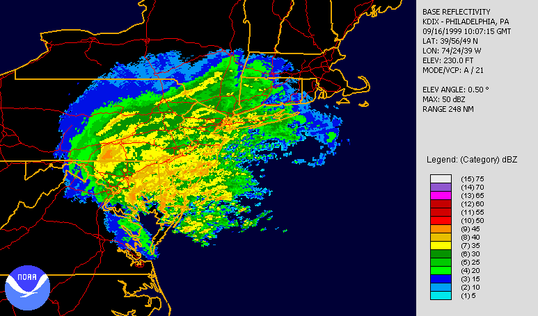
right|200px|thumb|Rainfall_from_Hurricane Floyd affecting the state]
*September 15, 1999 –Hurricane Floyd parallels the shore of the Delmarva Peninsula as a tropical storm. Chestertown, reports a maximum rainfall total of 14 inches (350 mm), with other locales reporting similar values.cite web
author = National Hurricane Center
year = 1999
title = Preliminary Report: Hurricane Floyd
publisher = NOAA
accessdate = 2006-02-13
url = http://www.nhc.noaa.gov/1999floyd.html] Extreme river flooding causes moderate damage to bridges and roads, resulting in a damage toll of $7.9 million (1999 USD, $10 million 2008 USD) throughout the state. [cite web
year = 2000
title = Hurricane Floyd Information: Maryland-Delaware-D.C. Area
publisher = USGS
accessdate = 2006-02-14
url = http://md.water.usgs.gov/floods/floyd/damage.html] In addition, over 250,000 residents are withoutelectricity because of high winds blowing down power lines.Cite web|author=National Climatic Data Center|title=Hurricane Floyd Event Report for Maryland|year=1999|publisher=|accessdate=2008-05-04|url=http://www4.ncdc.noaa.gov/cgi-win/wwcgi.dll?wwevent~ShowEvent~359747] More than 28 people are forced to be rescued byboat as a result of severe flooding. Nine other people were are from an apartment building near Great Mills. Two people are injured and one person is killed bycarbon monoxide after losing power and running a generator inside their home. Also, a 12 year old boy is caught inflood waters and is swept a half mile (800 m) down a drainage ditch before being rescued and treated forhypothermia .*October 17, 1999 – Showers from Hurricane Irene are reported, totaling to convert|1.29|in|mm|abbr=on in some places.
2000–2004
*September 19, 2000 – The remnants of Hurricane Gordon track over the
Delmarva Peninsula , producing up to convert|2.17|in|mm|abbr=on|lk=on of rainfall, mainly to the east of the center.
*June 16, 2001 – The weakeningTropical Storm Allison tracks northward along theU.S. East Coast , passing southeast of the state. Rainfall from Allison totaled to 7.5 inches (190 mm) in Denton, closing eleven roads and causing washouts on 41 others.cite web|author=National Climatic Data Center|year=2001|title=Tropical Storm Allison Event Report for Maryland|accessdate=2006-05-26|url=http://www4.ncdc.noaa.gov/cgi-win/wwcgi.dll?wwevent~ShowEvent~433132]
*September 11, 2002 – The pressure gradient between a stronghigh pressure system in the central United States and Hurricane Gustav located east of the state result in gusty winds, peaking at convert|44|mph|km/h|abbr=on|lk=on at Tolchester Beach. The winds damage tree limbs and caused power outages to 3,000 customers, although it was quickly restored. [cite web|author=National Climatic Data Center|title=Hurricane Gustav Event Report for Maryland|year=2002|publisher=|accessdate=2008-05-04|url=http://www4.ncdc.noaa.gov/cgi-win/wwcgi.dll?wwevent~ShowEvent~461874]
*September 27, 2002 – As the remnants ofHurricane Isidore track northward through theOhio Valley , it produces light to moderate showers in northern and central Maryland.
*October 11, 2002 — Remnant moisture from Hurricane Kyle produces moderate rainfall, reaching convert|4.03|in|mm|abbr=on in Salisbury.
*July 3, 2003 – Rainfall peaking at convert|4|in|mm|abbr=on falls in association with the remnants of Tropical Storm Bill. [cite web|author=National Climatic Data Center|title=Tropical Storm Bill Event Report for Maryland|year=2003|publisher=|accessdate=2008-05-04|url=http://www4.ncdc.noaa.gov/cgi-win/wwcgi.dll?wwevent~ShowEvent~499352] In northern and central Dorchester County, several secondary roads are closed due to heavy rainfall and flooding. [cite web|author=National Climatic Data Center|title=Tropical Storm Bill Event Report for Maryland (2)|year=2003|publisher=|accessdate=2008-05-04|url=http://www4.ncdc.noaa.gov/cgi-win/wwcgi.dll?wwevent~ShowEvent~499354]
*September 4, 2003 – The remnants of Tropical Storm Grace drop up to convert|5|in|mm|abbr=on of rain in western areas of the state, although there are no reports of damage. [Cite web|author=David Roth|title=Rainfall Summary for Tropical Storm Grace|year=2003|publisher=Hydrometeorological Prediction Center|accessdate=2008-05-04|url=http://www.hpc.ncep.noaa.gov/tropical/rain//grace2003.html]
*September 14, 2003 – The remnant moisture from Tropical Storm Henri produce light rainfall over the state. [cite web|author=David Roth|year=2006|title=Rainfall information on Tropical Storm Henri|publisher=Hydrometeorological Prediction Center|accessdate = 2006-06-12|url=http://www.hpc.ncep.noaa.gov/tropical/rain/henri2003.html]
*September 17, 2003 –Hurricane Isabel tracks south and west of the state, causing moderate to severe damage. Along the Eastern Shore, the hurricane produces astorm surge peaking at 8 feet (2.4 m) on theChesapeake Bay side in Hoopers Island and 6.5 feet (2 m) on the Atlantic coast in Ocean City.cite web|author=Wakefield, Virginia National Weather Service|year=2003|title=Hurricane Isabel Preliminary Storm Report|accessdate=2006-12-27|url=http://www.erh.noaa.gov/akq/wx_events/hur/isabel_2003.htm] The large size of Isabel causes strong winds across the area, including maximum sustained winds of 52 mph (84 km/h) and a gust of 66 mph (106 km/h) in Cambridge. Over 1.4 million people throughout the state lose electric power at some point during the storm.cite web|author=National Climatic Data Center|title=Hurricane Isabel Event Report for Maryland|year=2003|publisher=|accessdate=2008-05-04|url=http://www4.ncdc.noaa.gov/cgi-win/wwcgi.dll?wwevent~ShowEvent~499561] One death in Maryland is attributed to the hurricane, and over 200 injuries are reported. In all, damage is estimated at over $530 million (2003 USD, $621 million 2008 USD). Winds sensors inWashington, D.C. report winds of up to convert|85|mph|km/h|abbr=on, which causes $125 million (2003 USD, $146 million 2008 USD) in damage. [cite web|author=National Climatic Data Center|title=Hurricane Isabel Event Report for Washington D.C.|year=2003|publlisher=|accessdate=2008-05-06|url=http://www4.ncdc.noaa.gov/cgi-win/wwcgi.dll?wwevent~ShowEvent~489093]
*August 12, 2004 – Remnant moisture from Tropical Storm Bonnie drops light rainfall across portions of the state.
*August 30, 2004 – Hurricane Gaston tracks east of the state, producing light rainfall along the eastern shore.
*September 3, 2004 – The remnants ofHurricane Frances produce over convert|6|in|mm|abbr=on of rain in some locations, although there are no reports of damage.
*September 19, 2004 – The remnants ofHurricane Ivan drop up to convert|3.83|in|mm|abbr=on of rainfall, particularly in western areas. The system also results in several tornadoes, one of which is reported to have killed an elderly woman and her daughter when a tree fell on their home in Cecil County. [cite news|author="The Washington Times"|title=Maryland women die in Ivan's wake|year=2004|publisher=|accessdate=2008-05-03] [cite news|author=Lyndsey Layton and Jamie Stockwell|title=Tornado Damage Scattered, Severe; Residents Clean Up After Ivan Kills Two,
Destroys Homes and Businesses in Va., Md.|year=2004|publisher="The Washington Post"|accessdate=2008-05-03]
[
right|180px|thumb|Rainfall_totals_from_Hurricane Cindy (2005) ]
*September 28, 2004 – The remnants ofHurricane Jeanne spawn awaterspout which moves ashore as a tornado and damages a visitor center, tearing part of the roof off the structure and landing it onMaryland Route 2 . The hurricane drops up to convert|4|in|mm|abbr=on of rainfall which results in widespread minor to moderate flooding. In total over 50 roads were closed due to flooding, and a group of inmates were rescued from the roof of a security van. [cite web|author=National Climatic Data Center|title=Hurricane Jeanne Event Report for Maryland|year=2004|publisher=|accessdate=2008-05-03|url=http://www4.ncdc.noaa.gov/cgi-win/wwcgi.dll?wwevent~ShowEvent~539698]2005–present
*July 8, 2005 – The extratropical remnants of Hurricane Cindy drop upwards of convert|7|in|mm|abbr=on|lk=on in the state, [Cite web|author=David Roth|title=Rainfall Summary for Hurricane Cindy|year=2005|publisher=Hydrometeorological Prediction Center|accessdate=2008-05-03|url=http://www.hpc.ncep.noaa.gov/tropical/rain//cindy2005.html] and spawn one
tornado .Cite web|author=Stacy R. Stewart|title=Tropical Cyclone Report: Hurricane Cindy|year=2005|publisher=National Hurricane Center|accessdate=2008-05-03|url=http://www.nhc.noaa.gov/pdf/TCR-AL032005_Cindy.pdf] which causes sporadic tree damage. [Cite web|author=National Climatic Data Center|title=Hurricane Cindy Event Report for Maryland|year=2005|publisher=|accessdate=2008-05-03|url=http://www4.ncdc.noaa.gov/cgi-win/wwcgi.dll?wwevent~ShowEvent~577985] The rainfall causes flooding in some locations, leaving numerous roads underwater, [Cite web|author=National Climatic Data Center|title=Hurricane Cindy Event Report for Maryland (2)|year=2005|publisher=|accessdate=2008-05-03|url=http://www4.ncdc.noaa.gov/cgi-win/wwcgi.dll?wwevent~ShowEvent~577987] and flooding several basements. [cite web|author=National Climatic Data Center|title=Hurricane Cindy Event Report for Maryland (3)|year=2005|publisher=|accessdate=2008-05-03|url=http://www4.ncdc.noaa.gov/cgi-win/wwcgi.dll?wwevent~ShowEvent~577995]
*July 9, 2005 – The remnants ofHurricane Dennis produce widespread light rainfall across much of the state. [Cite web|author=David Roth|title=Rainfall Summary for Hurricane Dennis|year=2005|publisher=Hydrometeorological Prediction Center|accessdate=2008-05-03|url=http://www.hpc.ncep.noaa.gov/tropical/rain//dennis2005.html]
*October 8, 2005 – A combination of the remnants of Tropical Storm Tammy and Subtropical Depression Twenty-one contribute to theNortheast U.S. flooding of October 2005 , which produces up to convert|9|in|mm|abbr=on of rainfall. [cite web|author=Scott Stephens|title=Hazards/Climate Extremes|year=200|publisher=NOAA/NCDC|accessdate=2008-05-03|url=http://www.ncdc.noaa.gov/oa/climate/research/2005/oct/hazards.html#Flooding] Dozens of roads are flooded and closed, and about 30 people are forced from their homes. Flood waters reach up to convert|6|ft|m|abbr=on|lk=on as reported by a local newspaper. Damage is estimated at $200,000 (2005 USD, $220,000 2008 USD). [Cite web|author=National Climatic Data Center|title=Flooding Report for Maryland|accessdate=2008-05-03|url=http://www4.ncdc.noaa.gov/cgi-win/wwcgi.dll?wwevent~ShowEvent~578066]
*June 14, 2006 — The remnants of Tropical Storm Alberto drop light rainfall in southern locations.
*September 3, 2006 – High winds and heavy rainfall from Hurricane Ernesto leaves 44,000 homes without electric power, mostly in low-lying areas of southern locations and on the eastern shore. Several basements in Anne Arundel County are forced to be pumped out due to flooding. It is estimated that wind gusts peaked at convert|50|mph|km/h|abbr=on|lk=on. [Cite news|author=Stephanie Desmon and Gadi Dechte|title=Ernesto's wind gusts punched away at Md.|year=2006|publisher="Baltimore Sun"|accessdate=2008-05-03]
*June 3, 2007 – Tropical Storm Barry produces light rainfall over eastern portions of the state, peaking at convert|2.30|in|mm|abbr=on near Columbia.Cite web|author=David Roth|title=Tropical Cyclone Rainfall in the Mid-Atlantic|year=|publisher=Hydrometeorological Prediction Center|accessdate=2008-05-03|url=http://www.hpc.ncep.noaa.gov/tropical/rain/tcmidatl.html]
*September 15, 2007 – The remnants of Hurricane Humberto drop light rainfall in extreme southern locations. [Cite web|author=David Roth|title=Rainfall Summary for Hurricane Humberto|year=2007|publisher=Hydrometeorological Prediction Center|accessdate=2008-05-03|url=http://www.hpc.ncep.noaa.gov/tropical/rain//humberto2007.html]Monthly statistics
DateFormat=yyyyImageSize= width:350 height:auto barincrement:40Period = from:0 till:40TimeAxis = orientation:horizontalPlotArea = right:10 left:5 bottom:50 top:5 Colors= id:cat5red value:rgb(1,0.2,0.2) id:minorline value:rgb(0.9,0.9,0.9) id:line value:rgb(0.5,0.5,0.5)
PlotData= width:15 textcolor:black shift:(5,-5) anchor:from fontsize:M bar:Jun from:0 till:5 color:cat5red text:"June" bar:Jul from:0 till:8 color:cat5red text:"July" bar:Aug from:0 till:12 color:cat5red text:"August" bar:Sep from:0 till:20 color:cat5red text:"September" bar:Oct from:0 till:8 color:cat5red text:"October" bar:Nov from:0 till:1 color:cat5red text:"November"
ScaleMajor = gridcolor:line unit:year increment:5 start:0ScaleMinor = gridcolor:minorline unit:year increment:1 start:0
TextData = fontsize:M textcolor:black pos:(100,25) # tabs:(100-left) text:"Number of storms affecting Maryland and Washington, D.C."
Deadly storms
The following table includes all storms since 1980 that have caused reported fatalities in Maryland and Washington, D.C.
ee also
*
List of Maryland hurricanes (1950–1979)
*List of Delaware hurricanes
*List of United States hurricanes References
Wikimedia Foundation. 2010.