- Müritz (district)
-
Müritz — District — 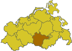
Country  Germany
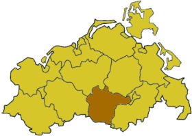
State Mecklenburg-Vorpommern Disbanded 2011 Capital Waren Area – Total 1,713 km2 (661.4 sq mi) Population (2010) – Total 64,615 – Density 37.7/km2 (97.7/sq mi) Time zone CET (UTC+1) – Summer (DST) CEST (UTC+2) Vehicle registration MÜR Website landkreis-mueritz.de Müritz is a former Kreis (district) in the southern part of Mecklenburg-Vorpommern, Germany. It is named after the lake Müritz. Neighboring districts were (from the north clockwise) Demmin, Mecklenburg-Strelitz, the district-free city Neubrandenburg, the district Ostprignitz-Ruppin in Brandenburg, Parchim and Güstrow. The district was disbanded at the district reform of September 2011. Its territory has been part of the Mecklenburgische Seenplatte district since.
Contents
Geography
The district of Müritz constituted roughly the western half of the Müritz lakeland and the Müritz National Park. The lake Müritz has an area of 117 km²; it is the second largest lake of Germany after Lake Constance, and the largest lake entirely within the German borders.
History
The district was created on June 12, 1994 by merging the previous districts Röbel and Waren, and a few municipalities from the districts Malchin and Neustrelitz. This district was merged with the district of Mecklenburg-Strelitz and most of the district of Demmin at the district reform of September 2011, forming the new Mecklenburgische Seenplatte district.
Coat of arms
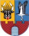
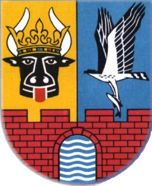
The coat of arms shows a bull head in the top left corner, symbolizing the Princes of Werle. The osprey to the right stands for the rich nature in the district. The city wall in the bottom with four tops stands for the four cities in the district, and the wavy lines in the city gate for the Müritz lake land. Towns and municipalities
The subdivisions of the district were (situation August 2011):
Amt-free town Ämter - 1. Malchow
- 3. Röbel-Müritz
- 4. Seenlandschaft Waren
[seat: Waren]
1seat of the Amt; 2town References
External links
 Media related to Landkreis Müritz at Wikimedia Commons
- Official website (German)
Urban districts 
Rural districts Bad Doberan · Demmin · Güstrow · Ludwigslust · Mecklenburg-Strelitz · Müritz · Nordvorpommern · Nordwestmecklenburg · Ostvorpommern · Parchim · Rügen · Uecker-RandowCategories:- Former districts of Mecklenburg-Vorpommern
Wikimedia Foundation. 2010.