- Ciugud
-
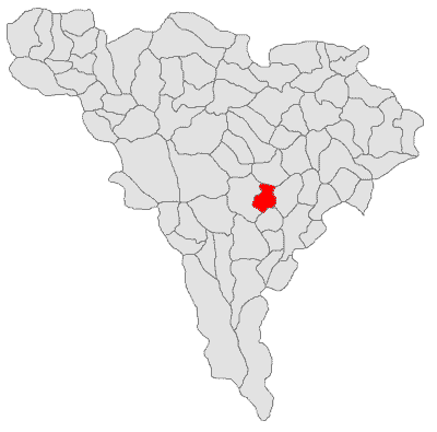
Ciugud — Commune — Location in Alba County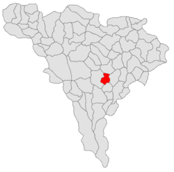 Location in Romania
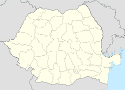
 Ciugud
Coordinates: 46°03′N 23°37′E / 46.05°N 23.617°E Country  Romania
County Alba County Population (2002)[1] - Total 2,664 Time zone EET (UTC+2) - Summer (DST) EEST (UTC+3) Coordinates: 46°03′N 23°37′E / 46.05°N 23.617°E
Ciugud (Hungarian: Maroscsüged; German: Schenkendorf) is a commune located in Alba County, Romania. It has a population of 2,664. It is composed of six villages: Ciugud, Drâmbar (Drombár), Hăpria (Oláhherepe), Şeuşa (Sóspatak), Teleac (Újcsongvaitelep) and Limba (Dumbrava from 1958 to 2004; Lombfalva).
External links
References
- ^ (Romanian) "Ciugud", at the Erdélyi Magyar Adatbank's Recensământ 2002; Retrieved on September 4, 2009
Alba County, Romania Cities 
Towns Abrud · Baia de Arieş · Câmpeni · Cugir · Ocna Mureş · Teiuş · Zlatna
Communes Albac · Almaşu Mare · Arieşeni · Avram Iancu · Berghin · Bistra · Blandiana · Bucerdea Grânoasă · Bucium · Câlnic · Cenade · Cergău · Ceru-Băcăinţi · Cetatea de Baltă · Ciugud · Ciuruleasa · Crăciunelu de Jos · Cricău · Cut · Daia Română · Doştat · Fărău · Galda de Jos · Gârda de Sus · Gârbova · Hopârta · Horea · Ighiu · Întregalde · Jidvei · Livezile · Lopadea Nouă · Lunca Mureşului · Lupşa · Meteş · Mihalţ · Mirăslău · Mogoş · Noşlac · Ocoliş · Ohaba · Pianu · Poiana Vadului · Ponor · Poşaga · Rădeşti · Râmeţ · Rimetea · Roşia de Secaş · Roşia Montană · Sălciua · Săliştea · Sâncel · Săsciori · Sântimbru · Scărişoara · Stremţ · Şibot · Sohodol · Şpring · Şugag · Şona · Unirea · Vadu Moţilor · Valea Lungă · Vidra · Vinţu de Jos
Categories:- Communes in Alba County
- Alba County geography stubs

Wikimedia Foundation. 2010.