- Makomanai River
-
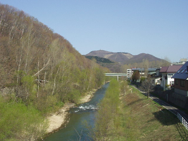
Makomanai River (Makomanai Gawa) 真駒内川 River  View northward from the Makomanai Green Heights Bridge in Minami ward, Sapporo. (May 2004)
Name origin: rear river Country Japan State Hokkaidō Region Ishikari District Sapporo Municipality Sapporo City Sapporo Source Bankei Pond - location Sapporo, Hokkaidō, Japan - elevation 913 m (2,995 ft) - coordinates 42°52′50″N 141°15′36″E / 42.88056°N 141.26°E Mouth Toyohira River - location Sapporo, Hokkaidō, Japan - coordinates 43°0′14″N 141°20′41″E / 43.00389°N 141.34472°E Length 21 km (13 mi) Basin 37 km2 (14 sq mi) Makomanai River (真駒内川 Makomanai Gawa) is a tributary of the Toyohira River in Sapporo, Hokkaidō, Japan. It has a length of 21 kilometres (13 mi) and has a watershed of 37 square kilometres (14 sq mi).
Flowing from Bankei Pond (万計沼 Bankei Numa) in the mountains, the Makomanai River's upper course is called Bankei River (万計沢川 Bankeisawa Gawa), too. Its middle course flows through a narrow valley about 200 metres (660 ft) wide in the Tokiwa (常盤) area. Running north, it merges with the Toyohira River at Makomanai area. The Toyohira River flows through the Sapporo city's center. Makomanai means rear river in the Ainu language. [1]
Edwin Dun, an Oyatoi gaikokujin, began development of Makomanai in the 1870s with a pioneer stock farm.[2] The valley of Tokiwa remained undeveloped for a long time. Flood control projects were begun in the later half of 20th century; straightening the river course in the 1960s.[3] Now a residential zone exists along the northern half of Tokiwa along National Route 453. Houses cover the surrounding hilltops around Makomanai. At the confluence with the Toyohira River is Makomanai Park. Cherry salmon migrate to and spawn in the park every year.
References
- ^ Kawa no Fuukei, p146, p247-248.
- ^ Oyatoi Gaikokujin, p72-73.
- ^ Makomanai-Gawa ni okeru Chisui Jigyō.
Bibliography
- Sapporo-shi Kyōiku Iinkai (Educational Committee of Sapporo City) edited Oyatoi Gaikokujin, Hokkiadō Shinbunsha, Sapporo, 1981. 札幌市教育委員会編『お雇い外国人』、さっぽろ文庫第19巻、北海道新聞社、1981年。
- Sapporo-shi Kyōiku Iinkai (Educational Committee of Sapporo City) edited Kawa no Fuukei (Landscapes of rivers), Hokkiadō Shinbunsha, Sapporo, 1988. 札幌市教育委員会編『川の風景』、さっぽろ文庫第44巻、北海道新聞社、1988年。
- OKADA Asuka, 'Makomanai-Gawa ni okeru Chisui Jigyō' (Flood Control Projects in Makomanai River), 1999 or 2000. 岡田明日香「真駒内川における治水事業」、1999年か2000年。
Categories:- Rivers of Hokkaidō
- Minami-ku, Sapporo
Wikimedia Foundation. 2010.