- Malargüe
-
Malargüe — City — Plaza San Martin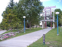 Location of Malargüe in Argentina
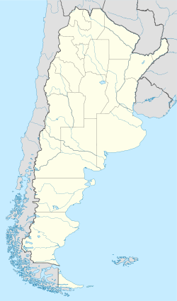
 Malargüe
Coordinates: 35°28.5′S 69°35′W / 35.475°S 69.583°WCoordinates: 35°28.5′S 69°35′W / 35.475°S 69.583°W Country Argentina Province Mendoza Department Malargüe Elevation 1,402 m (4,600 ft) Population - Total 23,020 Time zone ART (UTC-3) CPA base M5613 Dialing code +54 2627 Malargüe is a city in the southwest part of province of Mendoza, Argentina, about 370 km south of the provincial capital Mendoza. It is the head town of the Malargüe Department, and it has about 23,000 inhabitants as per the 2001 census [INDEC].
Contents
Overview
The city is located in a semi-arid area. Agriculture is focused on the production of seed potato, along with minor crops such as alfalfa, onion and garlic. In the past, the local industries included oil exploration and production (now almost completely deactivated) and uranium mining. As a touristic area, Malargüe provides hotels and cabins for visitors interested in eco-tourism in the summer and skiing in the winter at the nearby resorts of Las Leñas and Los Molles.
The city is known for its traditional dish, the chivito (baby goat). It hosts the annual National Festival of the Goat and the Provincial Festival of the Lamb, during the second week of January.
-
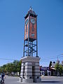
Clock tower in the city center
-
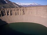
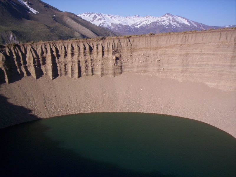
Las Animas well
History
Andes flight disaster
On 13 October 1972 the Uruguayan Air Force Flight 571 crashed in the Andes, in the municipal territory of Malargüe (34°45′54″S 70°17′11″W / 34.765°S 70.28639°W).
Climate
Malargue's climate is dry and relatively cold. Summers bring warm days (the average is 28°C, or 82F) and cool to cold nights (11°C, or 53F), with sporadic thunderstorms occurring. By March or early April, frost is to be expected, and during the winter (May to September), wild fluctuations of temperature can occur: the average high is 11°C (53F) and the average low is -2°C (28F), but northwesterly winds that blow downslope from the Andes can bring temperatures of 25°C (77F), and extreme Antarctic outbreaks will bring periods of snow, daytime highs well below 0°C (32F) and night lows well below -12°C (10F). Temperatures have reached lows of -23°C (-9F) in the past.
Climate data for Malargüe, Mendoza, Argentina (1981-1990 period) Month Jan Feb Mar Apr May Jun Jul Aug Sep Oct Nov Dec Year Average high °C (°F) 27.9
(82.2)27.2
(81.0)24.1
(75.4)19.7
(67.5)15.0
(59.0)11.7
(53.1)10.8
(51.4)13.5
(56.3)15.8
(60.4)20.5
(68.9)24.4
(75.9)27.0
(80.6)18.9 Average low °C (°F) 11.0
(51.8)10.6
(51.1)8.5
(47.3)4.4
(39.9)0.7
(33.3)−1.4
(29.5)−2.3
(27.9)−1.1
(30.0)0.6
(33.1)4.4
(39.9)7.3
(45.1)10.3
(50.5)4.4 Precipitation mm (inches) 31.0
(1.22)28.0
(1.102)29.9
(1.177)15.9
(0.626)19.2
(0.756)37.8
(1.488)45.1
(1.776)21.7
(0.854)30.6
(1.205)14.2
(0.559)21.5
(0.846)38.9
(1.531)333.8
(13.142)Source: Servicio Meteorologico Nacional[1] Transport and infrastructures
 Pierre Auger observatory
Transportation
Malargüe is linked to the north of Mendoza by National Route 40. This route continues south, entering Neuquén Province, but is only partially built and not well maintained beyond Malargüe City.
Air traffic in the area (only local flights) is served by the Comodoro D. Ricardo Salomón Airport (IATA: LGS, ICAO: SAMM).
Astronomic and space center
Malargüe is also home to the southern site of the Pierre Auger Observatory, an international physics experiment searching for ultra-high energy cosmic rays.
The European Space Agency began construction of a deep space ground station 30 km south of Malargüe in 2010.[2] Once operational by mid 2012 Malargüe Station will be the third 35m dish in its ESTRACK network.
References
External links
- Municipal information: Municipal Affairs Federal Institute (IFAM), Municipal Affairs Secretariat, Ministry of Interior, Argentina. (Spanish)
- Municipality of Malargüe — Official website.
- Pierre Auger Observatory.
Categories:- Populated places in Mendoza Province
- Uranium mines
- Mining in Argentina
-


Wikimedia Foundation. 2010.