- Grantsville, West Virginia
Infobox Settlement
official_name = Grantsville, West Virginia
settlement_type =Town
nickname =
motto =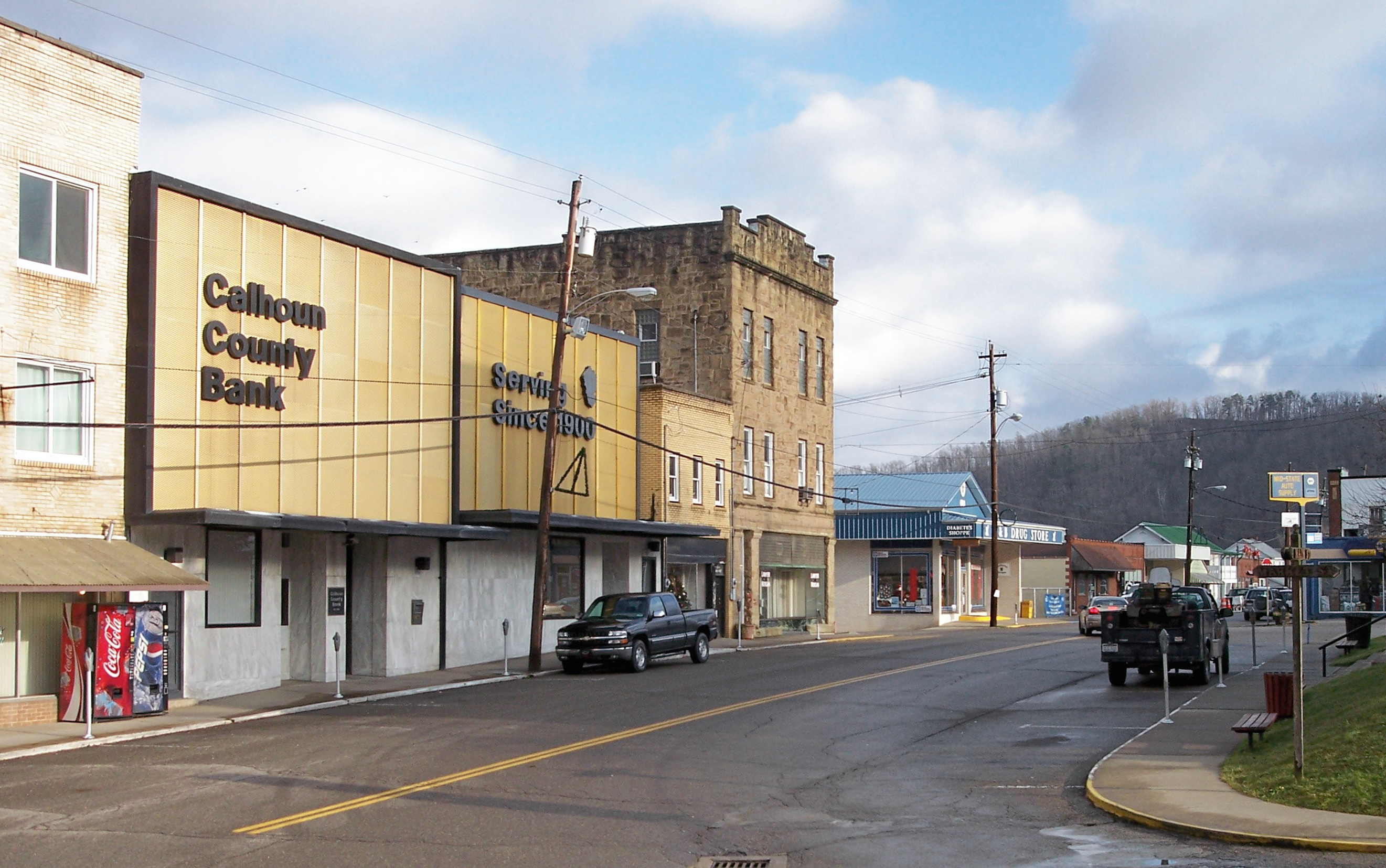
imagesize = 250px
image_caption = Main Street in Grantsville in 2006
image_
mapsize = 250px
map_caption = Location of Grantsville, West Virginia
mapsize1 =
map_caption1 =subdivision_type = Country
subdivision_name =United States
subdivision_type1 = State
subdivision_name1 =West Virginia
subdivision_type2 = County
subdivision_name2 = Calhoungovernment_footnotes =
government_type =
leader_title =
leader_name =
leader_title1 =
leader_name1 =
established_title =
established_date =area_footnotes =
area_magnitude =
area_total_km2 = 1.2
area_land_km2 = 1.2
area_water_km2 = 0.0
area_total_sq_mi = 0.5
area_land_sq_mi = 0.5
area_water_sq_mi = 0.0population_as_of = 2000
population_footnotes =
population_total = 565
population_density_km2 = 479.2
population_density_sq_mi = 1241.1timezone = Eastern (EST)
utc_offset = -5
timezone_DST = EDT
utc_offset_DST = -4
elevation_footnotes =
elevation_m = 217
elevation_ft = 712
latd = 38 |latm = 55 |lats = 23 |latNS = N
longd = 81 |longm = 5 |longs = 42 |longEW = Wpostal_code_type =
ZIP code
postal_code = 26147
area_code = 304
blank_name = FIPS code
blank_info = 54-32884GR|2
blank1_name = GNIS feature ID
blank1_info = 1539593GR|3
website =
footnotes =Grantsville is a town in Calhoun County,
West Virginia , in theUnited States . The population was 565 at the 2000 census. It is thecounty seat of Calhoun CountyGR|6. The town was established along theLittle Kanawha River [cite book| title= West Virginia Atlas & Gazetteer |year=1997 |publisher=DeLorme |location=Yarmouth, Me. |isbn= 0-89933-246-3 |pages= p.34] in 1865 and named forUlysses S. Grant . [cite book| author=Kenny, Hamill |title= West Virginia Place Names: Their Origin and Meaning, Including the Nomenclature of the Streams and Mountains |year=1945 |publisher=The Place Name Press |location=Piedmont, West Virginia |pages= p.280] Grantsville is home to Wayne Underwood Park, which includes a .25 mile long walking trail, and to the annual West Virginia Wood Festival.Geography
Grantsville is located at coor dms|38|55|23|N|81|5|42|W|city (38.922921, -81.094920)GR|1.
According to the
United States Census Bureau , the town has a total area of 1.2km² (0.5 mi²), all land.Demographics
As of the
census GR|2 of 2000, there were 565 people, 232 households, and 142 families residing in the town. Thepopulation density was 474.2/km² (1,241.1/mi²). There were 276 housing units at an average density of 231.7/km² (606.3/mi²). The racial makeup of the town was 99.65% White, and 0.35% from two or more races. Hispanic or Latino of any race were 0.35% of the population.There were 232 households out of which 23.3% had children under the age of 18 living with them, 43.1% were married couples living together, 12.5% had a female householder with no husband present, and 38.4% were non-families. 34.9% of all households were made up of individuals and 15.5% had someone living alone who was 65 years of age or older. The average household size was 2.33 and the average family size was 3.02.
In the town the population was spread out with 21.1% under the age of 18, 9.2% from 18 to 24, 20.9% from 25 to 44, 25.7% from 45 to 64, and 23.2% who were 65 years of age or older. The median age was 44 years. For every 100 females there were 96.9 males. For every 100 females age 18 and over, there were 89.8 males.
The median income for a household in the town was $26,111, and the median income for a family was $34,286. Males had a median income of $31,250 versus $15,192 for females. The
per capita income for the town was $13,501. About 19.3% of families and 20.5% of the population were below thepoverty line , including 15.4% of those under age 18 and 11.8% of those age 65 or over.References
External links
* [http://www.calhounchronicle.com/ Calhoun Chronicle]
* [http://www.hurherald.com/ Hur Herald]
* [http://www.calhounwoodfestival.com/ Wood Festival]
Wikimedia Foundation. 2010.