- Ompton
-
Coordinates: 53°11′N 0°58′W / 53.18°N 0.97°W
Ompton
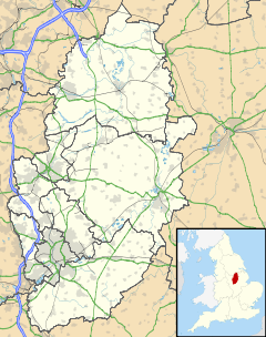
 Ompton shown within Nottinghamshire
OS grid reference SK688651 District Newark and Sherwood Shire county Nottinghamshire Region East Midlands Country England Sovereign state United Kingdom Post town RETFORD Postcode district NG22 Police Nottinghamshire Fire Nottinghamshire Ambulance East Midlands EU Parliament East Midlands List of places: UK • England • Nottinghamshire Ompton is a village in Nottinghamshire, England, three miles south-east of Ollerton. It is part of the civil parish of Kneesall, Kersall and Ompton. It has a red-brick chapel of 1860. About half a mile to the west is a water pumping station, built 1965-68 as a tiled pyramid on a glazed plinth[1].
References
- ^ Pevsner, Nikolaus (1979). Nottinghamshire. The Buildings of England. Harmondsworth: Penguin. p. 282.
External links
 Media related to Ompton at Wikimedia CommonsCategories:
- Villages in Nottinghamshire
- Nottinghamshire geography stubs
Wikimedia Foundation. 2010.

