- Lake McMurray, Washington
Infobox Settlement
official_name = Lake McMurray, Washington
settlement_type = CDP
nickname =
motto =
imagesize =
image_caption =
image_
imagesize =
image_caption =
image_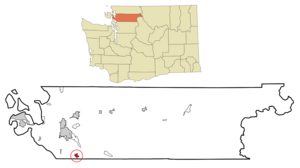
mapsize = 250x200px
map_caption = Location of Lake McMurray, Washington
mapsize1 =
map_caption1 =subdivision_type = Country
subdivision_name =United States
subdivision_type1 = State
subdivision_name1 =Washington
subdivision_type2 = County
subdivision_name2 = Skagitgovernment_footnotes =
government_type =
leader_title =
leader_name =
leader_title1 =
leader_name1 =
established_title =
established_date =unit_pref = Imperial
area_footnotes =area_magnitude =
area_total_km2 = 2.7
area_land_km2 = 2.1
area_water_km2 = 0.5
area_total_sq_mi = 1.0
area_land_sq_mi = 0.8
area_water_sq_mi = 0.2population_as_of = 2000
population_footnotes =
population_total = 200
population_density_km2 = 93.6
population_density_sq_mi = 242.5timezone = Pacific (PST)
utc_offset = -8
timezone_DST = PDT
utc_offset_DST = -7
elevation_footnotes =
elevation_m =
elevation_ft =
latd = 48 |latm = 18 |lats = 50 |latNS = N
longd = 122 |longm = 13 |longs = 49 |longEW = Wpostal_code_type =
postal_code =
area_code =
blank_name = FIPS code
blank_info = 53-37526GR|2
blank1_name =
blank1_info =
website =
footnotes =Lake McMurray is a
census-designated place (CDP) in Skagit County,Washington ,United States . The population was 200 at the 2000 census. It is included in the Mount Vernon-Anacortes, WashingtonMetropolitan Statistical Area .Based on per capita income, Lake McMurray ranks 43rd of 522 ranked areas in the state of Washington. It is part of the Conway School District.
Education
Lake McMurray is part of the Conway School District.
Geography
Lake McMurray is located at coor dms|48|18|50|N|122|13|49|W|city (48.313850, -122.230144)GR|1.
According to the
United States Census Bureau , the CDP has a total area of 1.0square mile s (2.7km² ), of which, 0.8 square miles (2.1 km²) of it is land and 0.2 square miles (0.5 km²) of it (19.42%) is water.Demographics
As of the
census GR|2 of 2000, there were 200 people, 83 households, and 62 families residing in the CDP. Thepopulation density was 242.5 people per square mile (94.2/km²). There were 104 housing units at an average density of 126.1/sq mi (49.0/km²). The racial makeup of the CDP was 90.00% White, 0.50% African American, 3.50% Asian, 2.00% Pacific Islander, 0.50% from other races, and 3.50% from two or more races. Hispanic or Latino of any race were 0.50% of the population.There were 83 households out of which 31.3% had children under the age of 18 living with them, 65.1% were married couples living together, 4.8% had a female householder with no husband present, and 25.3% were non-families. 22.9% of all households were made up of individuals and 12.0% had someone living alone who was 65 years of age or older. The average household size was 2.41 and the average family size was 2.79.
In the CDP the population was spread out with 20.5% under the age of 18, 5.5% from 18 to 24, 24.5% from 25 to 44, 33.5% from 45 to 64, and 16.0% who were 65 years of age or older. The median age was 44 years. For every 100 females there were 124.7 males. For every 100 females age 18 and over, there were 114.9 males.
The median income for a household in the CDP was $65,536, and the median income for a family was $62,083. Males had a median income of $36,071 versus $39,375 for females. The
per capita income for the CDP was $29,051. None of the population or families were below thepoverty line .Major Roads
References
External links
Wikimedia Foundation. 2010.