- Satsop, Washington
Infobox Settlement
official_name = Satsop, Washington
settlement_type = CDP
nickname =
motto =
imagesize =
image_caption =
image_
imagesize =
image_caption =
image_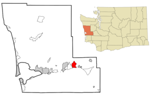
mapsize = 250px
map_caption = Location of Satsop, Washington
mapsize1 =
map_caption1 =subdivision_type = Country
subdivision_name =United States
subdivision_type1 = State
subdivision_name1 =Washington
subdivision_type2 = County
subdivision_name2 = Grays Harborgovernment_footnotes =
government_type =
leader_title =
leader_name =
leader_title1 =
leader_name1 =
established_title =
established_date =unit_pref = Imperial
area_footnotes =area_magnitude =
area_total_km2 = 18.1
area_land_km2 = 18.1
area_water_km2 = 0.0
area_total_sq_mi = 7.0
area_land_sq_mi = 7.0
area_water_sq_mi = 0.0population_as_of = 2000
population_footnotes =
population_total = 619
population_density_km2 = 34.2
population_density_sq_mi = 88.6timezone = Pacific (PST)
utc_offset = -8
timezone_DST = PDT
utc_offset_DST = -7
elevation_footnotes =
elevation_m = 13
elevation_ft = 43
latd = 47 |latm = 0 |lats = 21 |latNS = N
longd = 123 |longm = 28 |longs = 17 |longEW = Wpostal_code_type =
ZIP code
postal_code = 98583
area_code = 360
blank_name = FIPS code
blank_info = 53-61350GR|2
blank1_name = GNIS feature ID
blank1_info = 1512643GR|3
website =
footnotes =Satsop is a
census-designated place (CDP) in Grays Harbor County,Washington ,United States . The population was 619 at the 2000 census.Geography
Satsop is located at coor dms|47|0|21|N|123|28|17|W|city (47.005733, -123.471254)GR|1.
According to the
United States Census Bureau , the CDP has a total area of 7.0square mile s (18.1km² ), all of it land.Demographics
As of the
census GR|2 of 2000, there were 619 people, 228 households, and 166 families residing in the CDP. Thepopulation density was 88.6 people per square mile (34.2/km²). There were 258 housing units at an average density of 36.9/sq mi (14.3/km²). The racial makeup of the CDP was 94.67% White, 1.13% African American, 1.13% Native American, 1.94% Asian, 0.81% from other races, and 0.32% from two or more races. Hispanic or Latino of any race were 1.78% of the population.There were 228 households out of which 33.3% had children under the age of 18 living with them, 57.9% were married couples living together, 11.4% had a female householder with no husband present, and 26.8% were non-families. 22.4% of all households were made up of individuals and 12.3% had someone living alone who was 65 years of age or older. The average household size was 2.71 and the average family size was 3.13.
In the CDP the population was spread out with 28.6% under the age of 18, 7.1% from 18 to 24, 25.7% from 25 to 44, 24.6% from 45 to 64, and 14.1% who were 65 years of age or older. The median age was 38 years. For every 100 females there were 101.6 males. For every 100 females age 18 and over, there were 100.9 males.
The median income for a household in the CDP was $37,125, and the median income for a family was $43,125. Males had a median income of $31,000 versus $18,750 for females. The
per capita income for the CDP was $14,245. About 9.5% of families and 16.8% of the population were below thepoverty line , including 30.9% of those under age 18 and 5.8% of those age 65 or over.Landmarks
Satsop is known for the unfinished Satsop Nuclear Power Plant, a facility designed to house two 1250
megawatt pressurized water reactor s. Construction of the SatsopNuclear Power Plant began in 1977 and was halted in 1983 after a $961 million budget shortfall, leaving the plant 76% complete. The plant was maintained, ready for construction to be resumed, until 1994, when it was finally canceled. In 1995, a demolition plan was finalized that eventually turned the site into the [http://satsop.com/ Satsop Development Park] . Listed among the top three office parks in Washington state for 2005 by Washington CEO Magazine [http://www.ga.wa.gov/RES/satsop.htm] , the park offers office space with high-speed, redundant telecommunications links and dedicated utility infrastructure.ee also
*
Anti-nuclear movement in the United States
*References
External links
* [http://www.nytimes.com/2006/04/21/us/21nuke.html?n=Top/Reference/Times%20Topics/Subjects/A/Advertising%20and%20Marketing Can Unused A-Plant Become a Princess?]
Wikimedia Foundation. 2010.