- West Pasco, Washington
Infobox Settlement
official_name = West Pasco, Washington
settlement_type = CDP
nickname =
motto =
imagesize =
image_caption =
image_
imagesize =
image_caption =
image_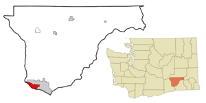
mapsize = 250px
map_caption = Location of West Pasco, Washington
mapsize1 =
map_caption1 =subdivision_type = Country
subdivision_name =United States
subdivision_type1 = State
subdivision_name1 =Washington
subdivision_type2 = County
subdivision_name2 = Franklingovernment_footnotes =
government_type =
leader_title =
leader_name =
leader_title1 =
leader_name1 =
established_title =
established_date =unit_pref = Imperial
area_footnotes =area_magnitude =
area_total_km2 = 18.7
area_land_km2 = 15.6
area_water_km2 = 3.1
area_total_sq_mi = 7.2
area_land_sq_mi = 6.0
area_water_sq_mi = 1.2population_as_of = 2000
population_footnotes =
population_total = 4629
population_density_km2 = 296.5
population_density_sq_mi = 767.8timezone = Pacific (PST)
utc_offset = -8
timezone_DST = PDT
utc_offset_DST = -7
elevation_footnotes =
elevation_m = 110
elevation_ft = 361
latd = 46 |latm = 15 |lats = 9 |latNS = N
longd = 119 |longm = 10 |longs = 58 |longEW = Wpostal_code_type =
postal_code =
area_code =
blank_name = FIPS code
blank_info = 53-77612GR|2
blank1_name = GNIS feature ID
blank1_info = 1867645GR|3
website =
footnotes =West Pasco is a
census-designated place (CDP) in Franklin County,Washington ,United States . The population was 4,629 at the 2000 census.Based on per capita income, one of the more reliable measures of affluence, West Pasco ranks 47th of 522 areas in the state of Washington to be ranked. It is also the highest rank achieved in Franklin County.
Geography
West Pasco is located at coor dms|46|15|9|N|119|10|58|W|city (46.252607, -119.182730)GR|1.
According to the
United States Census Bureau , the CDP has a total area of 7.2square mile s (18.7km² ), of which, 6.0 square miles (15.6 km²) of it is land and 1.2 square miles (3.1 km²) of it (16.37%) is water.Demographics
As of the
census GR|2 of 2000, there were 4,629 people, 1,618 households, and 1,380 families residing in the CDP. Thepopulation density was 767.8 people per square mile (296.4/km²). There were 1,661 housing units at an average density of 275.5/sq mi (106.4/km²). The racial makeup of the CDP was 89.59% White, 1.10% African American, 0.73% Native American, 1.17% Asian, 0.04% Pacific Islander, 4.47% from other races, and 2.89% from two or more races. Hispanic or Latino of any race were 10.02% of the population.There were 1,618 households out of which 35.8% had children under the age of 18 living with them, 76.8% were married couples living together, 4.9% had a female householder with no husband present, and 14.7% were non-families. 12.2% of all households were made up of individuals and 5.3% had someone living alone who was 65 years of age or older. The average household size was 2.85 and the average family size was 3.08.
In the CDP the population was spread out with 26.6% under the age of 18, 6.0% from 18 to 24, 24.2% from 25 to 44, 31.1% from 45 to 64, and 12.1% who were 65 years of age or older. The median age was 42 years. For every 100 females there were 99.5 males. For every 100 females age 18 and over, there were 99.5 males.
The median income for a household in the CDP was $65,865, and the median income for a family was $68,205. Males had a median income of $50,504 versus $31,947 for females. The
per capita income for the CDP was $28,523. About 2.2% of families and 2.8% of the population were below thepoverty line , including 4.0% of those under age 18 and 2.1% of those age 65 or over.References
External links
Wikimedia Foundation. 2010.