- Tinmouth, Vermont
Infobox Settlement
official_name = Tinmouth, Vermont
settlement_type = Town
nickname =
motto =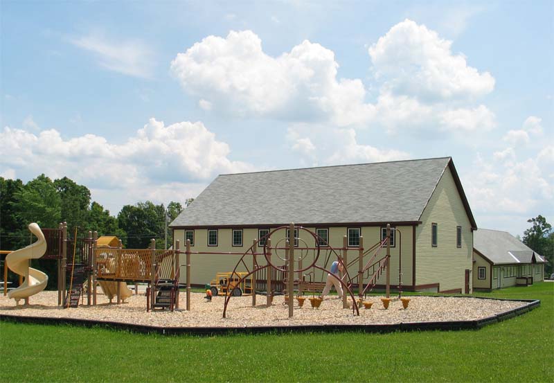
imagesize = 250px
image_caption = Community center and elementary school in Tinmouth
image_
mapsize = 250px
map_caption = Tinmouth, Vermont
mapsize1 =
map_caption1 =subdivision_type = Country
subdivision_name =United States
subdivision_type1 = State
subdivision_name1 =Vermont
subdivision_type2 = County
subdivision_name2 = Rutlandgovernment_footnotes =
government_type =
leader_title =
leader_name =
leader_title1 =
leader_name1 =
established_title =
established_date =unit_pref = Imperial
area_footnotes =
area_magnitude =
area_total_km2 = 73.6
area_land_km2 = 73.3
area_water_km2 = 0.3
area_total_sq_mi = 28.4
area_land_sq_mi = 28.3
area_water_sq_mi = 0.1population_as_of = 2000
population_footnotes =
population_total = 567
population_density_km2 = 7.7
population_density_sq_mi = 20.0timezone = Eastern (EST)
utc_offset = -5
timezone_DST = EDT
utc_offset_DST = -4
elevation_footnotes =
elevation_m = 418
elevation_ft = 1371
latd = 43 |latm = 26 |lats = 54 |latNS = N
longd = 73 |longm = 3 |longs = 3 |longEW = Wpostal_code_type =
ZIP code
postal_code = 05773
area_code = 802
blank_name = FIPS code
blank_info = 50-72925GR|2
blank1_name = GNIS feature ID
blank1_info = 1462227GR|3
website =
footnotes =Tinmouth is a town in Rutland County,
Vermont ,United States . The population was 567 at the 2000 census.Geography
According to the
United States Census Bureau , the town has a total area of 28.4square mile s (73.6km² ), of which, 28.3 square miles (73.2 km²) of it is land and 0.1 square miles (0.3 km²) of it (0.42%) is water.Demographics
As of the
census GR|2 of 2000, there were 567 people, 231 households, and 167 families residing in the town. Thepopulation density was 20.0 people per square mile (7.7/km²). There were 332 housing units at an average density of 11.7/sq mi (4.5/km²). The racial makeup of the town was 96.83% White, 1.41% Native American, 0.35% Asian, 0.18% from other races, and 1.23% from two or more races. Hispanic or Latino of any race were 0.35% of the population.There were 231 households out of which 32.5% had children under the age of 18 living with them, 61.5% were married couples living together, 8.2% had a female householder with no husband present, and 27.7% were non-families. 23.8% of all households were made up of individuals and 9.5% had someone living alone who was 65 years of age or older. The average household size was 2.45 and the average family size was 2.86.
In the town the population was spread out with 22.0% under the age of 18, 7.6% from 18 to 24, 29.3% from 25 to 44, 28.0% from 45 to 64, and 13.1% who were 65 years of age or older. The median age was 40 years. For every 100 females there were 95.5 males. For every 100 females age 18 and over, there were 104.6 males.
The median income for a household in the town was $32,604, and the median income for a family was $34,792. Males had a median income of $25,313 versus $22,708 for females. The
per capita income for the town was $16,583. About 7.6% of families and 11.1% of the population were below thepoverty line , including 11.1% of those under age 18 and 20.7% of those age 65 or over.Neighborhood
Tinmouth had only around 410 voters in 2008, and the town changed the way of voting from traditional town meeting to Australian ballot in 2007.
chool
The Tinmouth School had 54 children (grades PreK-6) in 2008. Classes are grades combined into one class, making 4 classes in the school. Students attend Mill River Middle School and Mill River Union High School, but some students attend other schools because secondary education has a tax-paid choice of schools.
Notable residents
*
Nathaniel Chipman , U.S. Senator from VermontReferences
External links
Wikimedia Foundation. 2010.