- Colorado State Highway 112
-
State Highway 112
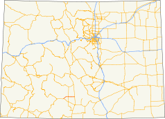
Route information Maintained by CDOT Length: 27.802 mi[1] (44.743 km) Major junctions West end:  US 160 at Del Norte
 US 285 near Center
North end:  SH 17 at Hooper
Highway system ←  SH 110
SH 113  →
→State Highway 112 (SH 112) is a 27.802 mi (44.743 km) long state highway in southern Colorado. Built in 1916 and formally defined in 1922, the route begins at its western end in Del Norte at a junction with U.S. Highway 160 (US 160). From there the road travels east crossing US 285 two miles (3.2 km) west of Center before reaching its eastern terminus at Hooper where it meets SH 17.
Contents
Route description
The route begins at US 160 in central Del Norte. Here, it begins northward along Oak Street before crossing the Rio Grande River,[2] where the route exits the city and curves northeastward.[3][4] The highway then straddles the Rio Grande – Saguache county line as it travels in a northeasterly direction. Soon, it intersects County Route 374, which traverses east all the way to US 285. The route then suddenly curves eastward when it meets Twelve Mile Road. As the route continues to meet numerous county roads along its length, the land along the side of the road transitions from plain grassland to circular-shaped fields of crops.[4] The route meets US 285 approximately twelve miles east of Del Norte.[3][5]
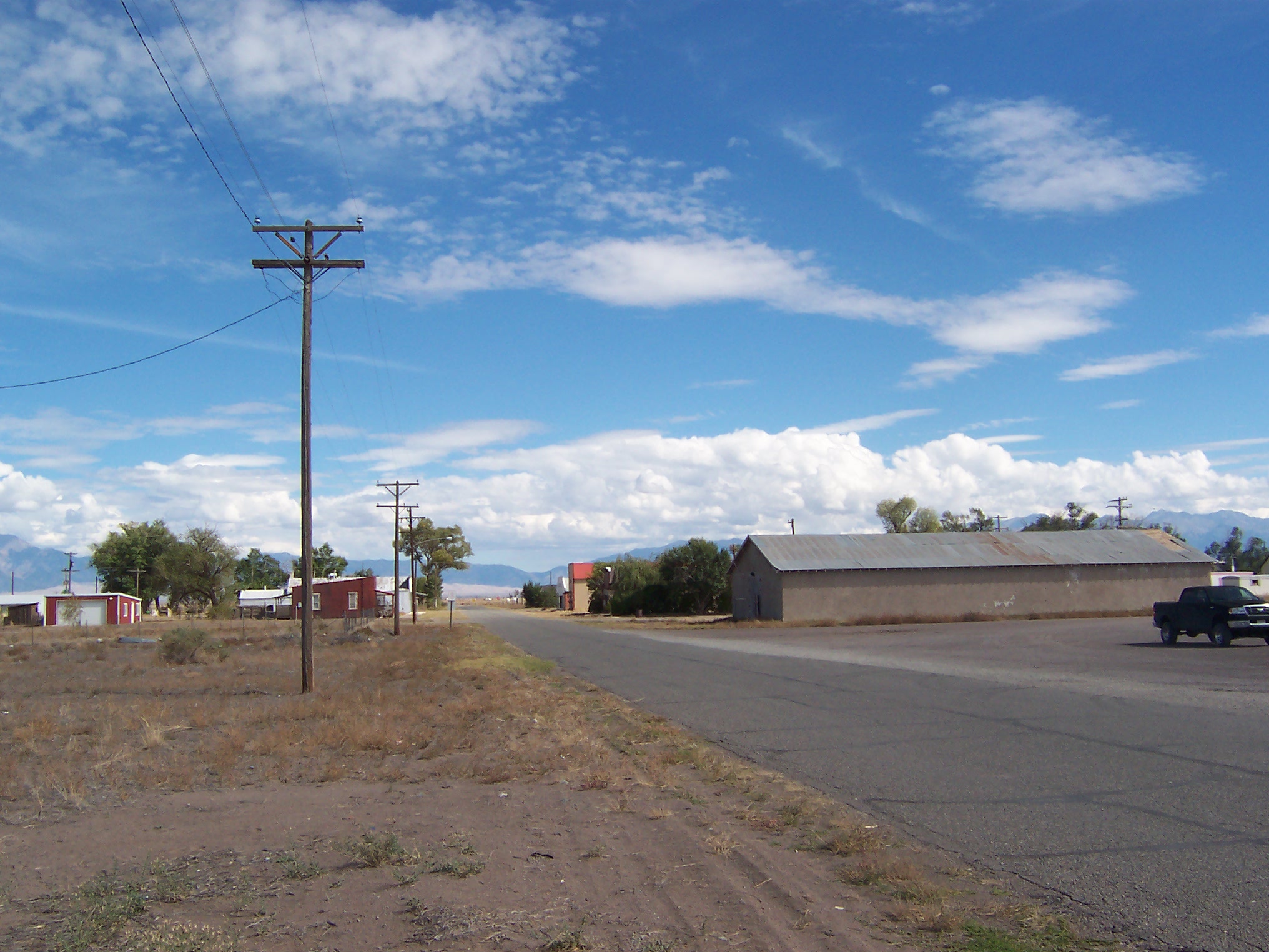
East of US 285, the route enters the town of Center, where it skirts the south side of town as 8th Street.[3] Here, it meets a railroad that connects the town to Sugar Junction farther south.[6] The route moves east through farmland, where it meets County Road 100, which continues south to SH 15. It then skirts along the county line all the way east to SH 17 at the north side of Hooper.[3][7]
History
In 1916, a 12-mile (19 km) gravel road numbered as 10-S ran from Center to Hooper.[3] Another unsurfaced part of the road continued to Alamosa from Hooper. By the late 1910s, the Highway Department of Colorado had built State Highway 68, which ran from Del Norte to SH 36. When built, the route had a five-mile (6.0 km) gap along the Rio Grande – Saguache county line, on which work began in the 1920s. In 1922, SH 68 was renumbered as SH 112 from Del Norte to Hooper.[3]

By 1930, SH 112 had been paved from Del Norte to the county line. However, the residents of San Luis Valley wanted better roads to use for travel. Because of this, the Department of Highways began improving SH 112 around the area, but it was not until 1946 until the highway was fully surfaced. The next year, Rio Grande and Saguache counties paid to resurface the rest of the road in asphalt.[3] Since 1947, there have been no major realignments in the routing.
Major intersections
County Location Mile[1] Destination Notes Rio Grande Del Norte 0.000 US 160West end of route Saguache 13.138 US 285Alamosa Hooper 27.802 SH 17East end of route References
- ^ a b "Segment Descriptions for Highway 112". Colorado Department of Transportation. http://www.dot.state.co.us/app_DTD_DataAccess/Highways/index.cfm?fuseaction=Description&route=112&begRefPt=0&endRefPt=500&Printable=true. Retrieved March 25, 2008.
- ^ Colorado Department of Transportation (August 21, 2008) (PDF). Map of Del Norte, Colorado (Map). http://www.dot.state.co.us/App_DTD_DataAccess/Downloads/CityMaps/Del%20Norte.pdf. Retrieved May 11, 2010.
- ^ a b c d e f g "Highways to the Sky". Colorado Department of Transportation. April 24, 2002. http://www.coloradodot.info/programs/environmental/archaeology-and-history/highways-to-the-sky/ch11.pdf/view. Retrieved May 10, 2010.
- ^ a b Microsoft. Map of Overview map of SH 112 – Bing Maps (Map). Cartography by NavTEQ, Inc. http://www.bing.com/maps/#JmNwPTM3LjcxNDA3NjkzNjI0NDk4fi0xMDYuMTE2NTIyMjUyNTU5NjYmbHZsPTEwJnN0eT1yJnJ0cD1wb3MuMzcuNjc4Njk1MjQ2NTc3MjZfLTEwNi4zNTI1NzAwNTY5MTUyOF9EZWwlMjBOb3J0ZSUyQyUyMENPX19fZV9+cG9zLjM3Ljc0NTcyMDI5NzA5ODE2Xy0xMDUuODgwNDc0NDQ4MjA0MDRfSG9vcGVyJTJDJTIwQ09fX19lXyZtb2RlPUQmcnRvcD0wfjB+MH4=. Retrieved May 10, 2010.
- ^ National Geographic (October 2006). The United States (Map).
- ^ Colorado Department of Transportation (August 21, 2008) (PDF). Map of Center, Colorado (Map). http://www.dot.state.co.us/App_DTD_DataAccess/Downloads/CityMaps/Center.pdf. Retrieved May 11, 2010.
- ^ Colorado Department of Transportation (August 21, 2008) (PDF). Map of Hooper, Colorado (Map). http://www.dot.state.co.us/App_DTD_DataAccess/Downloads/CityMaps/Hooper.pdf. Retrieved May 11, 2010.
Categories:- State highways in Colorado
- Transportation in Saguache County, Colorado


Wikimedia Foundation. 2010.