- Lasara, Texas
Infobox Settlement
official_name = Lasara, Texas
settlement_type = CDP
nickname =
motto =
imagesize =
image_caption =
image_
mapsize = 250px
map_caption = Location of Lasara, Texas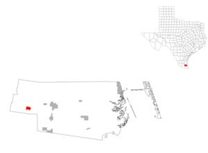
mapsize1 = 250px
map_caption1 =subdivision_type = Country
subdivision_name =United States
subdivision_type1 = State
subdivision_name1 =Texas
subdivision_type2 = County
subdivision_name2 = Willacygovernment_footnotes =
government_type =
leader_title =
leader_name =
leader_title1 =
leader_name1 =
established_title =
established_date =unit_pref = Imperial
area_footnotes =area_magnitude =
area_total_km2 = 3.6
area_land_km2 = 3.6
area_water_km2 = 0.0
area_total_sq_mi = 1.4
area_land_sq_mi = 1.4
area_water_sq_mi = 0.0population_as_of = 2000
population_footnotes =
population_total = 1024
population_density_km2 = 283.3
population_density_sq_mi = 733.6timezone = Central (CST)
utc_offset = -6
timezone_DST = CDT
utc_offset_DST = -5
elevation_footnotes =
elevation_m = 13
elevation_ft = 43
latd = 26 |latm = 27 |lats = 56 |latNS = N
longd = 97 |longm = 54 |longs = 43 |longEW = Wpostal_code_type =
ZIP code
postal_code = 78561
area_code = 956
blank_name = FIPS code
blank_info = 48-41548GR|2
blank1_name = GNIS feature ID
blank1_info = 1339691GR|3
website =
footnotes =Lasara is a
census-designated place (CDP) in Willacy County,Texas ,United States . The population was 1,024 at the 2000 census.Lasara was named after Laura Harding and Sarah Gill, the wives of settlers William Harding and Lamar Gill.
Geography
Lasara is located at coor dms|26|27|56|N|97|54|43|W|city (26.465449, -97.912001)GR|1.
According to the
United States Census Bureau , the CDP has a total area of 1.4square mile s (3.6km² ), all of it land.Demographics
As of the
census GR|2 of 2000, there were 1,024 people, 257 households, and 228 families residing in the CDP. Thepopulation density was 733.6 people per square mile (282.4/km²). There were 295 housing units at an average density of 211.4/sq mi (81.4/km²). The racial makeup of the CDP was 67.19% White, 0.68% African American, 0.68% Native American, 0.10% Asian, 29.59% from other races, and 1.76% from two or more races. Hispanic or Latino of any race were 95.80% of the population.There were 257 households out of which 57.6% had children under the age of 18 living with them, 71.2% were married couples living together, 14.0% had a female householder with no husband present, and 10.9% were non-families. 10.1% of all households were made up of individuals and 5.1% had someone living alone who was 65 years of age or older. The average household size was 3.98 and the average family size was 4.28.
In the CDP the population was spread out with 40.6% under the age of 18, 10.6% from 18 to 24, 27.5% from 25 to 44, 11.2% from 45 to 64, and 10.0% who were 65 years of age or older. The median age was 24 years. For every 100 females there were 95.8 males. For every 100 females age 18 and over, there were 93.0 males.
The median income for a household in the CDP was $17,794, and the median income for a family was $18,917. Males had a median income of $18,472 versus $12,917 for females. The
per capita income for the CDP was $6,336. About 40.9% of families and 45.2% of the population were below thepoverty line , including 54.1% of those under age 18 and 51.4% of those age 65 or over.Education
Lasara is within the
Lasara Independent School District (Pre-K through 8). Lasara ISD was approved onMarch 18 ,1925 .Residents of Lasara ISD may choose to attend high school in
Raymondville Independent School District orLyford Consolidated Independent School District .In addition,
South Texas Independent School District operates magnet schools that serve Lasara and many surrounding communities.References
External links
* [http://www.tsha.utexas.edu/handbook/online/articles/LL/hll20.html Handbook of Texas Online article]

Wikimedia Foundation. 2010.