- Clatterbridge
-
Coordinates: 53°20′N 3°02′W / 53.33°N 3.03°W
Clatterbridge 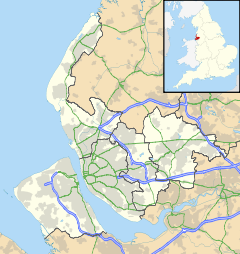
 Clatterbridge
Clatterbridge shown within MerseysidePopulation 30 (2001 Census)[1] OS grid reference SJ321823 Metropolitan borough Wirral Metropolitan county Merseyside Region North West Country England Sovereign state United Kingdom Post town WIRRAL Postcode district CH63 Dialling code 0151 Police Merseyside Fire Merseyside Ambulance North West EU Parliament North West England UK Parliament Wirral South List of places: UK • England • Merseyside Clatterbridge is a hamlet located on the Wirral Peninsula, England. It is situated to the west of the town of Bebington, close to the M53 motorway.
It is a ward of the Metropolitan Borough of Wirral, which includes Spital, Brimstage, Raby, the areas of Brookhurst and Marfords in Bromborough and Eastham, Raby Mere, parts of Bebington and Thornton Hough. At the 2001 Census, the total population of the ward was 16,906.[2] The hamlet itself only had a recorded resident population of 30.[1]
The area is the site of Clatterbridge Hospital, which is part of the Wirral University Teaching Hospital NHS Foundation Trust, and Clatterbridge Centre for Oncology NHS Foundation Trust.The centre's charity, 'Clatterbridge your cancer centre' is the only charity directly raising funds for Clatterbridge cancer patients across the region - improving care, funding world-class equipment, vital research and life-changing support services. Radio Clatterbridge is one of the North West region's oldest hospital radio stations.
References
- ^ a b Wirral 2001 Census: Clatterbridge, Metropolitan Borough of Wirral, http://www.wirral.gov.uk/factsandfigures/census2001/oneward2recset.asp?ref=TS09, retrieved 25 March 2008
- ^ 2001 Census: Clatterbridge (Ward), Office for National Statistics, http://neighbourhood.statistics.gov.uk/dissemination/LeadKeyFigures.do?a=3&b=5941388&c=clatterbridge&d=14&e=16&g=361442&i=1001x1003x1004&m=0&r=1&s=1206404664281&enc=1, retrieved 25 March 2008
External links
Categories:- Hamlets in England
- Towns and villages in Wirral (borough)
- Merseyside geography stubs

Wikimedia Foundation. 2010.