- Robstown, Texas
Infobox Settlement
official_name = City of Robstown
settlement_type =City
nickname =
imagesize =
image_caption =
image_
mapsize = 250px
map_caption = Location in the state ofTexas 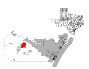
mapsize1 = 250px
map_caption1 =
subdivision_type = Country
subdivision_type1 = State
subdivision_type2 = County
subdivision_name =United States
subdivision_name1 =Texas
subdivision_name2 = Nueces
government_type =
leader_title =Mayor
leader_name =
area_footnotes =
established_date =
area_magnitude =
area_total_km2 = 31.3
area_land_km2 = 31.3
area_water_km2 = 0.0
area_total_sq_mi = 12.1
area_land_sq_mi = 12.1
area_water_sq_mi = 0.0
elevation_m = 22
elevation_ft = 72
latd = 27 |latm = 47 |lats = 33 |latNS = N
longd = 97 |longm = 40 |longs = 10 |longEW = W
population_as_of =2000 U.S. Census
population_note =
population_total = 12,727
population_urban =
population_metro =
population_density_sq_mi = 1054.6
timezone = CST
utc_offset = -6
timezone_DST = CDT
utc_offset_DST = -5
postal_code_type =ZIP code
postal_code = 78380
area_code = 361
latitude =
longitude =
website =
blank_name = FIPS code
blank_info = 48-62600GR|2
blank1_name = GNIS feature ID
blank1_info = 1345344GR|3
footnotes =Robstown is a city in Nueces County,
Texas ,United States and a western suburb of Corpus Christi. It was founded about 1906, and was named forRobert Driscoll . The population was 12,727 at the 2000 census.Geography
Robstown is located at coor dms|27|47|33|N|97|40|10|W|city (27.792615, -97.669386)GR|1.
According to the
United States Census Bureau , the city has a total area of 12.1square mile s (31.3km² ), all of it land.Demographics
As of the
census GR|2 of 2000, there were 13,044 people, 3,644 households, and 3,039 families residing in the city. Thepopulation density was 1,054.6 people per square mile (407.1/km²). There were 4,063 housing units at an average density of 336.7/sq mi (130.0/km²). The racial makeup of the city was 66.97% White, 1.41% African American, 0.60% Native American, 0.15% Asian, 0.06% Pacific Islander, 27.12% from other races, and 3.69% from two or more races. Hispanic or Latino of any race were 93.09% of the population.There were 3,644 households out of which 42.4% had children under the age of 18 living with them, 53.1% were married couples living together, 24.3% had a female householder with no husband present, and 16.6% were non-families. 15.1% of all households were made up of individuals and 8.5% had someone living alone who was 65 years of age or older. The average household size was 3.47 and the average family size was 3.85.
In the city the population was spread out with 33.5% under the age of 18, 11.1% from 18 to 24, 25.5% from 25 to 44, 18.4% from 45 to 64, and 11.5% who were 65 years of age or older. The median age was 29 years. For every 100 females there were 93.5 males. For every 100 females age 18 and over, there were 87.4 males.
The median income for a household in the city was $22,774, and the median income for a family was $25,576. Males had a median income of $23,151 versus $16,150 for females. The
per capita income for the city was $8,736. About 30.0% of families and 32.1% of the population were below thepoverty line , including 43.0% of those under age 18 and 25.3% of those age 65 or over.Cityscape
Robstown is divided into several neighborhoods. Two of these "barrios," as they are called in Spanish, are famous among the residents:
Bluebonnet is located in the northwest area of the city, right next to Robstown High School. Casa Blanca is located south of Avenue A, across the train tracks near the mammoth St. Anthony's Church.Education
The City of Robstown is served by the
Robstown Independent School District .Notable natives
*
Gene Upshaw (NFL Hall of Fame player)
*Damian Chapa (Actor)
* Eddie Jackson (Bassist ofQueensrÿche )
*Solomon Ortiz (Member of Congress)
*Mike Gonzalez ( MLB pitcher)
*Brooks Kieschnick
*Jesse Garcia (Baseball)
* ( 23 playoff appearances)
* (Island idiot)References
External links
* www.robstowntexas.blogspot.com
*

Wikimedia Foundation. 2010.