- Las Lomitas, Texas
Infobox Settlement
official_name = Las Lomitas, Texas
settlement_type = CDP
nickname =
motto =
imagesize =
image_caption =
image_
imagesize =
image_caption =
image_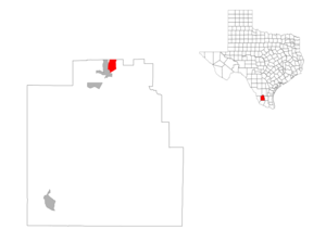
mapsize = 300px
map_caption =
mapsize1 =
map_caption1 =subdivision_type = Country
subdivision_name =United States
subdivision_type1 = State
subdivision_name1 =Texas
subdivision_type2 = County
subdivision_name2 = Jim Hogggovernment_footnotes =
government_type =
leader_title =
leader_name =
leader_title1 =
leader_name1 =
established_title =
established_date =unit_pref = Imperial
area_footnotes =area_magnitude =
area_total_km2 = 10.2
area_land_km2 = 10.2
area_water_km2 = 0.0
area_total_sq_mi = 4.0
area_land_sq_mi = 4.0
area_water_sq_mi = 0.0population_as_of = 2000
population_footnotes =
population_total = 267
population_density_km2 = 26.1
population_density_sq_mi = 67.5timezone = Central (CST)
utc_offset = -6
timezone_DST = CDT
utc_offset_DST = -5
elevation_footnotes =
elevation_m = 174
elevation_ft = 571
latd = 27 |latm = 20 |lats = 34 |latNS = N
longd = 98 |longm = 40 |longs = 8 |longEW = Wpostal_code_type =
postal_code =
area_code =
blank_name = FIPS code
blank_info = 48-41569GR|2
blank1_name = GNIS feature ID
blank1_info = 1852727GR|3
website =
footnotes =Las Lomitas is a
census-designated place (CDP) in Jim Hogg County,Texas ,United States . The population was 267 at the 2000 census.Geography
Las Lomitas is located at coor dms|27|20|34|N|98|40|8|W|city (27.342890, -98.668876)GR|1.
According to the
United States Census Bureau , the CDP has a total area of 4.0square mile s (10.3km² ), all of it land.Demographics
As of the
census GR|2 of 2000, there were 267 people, 69 households, and 56 families residing in the CDP. Thepopulation density was 67.5 people per square mile (26.0/km²). There were 87 housing units at an average density of 22.0/sq mi (8.5/km²). The racial makeup of the CDP was 69.66% White, 23.97% from other races, and 6.37% from two or more races. Hispanic or Latino of any race were 93.26% of the population.There were 69 households out of which 68.1% had children under the age of 18 living with them, 63.8% were married couples living together, 13.0% had a female householder with no husband present, and 17.4% were non-families. 13.0% of all households were made up of individuals and 2.9% had someone living alone who was 65 years of age or older. The average household size was 3.87 and the average family size was 4.23.
In the CDP the population was spread out with 46.1% under the age of 18, 11.6% from 18 to 24, 29.2% from 25 to 44, 10.5% from 45 to 64, and 2.6% who were 65 years of age or older. The median age was 20 years. For every 100 females there were 108.6 males. For every 100 females age 18 and over, there were 105.7 males.
The median income for a household in the CDP was $30,714, and the median income for a family was $30,714. Males had a median income of $36,875 versus $11,250 for females. The
per capita income for the CDP was $7,506. About 28.8% of families and 38.2% of the population were below thepoverty line , including 37.4% of those under the age of eighteen and 100.0% of those sixty five or over.Education
Las Lomitas, as with all of Jim Hogg County, is served by the
Jim Hogg County Independent School District .The district has three schools: Hebbronville Elementary School, Hebbronville Junior High School, and
Hebbronville High School . All of the schools are considered to be in the Hebbronville community.References
External links
Wikimedia Foundation. 2010.