- Mount Anne
-
Mount Anne 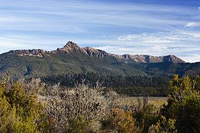
Mount Anne, Mount Eliza and the Eliza Plateau from Scotts Peak Dam RoadElevation 1,423 m (4,669 ft) AHD Location Location Tasmania, Australia Coordinates 42°56′31″S 146°25′26″E / 42.942°S 146.424°E Geology Type Dolerite Age of rock Jurassic Mount Anne is a mountain in the Southwest National Park in Tasmania, Australia. It is within the UNESCO World Heritage listed Tasmanian Wilderness.
Mount Anne is the nineteenth highest mountain in Tasmania, but the highest in south-west Tasmania, adding to its appearance of prominence.[1] It dominates the area surrounding Lake Pedder.
Although a primarily dolerite structure, it has a large sub-structure of dolomite, which contains an extensive cave system. This system includes the famous 'Anna-a-Kananda' cave - one of the deepest caves in Australia.[2] Several cavers have been killed trying to explore its depths.[citation needed]
Mount Anne has a superb region of ancient Gondwanan type vegetation on its north-east ridge, some of which are amongst the oldest surviving plant species on the planet.[citation needed]
Contents
History
Mount Anne was named by George Frankland after his wife, Georgina Anne in 1835.[3] Henry Judd reached the Mount Anne Plateau from the Huon Valley in 1880.[3] Walter Crookall and Geoff Chapman, members of the Hobart Walking Club found a way to the top on 25 December 1929. [4] The long hike from Maydena or Huonville became a day walk after the construction of the Scotts Peak Dam Road in 1970.[4]
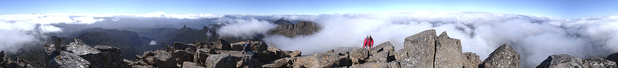 360° panorama from the peak of Mount Anne
See also
Notes
- ^ *Wilkinson, Bill. (1994) The Abels: Tasmania’s mountains over 1100 m high Launceston, Tas.: Regal Publications ISBN 0949457671. South west region highest at pp.39 and 40, and page 43 Table B - The Abels arranged in Order of Altitude, 28th highest in Wilkinsons list 1994.
- ^ Australian Caver 105, 1984 Features Anne-A-Kananda of Mount Anne Tasmania + map
- ^ a b Chapman, John. South West Tasmania. ISBN 978-1-920995-03-4.
- ^ a b Cannon, John. "Mount Anne". Centre for Tasmanian Historical Studies. http://www.utas.edu.au/library/companion_to_tasmanian_history/M/Mount%20Anne.htm. Retrieved 24 March 2010.
External links
Categories:- Mountains of Tasmania
- South West Tasmania
- Tasmania geography stubs


Wikimedia Foundation. 2010.