- Latexo, Texas
Infobox Settlement
official_name = Latexo, Texas
settlement_type =City
nickname =
motto =
imagesize =
image_caption =
image_
mapsize = 250px
map_caption = Location of Latexo, Texas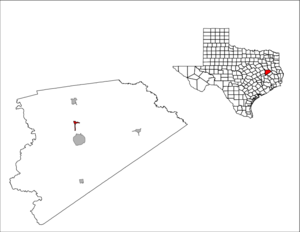
mapsize1 = 250px
map_caption1 =subdivision_type = Country
subdivision_name =United States
subdivision_type1 = State
subdivision_name1 =Texas
subdivision_type2 = County
subdivision_name2 = Houstongovernment_footnotes =
government_type =
leader_title =
leader_name =
leader_title1 =
leader_name1 =
established_title =
established_date =unit_pref = Imperial
area_footnotes =area_magnitude =
area_total_km2 = 2.6
area_land_km2 = 2.6
area_water_km2 = 0.0
area_total_sq_mi = 1.0
area_land_sq_mi = 1.0
area_water_sq_mi = 0.0population_as_of = 2000
population_footnotes =
population_total = 272
population_density_km2 = 106.6
population_density_sq_mi = 276.0timezone = Central (CST)
utc_offset = -6
timezone_DST = CDT
utc_offset_DST = -5
elevation_footnotes =
elevation_m = 121
elevation_ft = 397
latd = 31 |latm = 23 |lats = 21 |latNS = N
longd = 95 |longm = 28 |longs = 29 |longEW = Wpostal_code_type =
ZIP code
postal_code = 75849
area_code = 936
blank_name = FIPS code
blank_info = 48-41644GR|2
blank1_name = GNIS feature ID
blank1_info = 1360972GR|3
website =
footnotes =Latexo is a city in Houston County,
Texas ,United States . The population was 272 at the 2000 census.History
Just after 1900 the Louisiana Texas Orchard Company purchased 3,000 acres (12 km²) surrounding the settlement and platted a town named Latexo, an acronym of the company's name.
Geography
Latexo is located at coor dms|31|23|21|N|95|28|29|W|city (31.389285, -95.474699)GR|1.
According to the
United States Census Bureau , the city has a total area of 1.0square mile s (2.6km² ), all of it land.Demographics
As of the
census GR|2 of 2000, there were 272 people, 116 households, and 70 families residing in the city. Thepopulation density was 276.0 people per square mile (106.1/km²). There were 136 housing units at an average density of 138.0/sq mi (53.0/km²). The racial makeup of the city was 90.07% White, 3.31% African American, 0.37% Native American, 0.37% Asian, 3.68% from other races, and 2.21% from two or more races. Hispanic or Latino of any race were 5.51% of the population.There were 116 households out of which 29.3% had children under the age of 18 living with them, 46.6% were married couples living together, 11.2% had a female householder with no husband present, and 38.8% were non-families. 36.2% of all households were made up of individuals and 16.4% had someone living alone who was 65 years of age or older. The average household size was 2.34 and the average family size was 3.04.
In the city the population was spread out with 26.5% under the age of 18, 9.6% from 18 to 24, 27.2% from 25 to 44, 21.7% from 45 to 64, and 15.1% who were 65 years of age or older. The median age was 39 years. For every 100 females there were 88.9 males. For every 100 females age 18 and over, there were 81.8 males.
The median income for a household in the city was $22,750, and the median income for a family was $35,833. Males had a median income of $29,583 versus $18,750 for females. The
per capita income for the city was $15,603. About 21.4% of families and 22.7% of the population were below thepoverty line , including 27.2% of those under the age of eighteen and 12.7% of those sixty five or over.Education
The City of Latexo is served by the
Latexo Independent School District .They're all really really dumb and they suck at sports.
References
External links

Wikimedia Foundation. 2010.