- Tom Bean, Texas
Infobox Settlement
official_name = Tom Bean, Texas
settlement_type =City
nickname =
motto =
imagesize =
image_caption =
image_
mapsize = 250px
map_caption = Location of Tom Bean, Texas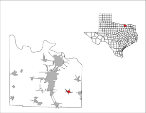
mapsize1 = 250px
map_caption1 =subdivision_type = Country
subdivision_name =United States
subdivision_type1 = State
subdivision_name1 =Texas
subdivision_type2 = County
subdivision_name2 = Graysongovernment_footnotes =
government_type =
leader_title =
leader_name =
leader_title1 =
leader_name1 =
established_title =
established_date =unit_pref = Imperial
area_footnotes =area_magnitude =
area_total_km2 = 3.7
area_land_km2 = 3.7
area_water_km2 = 0.0
area_total_sq_mi = 1.4
area_land_sq_mi = 1.4
area_water_sq_mi = 0.0population_as_of = 2000
population_footnotes =
population_total = 941
population_density_km2 = 257.5
population_density_sq_mi = 667.0timezone = Central (CST)
utc_offset = -6
timezone_DST = CDT
utc_offset_DST = -5
elevation_footnotes =
elevation_m = 250
elevation_ft = 820
latd = 33 |latm = 31 |lats = 15 |latNS = N
longd = 96 |longm = 28 |longs = 58 |longEW = Wpostal_code_type =
ZIP code
postal_code = 75489
area_code = 903
blank_name = FIPS code
blank_info = 48-73328GR|2
blank1_name = GNIS feature ID
blank1_info = 1369993GR|3
website =
footnotes =Tom Bean is a city in Grayson County,
Texas ,United States . The population was 941 at the 2000 census.Tom Bean is part of the Sherman–Denison Metropolitan Statistical Area.
Geography
Tom Bean is located at coor dms|33|31|15|N|96|28|58|W|city (33.520811, -96.482826)GR|1.The town is approximately 30 miles south of the Red River and the
Oklahoma border. The nearest town with a population over 20,000 people isSherman, Texas . The area is colloquially referred to as the Sher-Den area or Texomaland - or justTexoma .According to the
United States Census Bureau , the city has a total area of 1.4square mile s (3.7km² ), all of it land.History
Tom Bean was founded in
1887 and named after Thomas Bean, a land surveyor fromBonham, Texas who donated the land to be used as a stop on the local railway. It later became a stop on the St. Louis Southwestern Railway.In the late 19th/early 20th century, Tom Bean was bustling with two saloons, a movie theater, a social club, a cotton gin and factories. However, growth soon ended, and eventually the railroad removed the tracks through the city.
Current growth is due to its proximity to nearby Sherman, approximately twelve miles northwest.
Demographics
As of the
census GR|2 of 2000, there were 941 people, 357 households, and 263 families residing in the city. Thepopulation density was 667.0 people per square mile (257.7/km²). There were 380 housing units at an average density of 269.4/sq mi (104.1/km²). The racial makeup of the city was 96.17% White, 0.43% African American, 1.17% Native American, 0.21% Asian, 0.21% Pacific Islander, 0.64% from other races, and 1.17% from two or more races. Hispanic or Latino of any race were 3.93% of the population.There were 357 households out of which 41.7% had children under the age of 18 living with them, 58.0% were married couples living together, 12.0% had a female householder with no husband present, and 26.1% were non-families. 24.4% of all households were made up of individuals and 12.9% had someone living alone who was 65 years of age or older. The average household size was 2.64 and the average family size was 3.15.
In the city the population was spread out with 32.1% under the age of 18, 6.4% from 18 to 24, 31.8% from 25 to 44, 19.9% from 45 to 64, and 9.9% who were 65 years of age or older. The median age was 32 years. For every 100 females there were 91.3 males. For every 100 females age 18 and over, there were 82.1 males.
The median income for a household in the city was $38,875, and the median income for a family was $50,000. Males had a median income of $37,750 versus $23,036 for females. The
per capita income for the city was $16,113. About 7.6% of families and 9.0% of the population were below thepoverty line , including 9.2% of those under age 18 and 25.5% of those age 65 or over.Education
The City of Tom Bean is served by the
Tom Bean Independent School District .References
[http://www.texasescapes.com/They-Shoe-Horses-Dont-They/Three-Bean-Salad.htm "Three Bean Salad"] External links
* [http://www.tombean.net/ Tom Bean Official City Website]
* [http://hs.tombean-isd.org/ Tom Bean High School]
* [http://www.tombean-isd.org/ Tom Bean ISD]
* [http://tombeanfire.com/ Tom Bean Volunteer Fire Department]
* [http://www.beanstock.org/ Beanstock Festival]

Wikimedia Foundation. 2010.