- Missouri Route 66
-
Route 66
Route information Maintained by MoDOT Length: 14 mi (23 km) Existed: 1985 – present Major junctions West end:  K-66 at the Kansas state line
 Route 249 East of Duquesne

 Business US 71 in Joplin

 Bus. Loop 44/Route 43 in Joplin
East end:  I-44/Bus. Loop 44/US 71 East of Duenweg
Highway system Missouri Highways
Supplemental←  US 65
US 65US 67  →
→Route 66 is a fourteen mile (21 km) long road in southwest Missouri, USA, which had previously been U.S. Route 66 for its final six years. The highway begins at Interstate 44, passes through Duenweg, Duquesne, and Joplin, then crosses into Kansas becoming K-66.
Route of the highway
Route 66 begins at a partial interchange with I-44 east of Duenweg and heads west in an almost straight line to near the state line. About half of the highway is a concurrency with Interstate 44 Business. At the west side of Duenweg, Route 66/Business I-44 has an interchange with Route 249 (future Interstate 49), then heads through Duquesne (where it becomes a four-lane road) and on into Joplin, where it becomes Seventh Street. At Rangeline Road is an intersection with U.S. Route 71 Business, a major intersection in Joplin. At Main Street is an intersection with Route 43 and Business I-44 turns south.
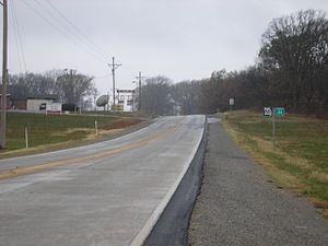
West of Main Street, Route 66 is marked "Historic Route 66" (see below). Just west of the city limits of Joplin, the highway becomes a divided highway all the way to the state line. About one mile (1.6 km) before entering Kansas, a county road, "Old Route 66", turns off and the newer highway turns southwest to the Kansas state line.
US 66 through the Joplin Area
Although all of Route 66 once served as US 66, only five of the six westernmost miles are marked as "Historic Route 66" being that the historic alignment comes in from the north (westbound) on Main Street in Joplin. The very westernmost mile of Historic Route 66 turns off Route 66 on a county road known as "Route 66 Boulevard" and enters Kansas at a different location than the current state highway.
See also
Categories:- State highways in Missouri
- U.S. Route 66


Wikimedia Foundation. 2010.