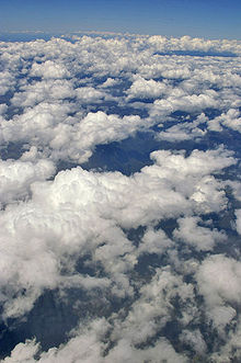
- Cumulus mediocris cloud
-
Cumulus mediocris cloud 
Cumulus mediocris cloudsAbbreviation Cu Symbol 
Genus Cumulus (heaped) Species mediocris (moderate) Altitude 500-3000 m
(1,500-10,000 ft)Precipitation cloud? Usually No Cumulus mediocris is a low to middle level cloud with some vertical extent (Family D1) of the genus cumulus, larger in vertical development than Cumulus humilis[1]. It may or may not show the cauliflower form characteristic of cumulus clouds. These clouds do not generally produce precipitation, but may further advance into clouds such as Cumulus congestus and Cumulonimbus, which do[1].
Forecast
These clouds are common in the advance of a cold front or in unstable atmospheric conditions such as an area of low pressure. They can grow into larger clouds which could bring storms. If these clouds are present in the morning or early afternoon they show a significant instability in the atmosphere likely leading to storms later in the day.[citation needed] usually in the spring time.
References
- ^ a b (English)National Weather Service. "L2 Clouds: Cumulus (Cu) of moderate/strong development". JetStream. NOAA. http://www.srh.noaa.gov/srh/jetstream/synoptic/l2.htm. Retrieved 2010-06-01.
Cloud genuses Extreme-level High-level Medium-level Low-level Fog · Stratus (St) · Cumulus (Cu) · Stratocumulus (Sc) · Arcus (Roll) · Fractus · Funnel · Nimbostratus (Ns) · Shelf · Wall · Actinoform cloud · Undulatus asperatusVertical Cumulonimbus (Cb) · Cumulonimbus mammatus · Pyrocumulus · Pyrocumulonimbus · Overshooting top · AccessoryCategories:- Cumulus
- Atmospheric science stubs
Wikimedia Foundation. 2010.

