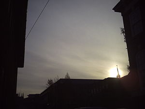
- Cirrostratus cloud
-
Cirrostratus cloud 
Cirrostratus fibratusAbbreviation Cs Genus Cirrus- "curl of hair" and
-stratus "layered"Altitude Above 6000 m
(Above 20,000 ft)Classification Family A (High-level) Appearance white veil Precipitation cloud? No, but may signify approaching rain Cirrostratus
 /ˌsɪroʊˈstrɑːtəs/ clouds are thin, generally uniform clouds, composed of ice-crystals. They are difficult to detect and capable of forming halos the cloud takes the form of thin cirrostratus nebulosus and have a fibrous texture with no haloes if it is thicker cirrostratus fibratus. On the approach of a frontal system, the cirrostratus often begins as nebulosus and turns to fibratus. Cirrostratus is usually located above 5.5 km (18,000 ft). Its presence indicates a large amount of moisture in the upper atmosphere.[1] Cirrostratus clouds sometimes signal the beginning of a warm front and thus may be signs that precipitation might follow in the next 12 to 24 hours [2]. Cumulus humilis or stratocumulus clouds are often found below cirrostratus formations, this being due to the stable air associated with cirrostratus creating an inversion and restricting convection, causing cumuloform clouds to become flattened.
See also
- Stratus cloud
- Altostratus cloud
- Nimbostratus cloud
- Cirrostratus nebulosus
- Cirrostratus fibratus
- Altostratus undulatus cloud
- Fractus cloud
References
- ^ Ludlum, D. (1991). New York: Alfred A. Knopf. ISBN 0-679-40851-7.
- ^ Vekteris, Donna (2004). Scholastic Atlas of Weather. Scholastic Inc. p. 14. ISBN 0-439-41902-6.
External links
Cloud genuses Extreme-level High-level Medium-level Low-level Fog · Stratus (St) · Cumulus (Cu) · Stratocumulus (Sc) · Arcus (Roll) · Fractus · Funnel · Nimbostratus (Ns) · Shelf · Wall · Actinoform cloud · Undulatus asperatusVertical Cumulonimbus (Cb) · Cumulonimbus mammatus · Pyrocumulus · Pyrocumulonimbus · Overshooting top · AccessoryCategories:- Cloud types
- Atmospheric science stubs
Wikimedia Foundation. 2010.
