- Camp Swift, Texas
Infobox Settlement
official_name = Camp Swift, Texas
settlement_type = CDP
nickname =
motto =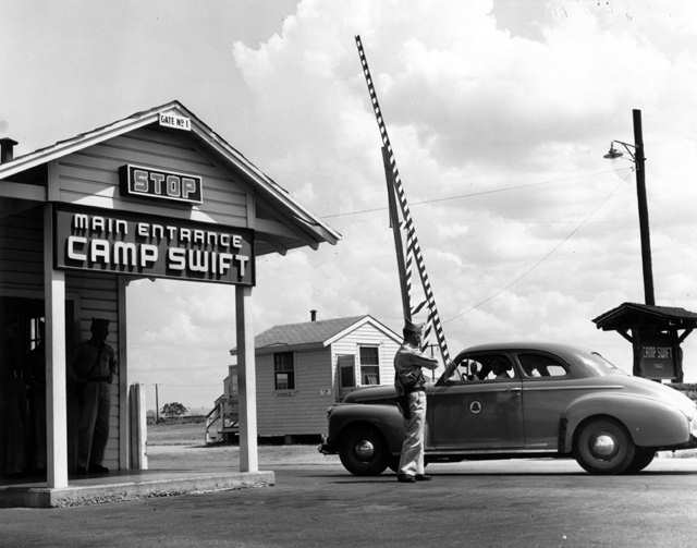
imagesize = 250px
image_caption = Main entrance to the Camp Swift facility of the Tenth Mountain Division duringWorld War II
image_
image_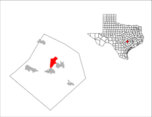
mapsize = 300px
map_caption =
mapsize1 =
map_caption1 =subdivision_type = Country
subdivision_name =United States
subdivision_type1 = State
subdivision_name1 =Texas
subdivision_type2 = County
subdivision_name2 = Bastropgovernment_footnotes =
government_type =
leader_title =
leader_name =
leader_title1 =
leader_name1 =
established_title =
established_date =unit_pref = Imperial
area_footnotes =area_magnitude =
area_total_km2 = 31.3
area_land_km2 = 30.9
area_water_km2 = 0.4
area_total_sq_mi = 12.1
area_land_sq_mi = 11.9
area_water_sq_mi = 0.1population_as_of = 2000
population_footnotes =
population_total = 4731
population_density_km2 = 153.0
population_density_sq_mi = 396.2timezone = Central (CST)
utc_offset = -6
timezone_DST = CDT
utc_offset_DST = -5
elevation_footnotes =
elevation_m = 134
elevation_ft = 440
latd = 30 |latm = 11 |lats = 2 |latNS = N
longd = 97 |longm = 17 |longs = 52 |longEW = Wpostal_code_type =
postal_code =
area_code =
blank_name = FIPS code
blank_info = 48-12334GR|2
blank1_name = GNIS feature ID
blank1_info = 1867544GR|3
website =
footnotes =Camp Swift is a
census-designated place (CDP) in Bastrop County,Texas ,United States . The population was 4,731 at the 2000 census.Geography
Camp Swift is located at coor dms|30|11|2|N|97|17|52|W|city (30.183879, -97.297684)GR|1. It is about 28 miles east of Austin and seven miles north of Bastrop.
According to the
United States Census Bureau , the CDP has a total area of 12.1square mile s (31.3km² ), of which, 11.9 square miles (30.9 km²) of it is land and 0.2 square miles (0.4 km²) of it (1.24%) is water.Demographics
As of the
census GR|2 of 2000, there were 4,731 people, 1,127 households, and 849 families residing in the CDP. Thepopulation density was 396.2 people per square mile (153.0/km²). There were 1,231 housing units at an average density of 103.1/sq mi (39.8/km²). The racial makeup of the CDP was 73.28% White, 8.84% African American, 1.16% Native American, 0.25% Asian, 0.06% Pacific Islander, 13.11% from other races, and 3.30% from two or more races. Hispanic or Latino of any race were 37.88% of the population.There were 1,127 households out of which 40.1% had children under the age of 18 living with them, 58.2% were married couples living together, 10.9% had a female householder with no husband present, and 24.6% were non-families. 19.3% of all households were made up of individuals and 4.4% had someone living alone who was 65 years of age or older. The average household size was 2.98 and the average family size was 3.40.
In the CDP the population was spread out with 22.6% under the age of 18, 8.9% from 18 to 24, 42.5% from 25 to 44, 21.1% from 45 to 64, and 5.0% who were 65 years of age or older. The median age was 34 years. For every 100 females there were 185.9 males. For every 100 females age 18 and over, there were 224.0 males.
The median income for a household in the CDP was $41,833, and the median income for a family was $44,352. Males had a median income of $30,572 versus $25,044 for females. The
per capita income for the CDP was $12,829. About 9.2% of families and 11.6% of the population were below thepoverty line , including 9.6% of those under age 18 and 25.7% of those age 65 or over.Education
Camp Swift is served by the
Bastrop Independent School District .References
External links
*
Wikimedia Foundation. 2010.