- Lowry, South Dakota
Infobox Settlement
official_name = Lowry, South Dakota
other_name =
native_name =
nickname =
settlement_type =Town
motto =
imagesize =
image_caption =
flag_size =
image_
seal_size =
image_shield =
shield_size =
image_blank_emblem =
blank_emblem_type =
blank_emblem_size =
imagesize =
image_caption =
flag_size =
image_
seal_size =
image_shield =
shield_size =
image_blank_emblem =
blank_emblem_type =
blank_emblem_size =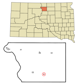
mapsize = 250px
map_caption = Location in Walworth County and the state ofSouth Dakota
mapsize1 =
map_caption1 =
image_dot_
dot_mapsize =
dot_map_caption =
dot_x =
dot_y =
pushpin_
pushpin_label_position =
pushpin_map_caption =
pushpin_mapsize =
subdivision_type = Country
subdivision_name =United States
subdivision_type1 = State
subdivision_name1 =South Dakota
subdivision_type2 = County
subdivision_name2 = Walworth
subdivision_type3 =
subdivision_name3 =
subdivision_type4 =
subdivision_name4 =
government_footnotes =
government_type =
leader_title =
leader_name =
leader_title1 =
leader_name1 =
leader_title2 =
leader_name2 =
leader_title3 =
leader_name3 =
leader_title4 =
leader_name4 =
established_title =
established_date =
established_title2 =
established_date2 =
established_title3 =
established_date3 =
area_magnitude =
unit_pref = Imperial
area_footnotes =
area_total_km2 = 0.6
area_land_km2 = 0.6
area_water_km2 = 0
area_total_sq_mi = 0.2
area_land_sq_mi = 0.2
area_water_sq_mi = 0
area_water_percent =
area_urban_km2 =
area_urban_sq_mi =
area_metro_km2 =
area_metro_sq_mi =
area_blank1_title =
area_blank1_km2 =
area_blank1_sq_mi =
population_as_of = 2000
population_footnotes =
population_note =
population_total = 10
population_density_km2 = 16.7
population_density_sq_mi = 50
population_metro =
population_density_metro_km2 =
population_density_metro_sq_mi =
population_urban =
population_density_urban_km2 =
population_density_urban_sq_mi =
population_blank1_title =
population_blank1 =
population_density_blank1_km2 =
population_density_blank1_sq_mi =
timezone = Central (CST)
utc_offset = -6
timezone_DST = CDT
utc_offset_DST = -5
latd = 45 |latm = 18 |lats = 59 |latNS = N
longd = 99 |longm = 59 |longs = 2 |longEW = W
elevation_footnotes =
elevation_m = 568
elevation_ft = 1864
postal_code_type =ZIP code
postal_code = 57472
area_code = 605
blank_name = FIPS code
blank_info = 46-39260GR|2
blank1_name = GNIS feature ID
blank1_info = 1256263GR|3
website =
footnotes =Lowry is a town in Walworth County,
South Dakota ,United States . The population was 10 at the 2000 census. The town has a church and a grain elevator. It also has an abandoned grain elevator, abandoned school, and some abandoned shops.Lowry was founded in 1907 as a station stop on a branch line of the
Minneapolis and St. Louis Railway built that year between Conde and LeBeau, South Dakota. Railway service to Lowry ended in 1940.Geography
Lowry is located at coor dms|45|18|59|N|99|59|2|W|city (45.316348, -99.983763)GR|1.
According to the
United States Census Bureau , the town has a total area of 0.2 square miles (0.6 km²), all land.Demographics
As of the
census GR|2 of 2000, there were 10 people, 5 households, and 4 families residing in the town. Thepopulation density was 41.6 people per square mile (16.1/km²). There were 6 housing units at an average density of 24.9/sq mi (9.7/km²). The racial makeup of the town was 100.00% White.There were 5 households out of which 1 had children under the age of 18 living with them, 4 were married couples living together, none had a female householder with no husband present, and 1 was a non-family. One household was made up of individuals and one had someone living alone who is 65 years of age or older. The average household size was two people and the average family size was 2.25 people.
In the town the population was spread out with 1 person under the age of 18, two from 18 to 24, none from 25 to 44, four from 45 to 64, and three who were 65 years of age or older. The median age was 53 years. There were an equal number of females and males. For every 100 females age 18 and over, there were 125.0 males.
The median income for a household in the town was $23,750, and the median income for a family was $43,750. Males had a median income of $0, as did females. The
per capita income for the town was $18,570. Two people but no families are below thepoverty line . Out of the total population, none of those under the age of 18 and 33.3% of those 65 and older were living below the poverty line.References
External links
Wikimedia Foundation. 2010.