- Beechmont, Queensland
Infobox Australian Place | type = suburb
name = Beechmont
city = Gold Coast
state = Queensland
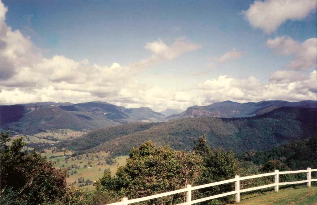
caption = Springbrook Plateau,Numinbah Valley , Lamington Plateau andMount Warning inNew South Wales
lga =Scenic Rim Regional Council
postcode = 4211
est =
pop =
area =
propval =
stategov =
fedgov = Forde
near-nw =
near-n =
near-ne =
near-w =
near-e =
near-sw =
near-s =
near-se =
dist1 =
location1=Location map
Queensland | label=Beechmont
lat_deg=-28|lat_min=-06
lon_deg=153|lon_min=13
width=160
position=left
caption=Location in QueenslandBeechmont is a residential village located in the Gold Coast hinterland of eastern
Australia .The suburb is positioned on a forested ridge leading from the Lamington Plateau to
Tambourine Mountain . Outstanding views in nearly all directions means that on a clear dayCunningham's Gap and otherScenic Rim landforms are visible as well asFlinders Peak , Moogerah Peaks and theD'Aguilar Range to the north west of Brisbane.Roads in the area are narrow and windy, some are prone to rockfalls and some with very steep slopes. The road to
Binna Burra and access toLamington National Park goes through Beechmont.The
Rosins Lookout Conservation Park is a popular launch site for hangliders and paragliders.History
The Beechmont district was first settled in the 1880's by
timber cutters. [cite book |title=Heritage Trails of the Great South East |last=Queensland Environmental Protection Agency |first= |authorlink= |coauthors= |year=2000 |publisher=State of Queensland |location= |isbn=0-7345-1008-X |pages=19 ] Attempts to grow fruit in the rich soils of the area were halted due tofruit fly infestations, before the area became to be known as a moutain tourist destination.ee also
References
Wikimedia Foundation. 2010.