- Binna Burra
Infobox_protected_area_of_Australia | name = Binna Burra
iucn_category = II
caption =
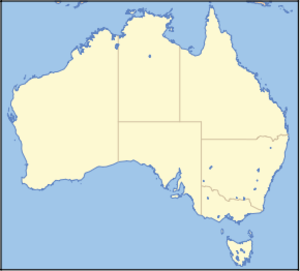
locator_x = 269
locator_y = 126
nearest_town_or_city = Canungra
coordinates = coord|28|08|32|S|153|06|55|E|type:landmark_region:AU
area = 206 km²
established = July 1915
visitation_num =
visitation_year =
managing_authorities = Queensland Parks and Wildlife Service
official_site = [http://www.epa.qld.gov.au/projects/park/index.cgi?parkid=97 Lamington National Park]Binna Burra is a parcel of private land surrounded by
Lamington National Park inQueensland ,Australia . The settlement lies in the north-eastern corner of the Lamington Plateau, 75 km south ofBrisbane . It is a part of theWorld Heritage site,Central Eastern Rainforest Reserves . Access to Binna Burra is from Beechmont, via a mountainous road not suitable for largecaravan s.The vegetation ranges from subtropical and temperate
rainforest to dry eucalypt and open heath. Binna Burra features a visitors centre, cafe, a guesthouse, campsites, safari tents and powered sites,picnic grounds and access towalking track s leading to the upperCoomera River , Coomera Gorge, Ship Stern Range and O'Reillys. The clearing at Binna Burra affords extensive views to the north. Extending away from the clearing a number of short and long walks, designed and built byRomeo Lahey during theGreat Depression .Binna Burra remained apart from the nearby national park as the properties around were bought by the
Queensland Government on an irregular basis, to extend the size of the park.The name, Binna Burra, is an Aboriginal word meaning "where the beech tree grows," referring to a stand of Antarctic Beech ("Nothofagus moorei") growing in the nearby
rainforest .Gallery
ee also
*
Protected areas of Queensland (Australia) References
* Lackner, Thomas. (1989) "Discovering Binna Burra on Foot". Envirobook ISBN 0-85881-088-3
* Rankin, Robert. (1992) "Secrets of the Scenic Rim". pp 25 - 46. Rankin Publishers ISBN 0-9592418-3-3External links
* [http://lamington.nrsm.uq.edu.au/HistoryMenu.htm History of the Lamington Plateau]
* [http://www.binnaburralodge.com.au Binna Burra Mountain Lodge and Campground]

Wikimedia Foundation. 2010.