- Shire of Buln Buln
Infobox Australian Place | type = lga
name = Shire of Buln Buln
state = vic
region =
area = 1259
est = 1878
seat = Drouin
pop = 11960 (1992) [cite book|title=Victorian Year Book|author=Australian Bureau of Statistics, Victoria Office|year=1994|page=49-52|id=ISSN 0067-1223]
logosize =
caption = Location in Victoria
county = Buln Buln, Mornington
near-nw = Upper Yarra
near-n = Upper Yarra
near-ne = Upper Yarra
near-w = Pakenham
near-e = Narracan
near-sw = Pakenham
near-s = Korumburra
near-se = Warragul
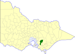
_noautocat = yesThe Shire of Buln Buln was a Local Government Area located about convert|95|km|mi|0 east-southeast of
Melbourne , the state capital of Victoria,Australia . The shire covered an area of convert|1259|km2|sqmi|1, and existed from 1878 until 1994.History
Buln Buln was first incorporated as a shire on 20 September 1878. Its eastern part split away on 9 December 1881 to form the Shire (later Rural City) of Warragul, while its southern part split away on 29 May 1891 to form the
Shire of Korumburra . Parts in its southwest around the town of Lang Lang were annexed to theShire of Cranbourne on 21 March 1892 and 27 January 1893.cite book|title=Victorian Municipal Directory|year=1992|publisher=Arnall & Jackson|location=Brunswick|pages=616-618 Accessed atState Library of Victoria , La Trobe Reading Room.]On 2 December 1994, the Shire was abolished, and merged with
Shire of Narracan ,Rural City of Warragul and parts of Upper Yarra into theShire of Baw Baw . [cite book|url=http://www.ausstats.abs.gov.au/ausstats/free.nsf/0/76E601D6DB55E88ACA25722500049195/$File/12570_1994-95.pdf|title=Victorian local government amalgamations 1994-1995: Changes to the Australian Standard Geographical Classification|author=Australian Bureau of Statistics |date=1 August 1995|publisher=Commonwealth of Australia|page=4|isbn=0-642-23117-6|accessdate=2008-01-05]Wards
Buln Buln was divided into four ridings on 30 April 1958, each of which elected three councillors:
* Neerim Riding
* North Drouin Riding
* South Drouin Riding
* Longwarry RidingTowns and Localities
* Drouin
* Drouin South
* Drouin West
* Hallora
* Icy Creek
* Jindivick
* Labertouche
* Lardner
* Longwarry
* Mountain View
* Nayook
* Neerim South
* Noojee
* Poowong East
* Ripplebrook
* TaragoPopulation
* Estimate in the 1958 Victorian Year Book.
References
Wikimedia Foundation. 2010.