- Emery, South Dakota
Infobox Settlement
official_name = Emery, South Dakota
other_name =
native_name =
nickname =
settlement_type =City
motto =
imagesize =
image_caption =
flag_size =
image_
seal_size =
image_shield =
shield_size =
image_blank_emblem =
blank_emblem_type =
blank_emblem_size =
imagesize =
image_caption =
flag_size =
image_
seal_size =
image_shield =
shield_size =
image_blank_emblem =
blank_emblem_type =
blank_emblem_size =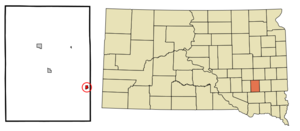
mapsize = 250px
map_caption = Location in Hanson County and the state ofSouth Dakota
mapsize1 =
map_caption1 =
image_dot_
dot_mapsize =
dot_map_caption =
dot_x =
dot_y =
pushpin_
pushpin_label_position =
pushpin_map_caption =
pushpin_mapsize =
subdivision_type = Country
subdivision_name =United States
subdivision_type1 = State
subdivision_name1 =South Dakota
subdivision_type2 = County
subdivision_name2 = Hanson
subdivision_type3 =
subdivision_name3 =
subdivision_type4 =
subdivision_name4 =
government_footnotes =
government_type =
leader_title =
leader_name =
leader_title1 =
leader_name1 =
leader_title2 =
leader_name2 =
leader_title3 =
leader_name3 =
leader_title4 =
leader_name4 =
established_title =
established_date =
established_title2 =
established_date2 =
established_title3 =
established_date3 =
area_magnitude =
unit_pref = Imperial
area_footnotes =
area_total_km2 = 0.9
area_land_km2 = 0.9
area_water_km2 = 0
area_total_sq_mi = 0.3
area_land_sq_mi = 0.3
area_water_sq_mi = 0
area_water_percent =
area_urban_km2 =
area_urban_sq_mi =
area_metro_km2 =
area_metro_sq_mi =
area_blank1_title =
area_blank1_km2 =
area_blank1_sq_mi =
population_as_of = 2000
population_footnotes =
population_note =
population_total = 439
population_density_km2 = 487.8
population_density_sq_mi = 1463.3
population_metro =
population_density_metro_km2 =
population_density_metro_sq_mi =
population_urban =
population_density_urban_km2 =
population_density_urban_sq_mi =
population_blank1_title =
population_blank1 =
population_density_blank1_km2 =
population_density_blank1_sq_mi =
timezone = Central (CST)
utc_offset = -6
timezone_DST = CDT
utc_offset_DST = -5
latd = 43 |latm = 36 |lats = 10 |latNS = N
longd = 97 |longm = 37 |longs = 14 |longEW = W
elevation_footnotes =
elevation_m = 423
elevation_ft = 1388
postal_code_type =ZIP code
postal_code = 57332
area_code = 605
blank_name = FIPS code
blank_info = 46-19420GR|2
blank1_name = GNIS feature ID
blank1_info = 1254933GR|3
website =
footnotes =Emery is a city in Hanson County,
South Dakota ,United States . It is part of theMitchell, South Dakota Micropolitan Statistical Area. The population was 439 at the 2000 census.School
Emery has a K-12 school (http://www.emery.k12.sd.us/). The current building was constructed in 1958, with additions in 1983 and 1999.
As with many small towns, high school athletics is a focus for the community. The boys basketball and football teams both have won state championships in their divisions. The football team (which plays in a Co-Op relationship with Ethan High School) won in 2001,2003 and most recently in 2007. The basketball team won in 1950 and 1973.
Community Amenities
Emery also has a very large park, having a baseball park and a football field, not forgetting the large pool they have.
Geography
According to the
United States Census Bureau , the city has a total area of 0.3square mile s (0.9km² ), all of it land.Emery has been assigned the
ZIP code 57332 and theFIPS place code 19420.Demographics
As of the
census GR|2 of 2000, there were 439 people, 195 households, and 123 families residing in the city. Thepopulation density was 1,255.4 people per square mile (484.3/km²). There were 204 housing units at an average density of 583.4/sq mi (225.0/km²). The racial makeup of the city was 100.00% White.There were 195 households out of which 27.7% had children under the age of 18 living with them, 55.9% were married couples living together, 5.6% had a female householder with no husband present, and 36.9% were non-families. 34.9% of all households were made up of individuals and 25.6% had someone living alone who was 65 years of age or older. The average household size was 2.25 and the average family size was 2.95.
In the city the population was spread out with 26.4% under the age of 18, 4.8% from 18 to 24, 23.5% from 25 to 44, 18.5% from 45 to 64, and 26.9% who were 65 years of age or older. The median age was 42 years. For every 100 females there were 85.2 males. For every 100 females age 18 and over, there were 81.5 males.
The median income for a household in the city was $28,958, and the median income for a family was $35,313. Males had a median income of $27,875 versus $16,094 for females. The
per capita income for the city was $17,324. About 3.8% of families and 5.2% of the population were below thepoverty line , including none of those under age 18 and 16.9% of those age 65 or over.References
External links
Wikimedia Foundation. 2010.