- Ree Heights, South Dakota
Infobox Settlement
official_name = Ree Heights, South Dakota
other_name =
native_name =
nickname =
settlement_type =Town
motto =
imagesize =
image_caption =
flag_size =
image_
seal_size =
image_shield =
shield_size =
image_blank_emblem =
blank_emblem_type =
blank_emblem_size =
imagesize =
image_caption =
flag_size =
image_
seal_size =
image_shield =
shield_size =
image_blank_emblem =
blank_emblem_type =
blank_emblem_size =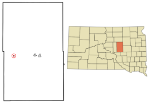
mapsize = 250px
map_caption = Location in Hand County and the state ofSouth Dakota
mapsize1 =
map_caption1 =
image_dot_
dot_mapsize =
dot_map_caption =
dot_x =
dot_y =
pushpin_
pushpin_label_position =
pushpin_map_caption =
pushpin_mapsize =
subdivision_type = Country
subdivision_name =United States
subdivision_type1 = State
subdivision_name1 =South Dakota
subdivision_type2 = County
subdivision_name2 = Hand
subdivision_type3 =
subdivision_name3 =
subdivision_type4 =
subdivision_name4 =
government_footnotes =
government_type =
leader_title =
leader_name =
leader_title1 =
leader_name1 =
leader_title2 =
leader_name2 =
leader_title3 =
leader_name3 =
leader_title4 =
leader_name4 =
established_title =
established_date =
established_title2 =
established_date2 =
established_title3 =
established_date3 =
area_magnitude =
unit_pref = Imperial
area_footnotes =
area_total_km2 = 0.8
area_land_km2 = 0.8
area_water_km2 = 0
area_total_sq_mi = 0.3
area_land_sq_mi = 0.3
area_water_sq_mi = 0
area_water_percent =
area_urban_km2 =
area_urban_sq_mi =
area_metro_km2 =
area_metro_sq_mi =
area_blank1_title =
area_blank1_km2 =
area_blank1_sq_mi =
population_as_of = 2000
population_footnotes =
population_note =
population_total = 85
population_density_km2 = 106.3
population_density_sq_mi = 283.3
population_metro =
population_density_metro_km2 =
population_density_metro_sq_mi =
population_urban =
population_density_urban_km2 =
population_density_urban_sq_mi =
population_blank1_title =
population_blank1 =
population_density_blank1_km2 =
population_density_blank1_sq_mi =
timezone = Central (CST)
utc_offset = -6
timezone_DST = CDT
utc_offset_DST = -5
latd = 44 |latm = 30 |lats = 58 |latNS = N
longd = 99 |longm = 12 |longs = 6 |longEW = W
elevation_footnotes =
elevation_m = 528
elevation_ft = 1732
postal_code_type =ZIP code
postal_code = 57371
area_code = 605
blank_name = FIPS code
blank_info = 46-53940GR|2
blank1_name = GNIS feature ID
blank1_info = 1265335GR|3
website =
footnotes =Ree Heights is a town in Hand County,
South Dakota ,United States . The population was 85 at the 2000 census.Geography
Ree Heights is located at coor dms|44|30|58|N|99|12|6|W|city (44.516044, -99.201552)GR|1.
According to the
United States Census Bureau , the town has a total area of 0.3square mile s (0.8km² ), all of it land.Ree Heights has been assigned the
ZIP code 57371 and theFIPS place code 53940.Demographics
As of the
census GR|2 of 2000, there were 85 people, 36 households, and 24 families residing in the town. Thepopulation density was 291.7 people per square mile (113.2/km²). There were 46 housing units at an average density of 157.9/sq mi (61.2/km²). The racial makeup of the town was 97.65% White, 1.18% Asian, and 1.18% from two or more races.There were 36 households out of which 30.6% had children under the age of 18 living with them, 55.6% were married couples living together, 5.6% had a female householder with no husband present, and 33.3% were non-families. 22.2% of all households were made up of individuals and 5.6% had someone living alone who was 65 years of age or older. The average household size was 2.36 and the average family size was 2.79.
In the town the population was spread out with 23.5% under the age of 18, 5.9% from 18 to 24, 22.4% from 25 to 44, 29.4% from 45 to 64, and 18.8% who were 65 years of age or older. The median age was 42 years. For every 100 females there were 112.5 males. For every 100 females age 18 and over, there were 116.7 males.
The median income for a household in the town was $27,083, and the median income for a family was $27,083. Males had a median income of $23,750 versus $20,000 for females. The
per capita income for the town was $10,276. There were 4.8% of families and 3.8% of the population living below thepoverty line , including no under eighteens and 25.0% of those over 64.Notable Natives
*
Riley Gardner
* Billy and Robert Etbaur Professional Bull Riders are originally from Ree Heights.
* Kristina M.Gimbel-Gonzalez was crowned the 1996 South Dakota Angus Queen.
* Kathy M.(Gimbel) Milbrandt was crowned the 1997 South Dakota Angus Queen.References
External links
Wikimedia Foundation. 2010.