- Unity Township, Pennsylvania
Infobox Settlement
official_name = Pagename
settlement_type = Township
nickname =
motto =
imagesize =
image_caption =
image_
mapsize = 250x200px
map_caption = Map of Westmoreland County, Pennsylvania Highlighting Unity Township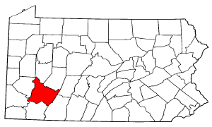
mapsize1 = 250x200px
map_caption1 = Map of Pennsylvania highlighting
Westmoreland County
subdivision_type = Country
subdivision_name =United States
subdivision_type1 = State
subdivision_name1 =Pennsylvania
subdivision_type2 = County
subdivision_name2 = Westmoreland
government_footnotes =
government_type =
leader_title =
leader_name =
leader_title1 =
leader_name1 =
leader_title2 =
leader_name2 =
established_title = Settled
established_date = 1760
established_title1 = Incorporated
established_date1 = September 23, 1789
unit_pref = Imperial
area_footnotes =
area_magnitude =
area_total_km2 =
area_land_km2 =
area_water_km2 =
area_total_sq_mi = 67.3
area_land_sq_mi = 67.1
area_water_sq_mi = 0.2
population_as_of = 2000
population_footnotes =
population_total = 21137
population_density_km2 =
population_density_sq_mi = 315.0
timezone = Eastern (EST)
utc_offset = -5
timezone_DST = EDT
utc_offset_DST = -4
postal_code_type =
postal_code =
area_code = 724
website = http://www.unitytownship.org
footnotes =Unity Township is a township in Westmoreland County,
Pennsylvania ,United States . The population was 21,137 at the 2000 census.History
Unity Township was incorporated on
September 23 1789 . Initial records show settlement going back to 1760. Residents of Mount Pleasant Township petitioned the court to establish a new township around the area next to theLoyalhanna creek , based on the inconvenience of the size of the existing township, and the need to travel long distances to conduct township affairs. One of the oldest communities in the township was Youngstown, an important stop in the wagon andstagecoach era, ca. 1818-1852, which became a separateborough in 1831. [ [http://www.pa-roots.com/~westmoreland/historyproject/vol1/chap41.html History of Westmoreland County Volume 1, Chapter 41] ]Geography
According to the
United States Census Bureau , the township has a total area of 67.3square mile s (174.2km² ), of which, 67.1 square miles (173.8 km²) of it is land and 0.2 square miles (0.4 km²) of it (0.24%) is water.The township contains the following communities: Baggaley, Beatty, Carney, Denison, Donohoe, Dorothy, Dry Ridge, George's Station, Greenwald, Hostetter, Humphreys, Lawson Heights, Lloydsville, Lycippus, Manito, Marguerite, Mutual, Old Crabtree, Pleasant Unity, and Whitney.
Demographics
As of the
census GR|2 of 2000, there were 21,137 people, 7,963 households, and 5,773 families residing in the township. Thepopulation density was 315.0 people per square mile (121.6/km²). There were 8,372 housing units at an average density of 124.8/sq mi (48.2/km²). The racial makeup of the township was 98.12% White, 0.32% African American, 0.13% Native American, 0.86% Asian, 0.02% Pacific Islander, 0.15% from other races, and 0.40% from two or more races. Hispanic or Latino of any race were 0.42% of the population.There were 7,963 households out of which 29.5% had children under the age of 18 living with them, 61.9% were married couples living together, 7.5% had a female householder with no husband present, and 27.5% were non-families. 24.6% of all households were made up of individuals and 11.4% had someone living alone who was 65 years of age or older. The average household size was 2.48 and the average family size was 2.95.
In the township the population was spread out with 21.5% under the age of 18, 9.1% from 18 to 24, 26.4% from 25 to 44, 25.8% from 45 to 64, and 17.2% who were 65 years of age or older. The median age was 41 years. For every 100 females there were 96.7 males. For every 100 females age 18 and over, there were 93.6 males.
The median income for a household in the township was $40,585, and the median income for a family was $49,593. Males had a median income of $37,907 versus $26,164 for females. The
per capita income for the township was $21,116. About 5.8% of families and 8.7% of the population were below thepoverty line , including 10.0% of those under age 18 and 9.8% of those age 65 or over.References
External links
* [http://www.unitytownship.org/ Unity Township official site]

Wikimedia Foundation. 2010.