- Tenabo (municipality)
Infobox Settlement
name = Tenabo
settlement_type = Municipality
subdivision_type = Country
subdivision_name =Mexico
subdivision_type1 = State
subdivision_name1 =Campeche
pushpin_
map_caption =
mapsize= 200px


population_as_of=2005
population_total=9050
population_urban= 6,934
population_note= municipal seat
population_density_km2=auto
area_total_km2= 821
elevation_m= 10
leader_title =Municipal president
leader_name = Julio Cesar Sánchez Caamal (2006-09)
leader_party =
subdivision_type2 = Municipal seat
subdivision_name2 =Tenabo
subdivision_type3 =
subdivision_name3 =
blank_name =Encomienda
blank_info =1549
blank1_name = Municipality created
blank1_info =1786
blank2_name = City status
blank2_info = 1960
timezone = CST
utc_offset = -6
timezone_DST = CDT
utc_offset_DST = -5
latd =19 | latm =50 | lats = | latNS =N
longd = 90 | longm= 00 | longs= | longEW =W
website= [http://www.tenabo.gob.mx/wb2/ www.tenabo.gob.mx]
footnotes=Tenabo (
Yucatec Maya : "place where they measure by hand-spans") is one of the 11 municipalities in the Mexican state ofCampeche . It is situated on the coast in the north of the state. The municipal seat, and largest settlement, is the city ofTenabo , 36 km fromstate capital Campeche, Camp.History and geography
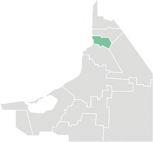
The municipality of Tenabo borders to the north with the municipality of
Hecelchakán , to the east with the municipality ofHopelchén , to the south with the municipality of Campeche, and to the west with theGulf of Mexico .It covers 882 km², accounting for 1.5% of the state's total surface area.
Demographics
The 2005 INEGI census reported a population of 9,050, up from 7,630 in 1990. Of these, 1,686 spoke one of several indigenous languages, predominatly
Yucatec Maya and Tzeltal.Population centres in the municipality include:
*Tenabo , the municipal seat, with 6,934 inhabitants
*Tinun (928 inhabitants)
*Emiliano Zapata (382)
*Kankí (182)
*Santa Rosa (170)
*Xkuncheil (102)References
* [http://www.inegi.gob.mx/est/contenidos/espanol/sistemas/conteo2005/localidad/iter/ Link to tables of population data from Census of 2005] INEGI: Instituto Nacional de Estadística, Geografía e Informática
* [http://www.e-local.gob.mx/work/templates/enciclo/campeche/Mpios/04008a.htm Tenabo] Enciclopedia de los Municipios de MéxicoExternal links
* [http://www.tenabo.gob.mx/ Ayuntamiento de Tenabo] Official website es icon


Wikimedia Foundation. 2010.