- Hecelchakán
Infobox Settlement
official_name = PAGENAME
other_name =
native_name =
nickname =
settlement_type =
motto =
imagesize =
image_caption =
flag_size =
image_
seal_size =
image_shield =
shield_size =
image_blank_emblem =
blank_emblem_type =
blank_emblem_size =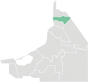
mapsize = 200px
map_caption = Hecelchakán municipality within Campeche
mapsize1 =
map_caption1 =
image_dot_
dot_mapsize =
dot_map_caption =
dot_x = |dot_y =
pushpin_
pushpin_label_position =bottom
pushpin_map_caption =Location in Mexico
subdivision_type = Country
subdivision_name =
subdivision_type1 = States
subdivision_name1 =Campeche
subdivision_type2 =
subdivision_name2 =
subdivision_type3 =
subdivision_name3 =
subdivision_type4 =
subdivision_name4 =
government_footnotes =
government_type =
leader_title =Mayor
leader_name =
leader_title1 =
leader_name1 =
leader_title2 =
leader_name2 =
leader_title3 =
leader_name3 =
leader_title4 =
leader_name4 =
established_title =
established_date =
established_title2 =
established_date2 =
established_title3 =
established_date3 =
area_magnitude =
unit_pref =Imperial
area_footnotes =
area_total_km2 = 1331.99
area_land_km2 =
area_water_km2 =
area_total_sq_mi =
area_land_sq_mi =
area_water_sq_mi =
area_water_percent =
area_urban_km2 =
area_urban_sq_mi =
area_metro_km2 =
area_metro_sq_mi =
area_blank1_title =
area_blank1_km2 =
area_blank1_sq_mi =
population_as_of =2005
population_footnotes =
population_note =
population_total =26,973
population_density_km2 =
population_density_sq_mi =
population_metro =9,974
population_density_metro_km2 =
population_density_metro_sq_mi =
population_urban =
population_density_urban_km2 =
population_density_urban_sq_mi =
population_blank1_title =Ethnicities
population_blank1 =
population_blank2_title =Religions
population_blank2 =
population_density_blank1_km2 =
population_density_blank1_sq_mi =
timezone =
utc_offset =
timezone_DST =
utc_offset_DST =
latd=20 |latm=10 |lats=0 |latNS=N
longd=90 |longm=8 |longs=0 |longEW=W
coordinates_display = inline,title
coordinates_type = type:city_region:MX
elevation_footnotes =
elevation_m =
elevation_ft =
postal_code_type =
postal_code =
area_code =
blank_name =
blank_info =
blank1_name =
blank1_info =
website =
footnotes =Hecelchakán is a city in the Mexican
state ofCampeche . The city is located some 70 km to the north of the state capital Campeche. It is the seat of the municipality of the same name. The city had a 2005 census population of 9,974, while the municipality had a population of 26,973. The municipality has an area of 1,331.99 km² (514.284 sq mi) and includes numerous smaller outlying communities, the largest of which is the town ofPomuch .The name comes from the Maya words "helel" (savanna) and "chakan" (rest).
Location
Hecelchakán borders to the north with the municipality of
Calkiní , to the south withTenabo , to the east with the state ofYucatán and the municipality ofHopelchén , and to the west with theGulf of Mexico , with 24 km of shoreline.It is at an average altitude of 10 m above sea level.
History
The city was founded close to a
cenote by inhabitants of the former city of Xkalumkin, between the years 1500 and 1600. In this city some important historic events took place, such as the battle between Don Francisco de Paula Toro and the federalists, led by Don Felipe Montero, who was defeated.In 1840, the district of Hecelchakán included the towns of Pomuch, Pocboc, Tenabo, Tepakán, San Antonio Sahcabchén,
Dzitbalché ,Bécal ,Nunkiní , and Calkiní.Around 1846, the district of Hecelchakán included three parishes: Hecelchakán, Calkiní and Bécal.
On
December 7 ,1915 , when decree no. 51 approved a new law of interior administration, Hecelchakán became one of the eight free municipalities of the new state of Campeche. That law came into effect onJanuary 1 ,1916 .In 1957 the seat of the municipality was given city status by
Governor of Campeche Alberto Trueba Urbina .References
*es icon [http://www.inegi.gob.mx/est/contenidos/espanol/sistemas/conteo2005/localidad/iter/ Link to tables of population data from Census of 2005] INEGI: Instituto Nacional de Estadística, Geografía e Informática
*es icon [http://www.e-local.gob.mx/work/templates/enciclo/campeche/Mpios/04005a.htm Enciclopedia de los Municipios de México] : Encyclopedia for Mexican Municipalities (in Spanish)External links
* [http://www.hecelchakan.gob.mx/ Ayuntamiento de Hecelchakán] Official website

Wikimedia Foundation. 2010.