- Châtres-la-Forêt
-
Châtres-la-Forêt

 Châtres-la-ForêtLocation within Pays de la Loire region
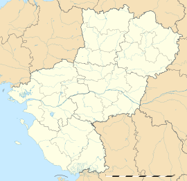 Châtres-la-Forêt
Administration Country France Region Pays de la Loire Department Mayenne Arrondissement Laval Canton Évron Mayor Claude Rouillard
(2008–2014)Statistics Elevation 82–129 m (269–423 ft)
(avg. 103 m/338 ft)Land area1 13.60 km2 (5.25 sq mi) Population2 752 (2006) - Density 55 /km2 (140 /sq mi) INSEE/Postal code 53065/ 53600 1 French Land Register data, which excludes lakes, ponds, glaciers > 1 km² (0.386 sq mi or 247 acres) and river estuaries. 2 Population without double counting: residents of multiple communes (e.g., students and military personnel) only counted once. Coordinates: 48°08′03″N 0°25′50″W / 48.1341666667°N 0.430555555556°W
Châtres-la-Forêt is a commune in the Mayenne department in north-western France.
See also
Categories:- Communes of Mayenne
- Mayenne geography stubs


Wikimedia Foundation. 2010.