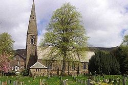
- Bamford Church
-
St John the Baptist church 
St John the Baptist
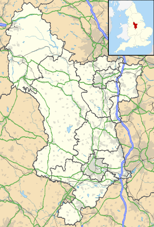
Basic information Location Bamford Geographic coordinates 53°20′53″N 1°41′37″W / 53.34800°N 1.69352°WCoordinates: 53°20′53″N 1°41′37″W / 53.34800°N 1.69352°W Affiliation Anglican District Diocese of Derby Ecclesiastical or organizational status Parish church Architectural description Architectural type Church Completed 1861 Specifications St John the Baptist church is a C of E church in Bamford in the Hope Valley, Derbyshire, England. The building that is seen today is largely a William Butterfield restoration dating from 1861, with a bell tower.
Contents
The Bells and Tower
The tower has six ringable bells, cast in 1998 to mark the Millennium. They replaced a peal from 1886. The modern bells have sprung metal stays instead of wooden ones. The Treble weighs 1 hundredweight (50 kg). The bellringers practice on Wednesdays. [1]
The Churchyard
Exhumations from the cemetery of the village of Derwent were re-interred in St John's churchyard after the construction of the Ladybower Dam submerged that village during the Second World War.[2] Also in the graveyard is a grave marking the dead from Tin Town (Birchinlee), a temporary village made to house the workers who built the Derwent and the Howden dams in 1902. There is also a memorial for the dead of the Holocaust.
Location
Main Road, Bamford, Hope Valley, Derbyshire, England, UK
Opposite St John's Close
See also
- Bamford station
- Brough and Shatton
- Hope Valley
- Birchinlee
- River Derwent
References
- ^ Julie Bunting/Peak Advertiser. "Church Bells". http://www.genuki.org.uk/big/eng/DBY/TakeaLook/ChurchBells.html.
- ^ Francis Frith. "Bamford". http://www.francisfrith.com/search/england/derbyshire/bamford/.
Categories:- Church of England churches in Derbyshire
Wikimedia Foundation. 2010.

