- Nemacolin, Pennsylvania
-
Nemacolin Census-designated place Country United States State Pennsylvania County Greene Coordinates 39°52′40″N 79°55′30″W / 39.87778°N 79.925°W Area 1.6 sq mi (4 km2) - land 1.4 sq mi (4 km2) - water 0.1 sq mi (0 km2) Population 1,034 (2000) Density 732.0 / sq mi (283 / km2) company town 1917[1] Timezone EST (UTC-4) - summer (DST) EDT (UTC-5) Area code 724  Location of Nemacolin in Greene County
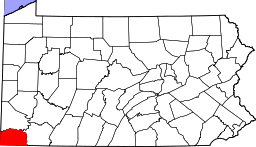 Location of Greene County in Pennsylvania
 Location of Pennsylvania in the United States
Nemacolin is a census-designated place (CDP) in Greene County, Pennsylvania, United States founded as a company town[1] around the workings of a YS&T company owned and operated coal mine in 1917 and named for a legendary Amerindian ally — Chief Nemacolin, who showed the Virginia settlers how to cross the successive Allegheny barrier ridges via the Cumberland Narrows and the Nemacolin Trail — which Braddock's Expedition widened into a wagon road through the barrier range. The population was 1,034 at the 2000 census.
Contents
History in brief
The land upriver from Brownsville along the eastern border of Greene County was acquired by Youngstown Sheet and Tube Co.[1] (YS&T) which planned, zoned, populated, and built the community complete with a Movie theater, tennis courts, amusement hall (in the fashion of the times in blue collar company towns, part pool hall, part Beer garden), and swimming pool[1] near Carmichaels Borough. At one time, Youngstown Sheet and Tube was the largest steel company in the nation.[2] Establishing the town well after the United Mine Workers flexed their muscles in the strikes of the 1890s–1900s and after its riot troubles in Youngstown in 1916,[2] it is also likely the company had a hand in establishing the local school and one or more churches and likely issued invitations and recruited the medical practitioners operating the various health clinics[notes 1]
The mine, established[when?] outside the town, was one of many large mines atop the 'Pittsburgh Coal Seam' on the west bank of the Monogahela[1] was operated as a subsidiary under the name as the Buckeye Coal Company and grew and benefited as being directly on the railroad route up the river to West Virginia[1] and was able to load both river coal barges and freight trains with its output. It is thought by some to have been the largest coal mine in the United States in 1919, and was rated at being the second most productive in Greene County in the 1940s[1] war years. The mine operated nearly 70 years, shutting down production in 1986, and was sealed (safed) 2–3 years[1] later.
Geography
Nemacolin is located at 39°52′40″N 79°55′33″W / 39.87778°N 79.92583°W (39.877676, -79.925858)[3].
According to the United States Census Bureau, the CDP has a total area of 1.6 square miles (4.1 km2), of which, 1.4 square miles (3.6 km2) of it is land and 0.1 square miles (0.26 km2) of it (8.97%) is water.
Demographics
As of the census[4] of 2000, there were 1,034 people, 401 households, and 271 families residing in the CDP. The population density was 732.0 people per square mile (283.1/km²). There were 451 housing units at an average density of 319.3/sq mi (123.5/km²). The racial makeup of the CDP was 97.58% White, 0.48% African American, 0.19% Native American, and 1.74% from two or more races. Hispanic or Latino of any race were 1.45% of the population.
There were 401 households out of which 34.9% had children under the age of 18 living with them, 42.6% were married couples living together, 17.5% had a female householder with no husband present, and 32.4% were non-families. 28.2% of all households were made up of individuals and 16.0% had someone living alone who was 65 years of age or older. The average household size was 2.58 and the average family size was 3.13.
In the CDP the population was spread out with 28.8% under the age of 18, 7.7% from 18 to 24, 28.3% from 25 to 44, 20.9% from 45 to 64, and 14.2% who were 65 years of age or older. The median age was 33 years. For every 100 females there were 92.9 males. For every 100 females age 18 and over, there were 85.4 males.
The median income for a household in the CDP was $23,458, and the median income for a family was $29,861. Males had a median income of $26,458 versus $25,972 for females. The per capita income for the CDP was $11,501. About 20.8% of families and 19.1% of the population were below the poverty line, including 27.8% of those under age 18 and 15.5% of those age 65 or over.
External links
Footnotes and references
Notes
- ^ The pleasant amenities might also have been a result of the 1916 riots the company experienced in its East Youngstown plant.
References
- ^ a b c d e f g h "Nemacolin, PA". http://www.coalcampusa.com/westpa/klondike/nemacolin/nemacolin.htm. Retrieved 2010-11-28.
- ^ a b Wikipedia article: Youngstown Sheet and Tube
- ^ "US Gazetteer files: 2010, 2000, and 1990". United States Census Bureau. 2011-02-12. http://www.census.gov/geo/www/gazetteer/gazette.html. Retrieved 2011-04-23.
- ^ "American FactFinder". United States Census Bureau. http://factfinder.census.gov. Retrieved 2008-01-31.
Municipalities and communities of Greene County, Pennsylvania County seat: Waynesburg Boroughs 
Townships Aleppo | Center | Cumberland | Dunkard | Franklin | Freeport | Gilmore | Gray | Greene | Jackson | Jefferson | Monongahela | Morgan | Morris | Perry | Richhill | Springhill | Washington | Wayne | Whiteley
CDPs Fairdale | Morrisville | Nemacolin
Unincorporated
communitiesCategories:- Census-designated places in Greene County, Pennsylvania


Wikimedia Foundation. 2010.