- Creag Ghlas Laggan
-
Creag Ghlas Laggan Elevation 444 m (1,457 ft) Prominence 241 m (791 ft) Parent peak Caisteal Abhail Listing Marilyn Translation ??? (Gaelic) Location Location Isle of Arran,  Scotland
Topo map OS Landranger 69 OS grid NR977497 Creag Ghlas Laggan (also known as Fionn Bhealach) is a Marilyn on the Isle of Arran in south-western Scotland. It is the highest point of the seven-mile-long ridge of land that runs north-west to south-east between the A841 road and the Sound of Bute in the north-eastern part of the island.
The best way up in terms of scenery is to follow the well-trodden and easily-graded path from Lochranza to Bearradh Tom a' Muidhe at grid ref 962508, and strike south-east up the ridge from there. The shortest way up is a straight line from the parking area at Boguillie at grid ref 973483.
The hill has a remarkable variety of geology. On its north-western slopes is the famous Hutton's Unconformity in the Dalradian metasediments. On the north-east shore can be found Carboniferous limestone and Permian desert deposits. At the south-eastern end is some Devonian Old Red Sandstone.
Creag Ghlas Laggan offers stunning views towards Caisteal Abhail and the other peaks such as Goat Fell.
Coordinates: 55°41′56″N 5°13′12″W / 55.69889°N 5.22°W
Arran Main villages 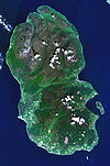
Smaller villages and settlements Mountains and hills Goat Fell · Beinn Tarsuinn · Caisteal Abhail · Cìr Mhòr · Creag Ghlas Laggan · Tighvein · Sleeping WarriorHistory Environment Economy Surrounding islands Categories:- Marilyns of Scotland
- Isle of Arran

Wikimedia Foundation. 2010.