- Rockcreek, Oregon
Infobox Settlement
official_name = Rockcreek, Oregon
settlement_type = CDP
nickname =
motto =
imagesize =
image_caption =
image_
imagesize =
image_caption =
image_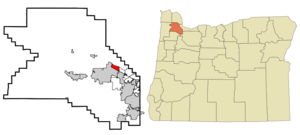
mapsize = 250px
map_caption = Location of Rockcreek, Oregon
mapsize1 =
map_caption1 =subdivision_type = Country
subdivision_name =United States
subdivision_type1 = State
subdivision_name1 =Oregon
subdivision_type2 = County
subdivision_name2 = Washingtongovernment_footnotes =
government_type =
leader_title =
leader_name =
leader_title1 =
leader_name1 =
established_title =
established_date =unit_pref = Imperial
area_footnotes =area_magnitude =
area_total_km2 = 5.2
area_land_km2 = 5.2
area_water_km2 = 0.0
area_total_sq_mi = 2.0
area_land_sq_mi = 2.0
area_water_sq_mi = 0.0population_as_of = 2000
population_footnotes =
population_total = 9404
population_density_km2 = 1810.7
population_density_sq_mi = 4689.8timezone = Pacific (PST)
utc_offset = -8
timezone_DST = PDT
utc_offset_DST = -7
elevation_footnotes =
elevation_m = 55
elevation_ft = 180
latd = 45 |latm = 33 |lats = 16 |latNS = N
longd = 122 |longm = 52 |longs = 47 |longEW = Wpostal_code_type =
ZIP code
postal_code = 97229
area_code = 503
blank_name = FIPS code
blank_info = 41-63010GR|2
blank1_name = GNIS feature ID
blank1_info = 1867479GR|3
website =
footnotes =Rockcreek is a
census-designated place inWashington County, Oregon , north of U.S. Route 26. It is named for the Rock Creek neighborhood in the area. As of the 2000 census, the CDP population was 9,404.Geography
Rockcreek CDP is centered at coor dms|45|33|16|N|122|52|47|W|city (45.554391, -122.879787)GR|1.
According to the
United States Census Bureau , the CDP has a total area of 2.0 square miles (5.2 km²), none of which is covered with water.Demographics
As of the
census GR|2 of 2000, there were 9,404 people, 3,501 households, and 2,559 families residing in the CDP. Thepopulation density was 4,689.8 people per square mile (1,806.4/km²). There were 3,609 housing units at an average density of 1,799.8/sq mi (693.3/km²). The racial makeup of the CDP was 85.68% White, 0.84% African American, 0.47% Native American, 7.54% Asian, 0.28% Pacific Islander, 2.20% from other races, and 3.00% from two or more races. Hispanic or Latino of any race were 4.58% of the population.There were 3,501 households out of which 39.6% had children under the age of 18 living with them, 62.3% were married couples living together, 7.8% had a female householder with no husband present, and 26.9% were non-families. 20.3% of all households were made up of individuals and 3.4% had someone living alone who was 65 years of age or older. The average household size was 2.69 and the average family size was 3.15.
In the CDP the population was spread out with 28.6% under the age of 18, 7.5% from 18 to 24, 31.5% from 25 to 44, 25.6% from 45 to 64, and 6.7% who were 65 years of age or older. The median age was 35 years. For every 100 females there were 102.5 males. For every 100 females age 18 and over, there were 100.9 males.
The median income for a household in the CDP was $63,958, and the median income for a family was $71,377. Males had a median income of $51,257 versus $34,591 for females. The
per capita income for the CDP was $30,102. About 4.2% of families and 6.5% of the population were below thepoverty line , including 9.3% of those under age 18 and 2.0% of those age 65 or over.References
External links
* [http://www.mcmenamins.com/index.php?loc=48&id=196 Rock Creek Tavern history] from the
McMenamins website
Wikimedia Foundation. 2010.