- Denison Township, Crawford County, Iowa
-
Denison Township — Township — Location in Crawford County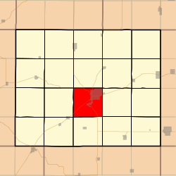
Coordinates: 41°59′26″N 095°22′53″W / 41.99056°N 95.38139°WCoordinates: 41°59′26″N 095°22′53″W / 41.99056°N 95.38139°W Country  United States
State  Iowa
IowaCounty Crawford Area - Total 35.39 sq mi (91.66 km2) - Land 35.35 sq mi (91.56 km2) - Water 0.04 sq mi (0.1 km2) 0.11% Elevation 1,263 ft (385 m) Population (2000) - Total 7,757 - Density 219.4/sq mi (84.7/km2) GNIS feature ID 0467702 Denison Township is a township in Crawford County, Iowa, USA. As of the 2000 census, its population was 7,757.
Contents
Geography
Denison Township covers an area of 35.39 square miles (91.7 km2) and contains one incorporated settlement, Denison (the county seat). According to the USGS, it contains five cemeteries: Crawford County Home, Crawford Heights Memorial, Oakland, Saint Rose of Lima and Zion.
The streams of Coon Creek, East Boyer River and Willow Creek run through this township.
Transportation
Denison Township contains one airport, Denison Municipal Airport.
References
External links
Municipalities and communities of Crawford County, Iowa County seat: Denison Cities 
Townships Boyer | Charter Oak | Denison | East Boyer | Goodrich | Hanover | Hayes | Iowa | Jackson | Milford | Morgan | Nishnabotny | Otter Creek | Paradise | Soldier | Stockholm | Union | Washington | West Side | Willow
Footnotes ‡This populated place also has portions in an adjacent county or counties
Categories:- Townships in Crawford County, Iowa
- Iowa geography stubs

Wikimedia Foundation. 2010.