Doyle Township, Clarke County, Iowa
- Doyle Township, Clarke County, Iowa
-
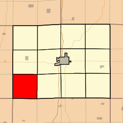
Doyle Township is a township in Clarke County, Iowa, USA. As of the 2000 census, its population was 200.
Geography
Doyle Township covers an area of 36.05 square miles (93.4 km2) and contains no incorporated settlements. According to the USGS, it contains three cemeteries: Gregg, Hopeville and Sanders.
The streams of East Long Creek and West Long Creek run through this township.
References
External links
Categories: - Townships in Clarke County, Iowa
- Iowa geography stubs
Wikimedia Foundation.
2010.
Look at other dictionaries:
Osceola Township, Clarke County, Iowa — Osceola Township Township Location in Clarke County … Wikipedia
Richland Township, Decatur County, Iowa — Infobox Settlement official name = Richland Township settlement type = Township nickname = motto = imagesize = image caption = image imagesize = image caption = image mapsize = map caption = Location in Decatur County mapsize1 = map caption1 =… … Wikipedia
Long Creek Township, Decatur County, Iowa — Infobox Settlement official name = Long Creek Township settlement type = Township nickname = motto = imagesize = image caption = image imagesize = image caption = image mapsize = map caption = Location in Decatur County mapsize1 = map caption1 =… … Wikipedia
List of townships in Iowa — This alphabetic list of townships in Iowa is based on the U.S. Census for 2000. Iowa has 1,599 townships. See: List of townships in Iowa by county, List of counties in Iowa, List of cities in Iowa. Index: compactTOC A* Adams Township, Dallas… … Wikipedia
Current members of the United States House of Representatives — Percent of members of the House of Representatives from each party current to January 2011. Region Democrats Republicans Vacant Total States as defined in the US Census New England … Wikipedia
Members of the 110th United States Congress — The One Hundred Tenth United States Congress was the meeting of the legislative branch of the United States federal government, between January 3, 2007, and January 3, 2009, during the last two years of the second term of President George W. Bush … Wikipedia
performing arts — arts or skills that require public performance, as acting, singing, or dancing. [1945 50] * * * ▪ 2009 Introduction Music Classical. The last vestiges of the Cold War seemed to thaw for a moment on Feb. 26, 2008, when the unfamiliar strains … Universalium
National Register of Historic Places listings in Nebraska — … Wikipedia
List of Barack Obama presidential campaign endorsements from state, local and territory officials — This is a list of state, local and territory officials who have formally endorsed or voiced support for Barack Obama as the Democratic Party s presidential nominee for the 2008 U.S. presidential election. Alabama*Alabama State Rep. Merika Coleman … Wikipedia
 United States
 Iowa
Iowa
