- Chamborand
-
Chamborand

 Chamborand
Administration Country France Region Limousin Department Creuse Arrondissement Guéret Canton Grand-Bourg Intercommunality Bénévent-Grand-Bourg Mayor Thomas Bernard
(2008–2014)Statistics Elevation 340–479 m (1,120–1,572 ft)
(avg. 426 m/1,398 ft)Land area1 11.18 km2 (4.32 sq mi) Population2 234 (2008) - Density 21 /km2 (54 /sq mi) INSEE/Postal code 23047/ 23240 1 French Land Register data, which excludes lakes, ponds, glaciers > 1 km² (0.386 sq mi or 247 acres) and river estuaries. 2 Population without double counting: residents of multiple communes (e.g., students and military personnel) only counted once. Coordinates: 46°09′24″N 1°34′23″E / 46.1566666667°N 1.57305555556°E
Chamborand is a commune in the Creuse department in the Limousin region in central France.
Contents
Geography
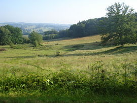
A village of farming, forestry, streams and lakes situated some 15 miles (24 km) west of Guéret, at the junction of the D4, D49 and the D10 roads.
Population
Historical population of Chamborand 1962 1968 1975 1982 1990 1999 2008 239 310 283 277 266 237 234 Sights
- The church of St. Martial, dating from the fifteenth century.
- Remains of a castle dating from the twelfth century, including the motte and a donjon.
See also
References
External links
- A website about Chamborand (French)
- Chamborand on the Quid website (French)
Categories:- Communes of Creuse
- Creuse geography stubs


Wikimedia Foundation. 2010.