Littleport railway station
- Littleport railway station
Infobox UK station
name = Littleport
code = LTP
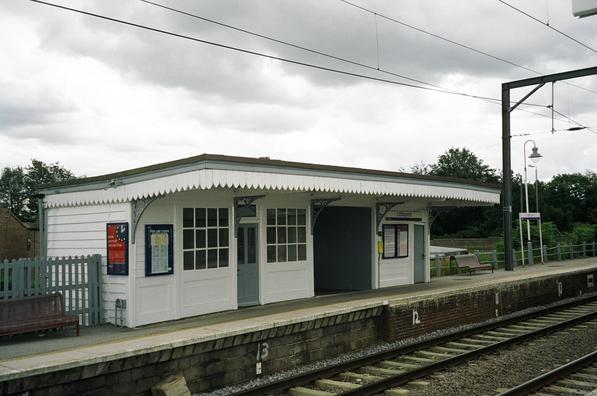
caption = The shelter on the southbound platform at Littleport (now burned down)
manager = First Capital Connect
locale = Littleport
borough = East Cambridgeshire
lowusage0405 = 119,198
lowusage0506 = 122,655
lowusage0607 = 146,218
platforms = 2
start = ?Littleport railway station is a railway station serving the village of Littleport in Cambridgeshire. The station lies on Fen Line from Cambridge to King's Lynn, which is electrified at 25 kV AC overhead.
The station is served by First Capital Connect as part of their service from London King's Cross to King's Lynn.
ervices
Outside peak hours the services run non-stop between London and Cambridge as part of the half-houly "Cambridge Cruiser" service. One train per hour then continues beyond Cambridge, stopping at all stations on the Fen Line to King's Lynn. These services use Class 317 or Class 365 electrical multiple units.
Former Services
Disused Rail Start
External links
Wikimedia Foundation.
2010.
Look at other dictionaries:
Downham Market railway station — Downham Market Location Place … Wikipedia
New Barnet railway station — New Barnet The new station building … Wikipedia
Oakleigh Park railway station — Oakleigh Park Western entrance, leading to station footbridge … Wikipedia
Littleport, Cambridgeshire — infobox UK place country = England latitude= 52.45 longitude= 0.29 official name= Littleport population = 7,521 (2001) shire district= East Cambridgeshire shire county = Cambridgeshire region= East of England constituency westminster= North East… … Wikipedia
Ely, Cambridgeshire — Coordinates: 52°24′N 0°16′E / 52.40°N 0.26°E / 52.40; 0.26 … Wikipedia
Fen skating — is a traditional form of ice skating in the Fenland of England. The Fens of East Anglia, with their meres and washes, networks of drainage ditches, slow flowing rivers and easily flooded meadows, form an ideal skating terrain. Skates were… … Wikipedia
Milton Keynes — For Milton Keynes, the original village, see Milton Keynes Village. Coordinates: 52°02′10″N 0°46′12″W / 52.036°N 0.770°W / 52.036; 0.770 … Wikipedia
Wolverton — This article is about Wolverton in Milton Keynes, Buckinghamshire. For other uses, see Wolverton (disambiguation). Coordinates: 52°03′46″N 0°48′37″W / 52.06265°N 0.8102°W … Wikipedia
Ouse Valley Way — Swans nesting beside the Great Ouse near St Neots The Ouse Valley Way is a 150 mile footpath in England, following the River Great Ouse from its source near Brackley in Northamptonshire to its mouth in The Wash near King s Lynn. The path begins… … Wikipedia
Burwell, Cambridgeshire — For other places named Burwell, see Burwell. Coordinates: 52°16′30″N 0°19′37″E / 52.275°N 0.327°E / 52.275; 0.327 … Wikipedia