- Alvordton, Ohio
Infobox Settlement
official_name = Alvordton, Ohio
settlement_type = Unincorporated community
nickname =
motto =
imagesize =
image_caption =
image_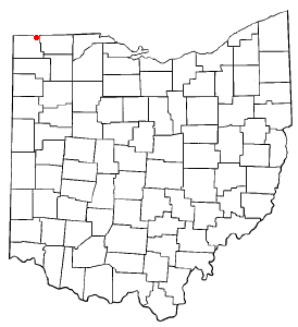
mapsize = 250px
map_caption = Location of Alvordton, Ohio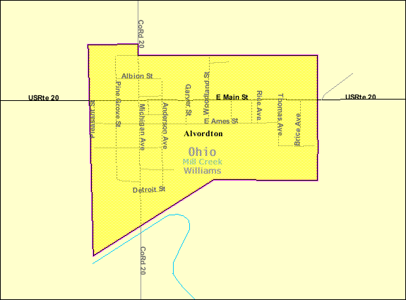
mapsize1 = 250px
map_caption1 = Detailed map of Alvordtonsubdivision_type = Country
subdivision_name =United States
subdivision_type1 = State
subdivision_name1 =Ohio
subdivision_type2 = County
subdivision_name2 = Williamsgovernment_footnotes =
government_type =
leader_title =
leader_name =
leader_title1 =
leader_name1 =
established_title =
established_date =unit_pref = Imperial
area_footnotes =area_magnitude =
area_total_km2 = 0.7
area_land_km2 = 0.7
area_water_km2 = 0.0
area_total_sq_mi = 0.3
area_land_sq_mi = 0.3
area_water_sq_mi = 0.0population_as_of = 2000
population_footnotes =
population_total = 305
population_density_km2 = 457.0
population_density_sq_mi = 1183.6timezone = Eastern (EST)
utc_offset = -5
timezone_DST = EDT
utc_offset_DST = -4
elevation_footnotes = GR|3
elevation_m = 262
elevation_ft = 860
latd = 41 |latm = 39 |lats = 55 |latNS = N
longd = 84 |longm = 26 |longs = 7 |longEW = Wpostal_code_type =
ZIP code
postal_code = 43501
area_code = 419
blank_name = FIPS code
blank_info = 39-01588GR|2
blank1_name = GNIS feature ID
blank1_info = 1064318GR|3
website =
footnotes =Alvordton is a former village in central Mill Creek Township, Williams County,
Ohio ,United States . The population was 305 at the 2000 census.History
On August 7, 2007 voters overwhelmingly approved a measure to dissolve the village. [ [http://toledoblade.com/apps/pbcs.dll/article?AID=/20070808/NEWS09/70808030/-1/NEWS Area voters OK fire levy, reject funds for schools] , "The Blade",
2007-08-08 . Accessed2007-09-04 .]Geography
Alvordton is located at coor dms|41|39|55|N|84|26|7|W|city (41.665177, -84.435265)GR|1.
According to the
United States Census Bureau , the village had a total area of 0.3square mile s (0.7km² ), all of it land.Demographics
As of the
census GR|2 of 2000, there were 305 people, 102 households, and 72 families residing in the village. Thepopulation density was 1,183.6 people per square mile (452.9/km²). There were 115 housing units at an average density of 446.3/sq mi (170.8/km²). The racial makeup of the village was 94.43% White, 1.31% African American, 0.98% Native American, 1.64% from other races, and 1.64% from two or more races. Hispanic or Latino of any race were 3.61% of the population.There were 102 households out of which 31.4% had children under the age of 18 living with them, 48.0% were married couples living together, 15.7% had a female householder with no husband present, and 29.4% were non-families. 23.5% of all households were made up of individuals and 10.8% had someone living alone who was 65 years of age or older. The average household size was 2.65 and the average family size was 3.03.
In the village the population was spread out with 25.2% under the age of 18, 9.2% from 18 to 24, 28.5% from 25 to 44, 25.2% from 45 to 64, and 11.8% who were 65 years of age or older. The median age was 36 years. For every 100 females there were 119.4 males. For every 100 females age 18 and over, there were 121.4 males.
The median income for a household in the village was $36,250, and the median income for a family was $43,375. Males had a median income of $25,000 versus $19,205 for females. The
per capita income for the village was $16,525. About 8.4% of families and 11.5% of the population were below thepoverty line , including 18.1% of those under the age of eighteen and 14.7% of those sixty five or over.Education
School-aged students in Alvordton attend school in the Millcreek-West Unity School District in nearby West Unity.
References
External links
Wikimedia Foundation. 2010.